Download
1 / 21
210 likes | 354 Views
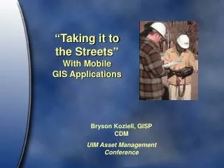
“Taking it to the Streets” With Mobile GIS Applications. Bryson Koziell, GISP CDM UIM Asset Management Conference. Taking it to the Streets…. Options for getting GIS and related data into the field. ArcPad ArcPublisher /Reader ArcEngine New Technologies. 1 - ArcPad… Light and Easy.

E N D
“Taking it to the Streets”With Mobile GIS Applications Bryson Koziell, GISPCDM UIM Asset Management Conference
Taking it to the Streets… Options for getting GIS and related data into the field • ArcPad • ArcPublisher/Reader • ArcEngine • New Technologies
1 - ArcPad… Light and Easy • Simple to Use • Can Run on PDA, GPS, PCs, etc. • Pretty Easy to Set Up and Customizable • Inexpensive • Older Technology • Starting to See Less and Less of ArcPad
ArcMap’s ArcPad Toolbar… Clip DataCheck OutEditCheck InSynchronize
ArcPad’s Limitations • Older Technology • Stores GIS data in older file format • Limited set of tools • Starting to See Less and Less of ArcPad
2 - ArcReader… Heavy and Free • Create with ArcPublisher Extension ($2,000) • Customize through the “ArcReader Control” • Designed for PC/Tablet Use • Simple to Create Basic Applications • Free Deployment
3 – ArcEngine… Full GIS “in the Field” • Custom Development Environment • Query, Edit, Redline, GPS, Etc. Capabilities • Have to Develop Your Application • Great for Custom Field Development • Needs ArcGIS Engine Runtime License ($500) • Cost-Efficient Way to Deploy High-End GIS
CDM Mobile Mapper • Built with ArcObjects • Developed to provide full GIS functionality in the field. • Designed for use on tablet pc or field computer • User friendly interface • Highly flexible
CDM Mobile Mapper-Functionality • Standard GIS Functionality (Pan, Zoom, Measure, Identify)
CDM Mobile Mapper-Functionality • Enhanced Address and Customer searches
CDM Mobile Mapper-Functionality • Quick Maps – Automatically toggle on relevant layers Parcel map Base Map Ortho Map Water Distribution Topo Map Wastewater Map
CDM Mobile Mapper-Functionality • Hyperlinking – Access to scanned documents
CDM Mobile Mapper-Functionality • Valve Isolation
CDM Mobile Mapper-Functionality • Network Tracing – Upstream/Downstream Pipe Tracing
CDM Mobile Mapper-Functionality • Redlining
CDM Mobile Mapper-Functionality • Mobile Inspector – Create, edit, and view inspection information for a variety of assets
4 – Crazy New Technologies • Pen Computing with Adapx Pen • Print Maps in the Office • Give Maps to Field Crews • Field Crews Use “Magic Pen” to Edit Maps • Pen is Docked in Office andEdits Show in GIS • People “Freak Out” WhenThey See This
Final Thoughts… • ArcPad and ArcReader Still Have Their Place • ArcPad May Eventually be Replaced by ArcGIS Mobile • ArcEngine is a Good, Solid Environment for Field Deployment • CDM has customized ArcEngine application developed • ArcGIS Mobile is the Future but is New and Fairly Expensive • Look at Other Technologies like the “Magic Pen”
“Taking it to the Streets”With Mobile GIS Applications Bryson Koziell, GISPCDMkoziellbj@cdm.com