Understanding Major Concepts of GIS Data Models and Sharing
270 likes | 366 Views
Prepare for the midterm test next Wednesday with this guide to major GIS concepts like data models, geodatabases, and data sharing. Learn about object vs. field models, UML terminology, and more. Discover how to overcome barriers to data sharing.

Understanding Major Concepts of GIS Data Models and Sharing
E N D
Presentation Transcript
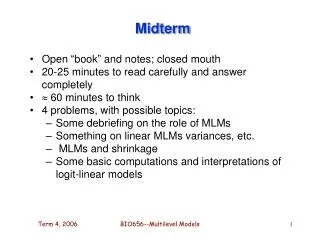
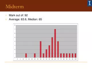
Midterm • May start off with multiple choice • Bulk will be short answer/short essay • Lecture PPTs and your notes, readings in Longley et al., Zeiler • Will not include • Labs or Arc Marine exercise • Journal articles
Major concepts • Representations • Object vs Field • Model, data model, analysis model • Data models • UML terminology, basic procedure from • Reality --> conceptual --> logical --> physical • Customized Arc GIS data models • For enterprise GIS • Analysis Models • Binary, ranking, rating, weighted rating
Major concepts - cont. • Geodatabase • what it is, why it’s important • Topology, Spatial Analysis • what they are, why they are important, how they relate • Object orientation • Identity, inheritance, encapsulation • Data Sharing (barriers)
NSDI ---> geodata.govGeospatial One-Stop ( GOS ) • Who needs to share data? • jurisdictions with common borders • jurisdictions in a region • private and public sectors • local, state, and Federal agencies • government and individuals • Geospatial One-Stop • www.geodata.gov/
NSDI ---> geodata.govGeospatial One-Stop ( GOS ) • State, local, private production of geospatial data • loss of Federal monopoly, patchwork • variable accuracy, level of detail • the WWW • everyone can be a producer, publisher, distributor ofgeospatial data • See GEO 465/565 lecture #6 • dusk.geo.orst.edu/gis/lec06.html#nsdi
Barriers to Data Sharing (1) interoperability • will ArcGIS read Intergraph data? • find a common format that both can read • output into the common format • input the common format • is the common format the same as one of the GIS formats? • if yes, only one conversion is needed • if no, two conversions are needed • issues of format, syntax within ONE GIS
Digital Line Graphs (DLGs) • vector topographic maps • 1:24,000, 1:100,000 ,1:10,000
Govt Agency Data Formats • Digital Raster Graphics (DRGs) • raster topographic maps at 1:24,000 • Digital Elevation Models (DEMs) • raster elevation data • 90m, 30m, 10m • Oregon 10m DEMs from buccaneer.geo.orst.edu/dem
Govt Agency Data Formats • Digital Orthophoto Quads (DOQs or DOQQs) • aerial photographs • camera orientation, terrain info. • raster images at 1m resolution • 6m positional accuracy at scale of 1:12000 • Imagery • satellites • Landsat, SPOT, SPIN, etc.
National Data Sharing (cont.) • new high resolution commercial imagery • 1 m resolution • www.spaceimaging.com
Barriers to Data Sharing (2) how to describe what you need • how to assess whether some data set fits the need?
Describing Data • Metadata • Again, see GEO 465/565 lecture #6 • dusk.geo.orst.edu/gis/lec06.html#nsdi • ArcCatalog • graphic thumbnail • Tables • FGDC format metadata • ESRI format metadata • XML format metadata
Issues with metadata? • potential complexity • can be larger than the data set! • investment to create • can be larger than the data set! • carrots and sticks • FGDC’s "don't duck metadata"
Barriers to Data Sharing (3) retrieval - large spatial data sets (4) national security - e.g., impact of 9/11 (5) search engines • how to know where to look on the WWW? • SAPs know where to look (more on this soon) • National clearinghouse, www.geodata.gov/ or geographynetwork.com • Regional and campus clearinghouses, • www.geo.oregonstate.edu/ucgis/datasoft.html • Google
Finding Data • How to find geospatial data on the WWW • 10,000,000 servers worldwide and quickly rising • containing order 1x 1015 bytes of information • several servers contain more than 1 x 1012 bytes of geospatial information (terabytes) • WWW search engines • Google, Yahoo, Ask Jeeves, Hot Bot, AltaVista • send out “spiders” to find pages • find the most important words in pages • build a catalog of words • how many pages contain the word "map”?
Finding Data (cont.) • most important metadata element is geographic location • find me some data about area x • only some areas have names • what if there's no name for the area you want? • only some hits on a name lead to geospatial data • search engines work on text, not GIS data sets
Some Searching Solutions (1) Know whereto look for a particular type of data • ortho.mit.edu contains a lot of DOQ data for Massachusetts • Valley library has free DOQ data for Oregon • osulibrary.orst.edu/research/guides/maps/ maproom.htm • USGS geospatial data is at the Eros Data Center, edc.usgs.gov
(1)Types of Data (cont.) • Microsoft's Terraserver contains DOQs and Russian imagery • www.terraserver.microsoft.com • >1 terabyte • millions of hits per day • EPA data, www.epa.gov • Corvallis ecoregion data at www.epa.gov/wed/pages/ecoregions/ ecoregions.htm • Again, only SAPs know this stuff ...
Some Searching Solutions (cont.) (2) Go to a clearinghouse site • www.geodata.gov • Over 300 servers • Common metadata format, FGDC standard • must select (multiple) servers to search • Regional node of NSDI • Oregon Coastal Atlas, www.coastalatlas.net
Some Searching (cont.) (2) Go to a clearinghouse site • many states have government-sponsored clearinghouses • Oregon Geospatial Data Clearinghouse • www.oregon.gov/DAS/EISPD/GEO/alphalist.shtml • Campus clearinghouses • www.geo.oregonstate.edu/ucgis/datasoft.html • ESRI-sponsored data sites • Geography Network, www.geographynetwork.com
Some Searching Solutions (cont.) (3) Go to a digital library a digital library whose contents are searchable by geographic location • National Academy of Sciences report Distributed Geolibraries (1999) • using a map • using a placename directory • using coordinates • what have you got about there?
Digital Libraries (cont.) • specify area of interest as a box on a map • or one of millions of placenames • how do I know that the library is likely to have what I want? • collection level metadata • a description of the contents of a collection
Digital Libraries (cont.) • OSU’s Oregon Explorer • oregonexplorer.info • UCSB’s Alexandria Digital Library • www.alexandria.ucsb.edu • Part of California Digital Library • over 2,500,000 data sets
Some Searching Solutions (cont.) (4) Issue-oriented site … http://www.ushmm.org/googleearth/ Download and use Darfur KML from course lecture page Who knows where Google will go with sites such as this?