Download
1 / 28
280 likes | 460 Views
Applications of Aircraft Sounding Data In Short-term Convective Forecasting. Phillip G. Kurimski* Eugene S. Brusky Jr. National Weather Service Green Bay, Wisconsin 23 rd Conference on Severe Local Storms (SLS) St. Louis, Missouri November 6, 2006 *Corresponding Author Address:

E N D
Applications of Aircraft Sounding Data In Short-term Convective Forecasting Phillip G. Kurimski* Eugene S. Brusky Jr. National Weather Service Green Bay, Wisconsin 23rd Conference on Severe Local Storms (SLS) St. Louis, Missouri November 6, 2006 *Corresponding Author Address: Phillip G. Kurimski 2485 S. Point Road Green Bay, WI 54313 Phil.Kurimski@noaa.gov (920) 405-3165 No Regional Aircraft Data? Regional Aircraft Data?
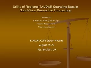
Applications of Aircraft Sounding Data In Short-term Convective ForecastingGoal & Methodology • Goal of this study: • To assess the utility of regional aircraft soundings in short-term (0-12 hour) convective forecasting during the Great Lakes Fleet Experiment (GLFE) which ended earlier this year. Two types of scenarios were examined: • NULL events - severe weather anticipated but did not materialize • Warning event - aircraft soundings aided in the Warning Decision Making process • Cases Selection: • Cases were chosen for examination if the GRB forecast area was included in (or near) a Day 1 Convective Outlook (Slight, Moderate or High Risk area) and/or a Convective Watch (Severe or Tornado). • This presentation will: • Provide examples illustrating the potential of regional aircraft sounding data (used in concert with other datasets) to Increase PODs and Reduce FARs of convective warnings, watches and outlooks. • Reduction of FARs will be emphasized in this presentation • 1 warning and 2 null cases will be presented No Regional Aircraft Data? Regional Aircraft Data?
Applications of Aircraft Sounding Data In Short-term Convective Forecasting Null Case Examples • Illustrate utility of regional aircraft soundings in assessing convective inhibition (convective capping inversion or CAP) • June 07, 2005 • July 23, 2005
June 07, 2005Null Case #1 GRB Forecast Area Case Overview Damaging wind-producing linear MCS developed overnight over western Minnesota north of an advancing warm front in region of strong warm air advection associated with 850 mb LLJ. Storms were quickly approaching the Green Bay (GRB) forecast area.
June 07 2005Null Case #1 Storms had weakened somewhat during the morning…but… Model forecast soundings suggested that the atmosphere ahead of the MCS would destabilize sufficiently to support surface-based convection and maintain the severe weather threat. Severe Thunderstorm Watch was issued downstream by 1530 UTC.
12Z GRB RAOB (right) GRB RAOB sounding (located in northeast corner of watch) indicated modest westerly shear & steep mid-level lapse rates in place over Wisconsin. There was potential for severe weather if insolation downstream can help to remove the cap.
15Z RUC40 Hourly Forecast Soundings from 15Z-19Z June 07, 2005 RUC40 forecast soundings over ARX, EAU & CWA indicated the CAP would erode as the morning progressed.
12Z NAM40 Forecast Soundings valid at 15Z & 18Z June 07, 2005 NAM40 forecast soundings (ARX, CWA & EAU) showed a similar trend as RUC with respect to eroding the CAP. NAM40 forecasting boundary layer moisture to increase during the morning.
June 07 2005Null Case #1 However, abundant cloud cover over the region would make erosion of the CAP a bit more difficult during the morning hours, despite the model forecast soundings.
15Z – 17Z TAMDAR Soundings Downstream TAMDAR aircraft soundings indicated a rather dry air mass and a substantial capping inversion. ATW sounding (top right) also indicated shallower boundary layer moisture.
June 07 2005Null Case #1 Convection was unable to become surface-based through early afternoon and the MCS dissipated. Some isolated convection developed near southern periphery of dissipating MCS along an outflow boundary generating an isolated ¾ inch hail report. In contrast to the model forecast soundings, observedregional aircraft soundings suggested severe weather threat was minimal as widespread surface-based convection was unlikely (given increasingly overcast conditions) and strong CAP in place. CWA *
July 23, 2005Null case #2 Case Overview Large damaging wind-producing MCS moved across central and southern Wisconsin during the afternoon hours of July 23, 2005. Widespread wind damage was reported across eastern Minnesota, western and central Wisconsin.
In the wake of the MCS, additional thunderstorms were expected to redevelop during the evening asmodel forecasts indicated rapid moisture return as the nocturnal low-level jet (LLJ) became established ahead of an approaching short-wave and north of a surface warm front. • General threat area denoted in red
July 23, 2005 Null Case • A Moderate Risk for severe thunderstorms was highlighted in the 20 UTC Convective Outlook • Standard RAOBs were too sparse to adequately assess short-term severe weather potential • Bewteen 20 and 03 UTC, > 45 regional aircraft soundings(white circles) versus2 RAOBs (red triangles) were available to forecasters to assess short-term convective potential within and near the Moderate Risk area.
Assessment of convective potential over western portion of outlook area • BJI soundings indicate strengthening CAP and decreasing boundary layer moisture. CAP • BRD soundings indicate deepening moisture but persistent & strong CAP. • MSP soundings indicate persistent strong CAP and boundary layer moisture becoming more shallow.
Assessment of convective potential over eastern portion of outlook area • RHI soundings reveal deepening moisture and weakening CAP. Shortwave also approaching from west. CAP • EAU soundings indicate deepening moisture but persistent strong CAP. • CWA soundings around same time but from aircraft approaching from opposite directions indicate CAP still strong but notably weaker to the east.
July 23, 2005 Null case 06Z July 24 Outlook Thunderstorms eventually developed shortly before midnight ahead of the mid-level disturbance but were confined to far northern Wisconsin (as suggested by the supplemental regional aircraft soundings) near the northern periphery of the capping inversion. Only marginally severe weather was reported. CAP Previous 20Z July 23 Outlook Regional aircraft soundings were invaluable in helping forecasters better define the area of greatest convective potential.
Applications of Aircraft Sounding Data In Short-term Convective Forecasting Warning Case Example • Illustrate utility of regional aircraft soundings in the Warning Decision Making process. • October 03, 2006
October 03, 2006Warning Case #1 Case Overview Surface warm front expected to be the focus for surface based convection during the afternoon hours. Given the high cape and high shear environment the area was in a Moderate Risk for severe weather with a heightened threat for tornadoes. Very dry air was in place across Northern Wisconsin which would stabilize the lower layers later on.
2000 UTC SPC Day 1 Outlook • Moderate Risk highlighted area of high shear, instability and moisture pooling along a frontal boundary. • These factors lead to an increased tornado threat.
October 03 2006Warning Case #1 CAPE and CIN Evolution CAPEs increase during the afternoon with decreasing CIN values. 850 mb & 500 mb Winds High Shear environment with southerly 850 mb winds and westerly 500 mb winds.
October 03 2005Warning Case #1 • MCD indicated storms expected to develop in the outlook area with increasing CAPE just north of a warm front. • Although a capping inversion was in place this was expected to weaken during the afternoon hours. • Strong deep layer shear expected to promote supercells with possible tornadoes. • Tornado Watch was issued at 2035 UTC. • Nearby aircraft sounding locations indicated by dark blue dots…
Pre-Warning Radar Loop • Large Supercell over the MPX cwa closing in on the ARX cwa. • Multiple tornado warnings issued for storm as it moves into western Wisconsin. • Warning decision needs to be made around 0100 UTC for ARX
RST soundings again show dry/stable air. Available Aircraft Soundings 18Z-02Z • EAU sounding indicated very dry air at the surface and a strong CAP. • MSP soundings shows a stronger CAP to the south but a strong and persistent cap in all directions. • A subsequent MSP sounding showed a stronger CAP and deeper stable layer than the RUC. • LSE soundings show a strengthening CAP and dry air at low-levels.
Warning Radar Loop • Aircraft soundings gave ARX forecasters confidence in issuing Severe Thunderstorm Warnings and holding off on Tornado Warnings. • The Supercell subsequently weakened as it moved through the ARX cwa.
Storm Reports • Not much wind damage and no tornadoes as the storm moved through Minnesota and Wisconsin. • Although the storm produced very large hail…there were no wind reports in ARX cwa.
Impact of FAR reduction associated with Convective Watches, Warnings and Outlooks… • More accurate hazardous outlooks (used to alert emergency managers and storm spotters of the potential for severe weather and determine NWS staffing) • More accurate short-term forecasts (NDFD grids) • Reduction of aviation operating costs (carry less fuel) – (forecasters less likely to include thunder in TAFs and other aviation products) • Increased credibility Increased temporal and spatial resolution of regional aircraft sounding data has demonstrated significant promise in improving assessment of short-term convective potential, particularly in the reduction of false alarms.
Acknowledgements Applications of Aircraft Sounding Data In Short-term Convective ForecastingPhillip G. KurimskiEugene S. Brusky Jr. • Entire NWS Green Bay staff • Dave Helms – NWS Office of Science and Technology • Taumi Daniels – NASA Langley Research Center • Pete Browning – NWS Central Region • Bill Moninger (NOAA, ESRL) – Assistance with FSL Aircraft Java web page. • Rich Mamrosh and Steve Fleegel – NWS Green Bay • Ralph Petersen – University of Wisconsin Madison (CIMMS) • Dan Baumgardt – NWS La Crosse