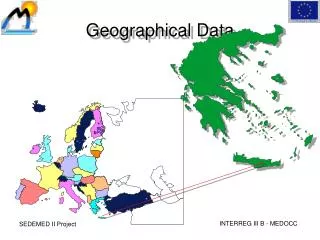

Geographical Data Mining
E N D
Presentation Transcript
Geographical Data Mining Thales Sehn Korting tkorting@dpi.inpe.br http://www.dpi.inpe.br/~tkorting/
Motivation • Large datasets • Few data manipulation techniques • Few information extraction tools • [Silva 2005] prototype system for mining patterns applied to Brazilian Amazon deforestation
Amount of data • Simple crop • 2562 x 3 = • 196608 values!
Amount of data • 196608 input values to answer questions like: • What kind of image? • What objects are in the image? • How many houses? • Where are the streets?
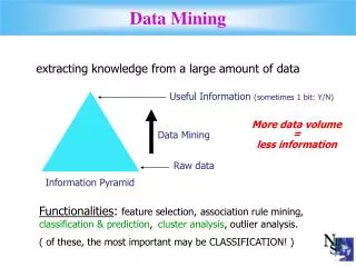
How to reduce input data? • Segmentation Regions Data Information Area Perimeter Rectangularity … Pixels’ Mean Pixels’ STD Texture …
In Practice • Segment image = software A • Visualize segmentation = software B • Extract attributes = software C • Normalize attributes = software D • Visualize attributes’ space = software D • Select Samples = software E • Classify regions = software F • Visualize results = software B
In Practice • More than 5 different softwares! • Processing time • File-conversion time • etc. • GeoDMA – Geographical Data Mining Analyst • All tools on the same system
GeoDMA • Input • Raster • Polygons • Processing • Attributes Extraction • Normalization • Supervised training • Output • Thematic classification
GeoDMA and TerraLib • Image processing functions • Segmentation • Region Growing • Attributes Extraction • Data Mining algorithms • C4.5 Decision Tree • Self-Organizing Maps • ...
Land Change in Brazilian Amazon Urban classification Current Applications
Future Works • Allow multi-temporal data mining • Snapshots • Try to explain changes • More classification algorithms • More precise segmentation
Geographical Data Mining Try GeoDMA! http://www.dpi.inpe.br/geodma/