Download
1 / 23
230 likes | 330 Views
Discover how the Open Space Residential Development bylaw benefits environments, developers, and homeowners. Learn about the four-step design process, benefits, and values it offers. Consult with town officials to implement this sustainable development approach.

E N D
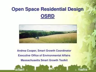
Open Space Residential Development Bylaw Town of Rehoboth
Sprawl development covers natural open space. Milford Wasted linear miles of asphalt, piping and utilities
Sprawl Development Maximizes Cost of Infrastructure BerkshireCounty
So What Is An OSRD….. Arranging homes in a compact form to… • preserve open space and respect resource areas, • reduce disturbed area and minimize runoff, • establish green belts, Standard Conservation Subdivision
So What Is It…… The Problem The Solution Loss of Open Space Smart Development OSRD provisions promote design flexibility related to minimum lot size, setbacks and frontage and can help streamline the permitting process.
Step One: The Yield Plan THE YIELD PLAN:The maximum number of lots achievable under conventional Zoning Bylaw provisions and Subdivision Rules and Regulations. The contents of this plan are similar to those of a Preliminary Subdivision Plan.
After The Yield is Calculated, the Four Step OSRD Design Process Follows…
1. Four Step Design Process • Step One: Evaluate the Site – Identify Conservation and Resource Areas Existing Natural Conditions Water Resources Historical and Cultural Features Steep Slopes
This leads to composite indicating areas for conservation and areas for development.
Step Three: Align Streets - meet subdivision road standards.
Comparison Land Pre-Development Standard Design Conservation Design
Lots- Number • Determine the number that could be constructed under Standard Subdivision approach meeting all regulations and that is number of lots under Conservation Subdivision. That is no increase in the number of homes that can be built.
Open Space • Quantity • 50% of parcel must be permanently protected Open Space. Not more than 30% of this can be wetlands and detention/retention areas do not count as open space. Individual wells may be located in the open space. • Quality • More than just regulated lands – resource value identified in the design process. • Related to other open space or recreational needs • Buffer of 50 feet from adjacent property and 100 feet buffer from wetlands.
Open Space • Ownership and Maintenance - Planning Board can determine who will retain control of the property (Homeowner’s Association, Conservation Commission, Land Trust, etc) - Permanent protection through a recorded Conservation Restriction
Water/Wastewater • Bylaw prefers septic systems (soil absorption system) on individual lots with individual wells on lots or, if not possible, within common open space.
Water/Wastewater • Other arrangements such as a community wastewater or community well system must meet Board of Health approval.
Special Permit Review Process • Special Permit • Optional, standard subdivisions still possible. • Provides Planning Board more authority to add conditions. • Requires 4 out of 5 vote rather than majority of Planning Board • Typically Boards are given great discretion by the courts (trade off of thus less secure for applicant)
In designing the Bylaw the Rehoboth OSRD Committee should consulted with: • Board of Health • Conservation Commission • Board of Selectmen • Solicited input from ZBA, Highway Superintendent, Building Inspector/Zoning Official, Fire, and Police
Benefits of OSRD Environmental - Protects unique or fragile habitats - Reduces the pollution impacts of stormwater runoff - Promotes aquifer recharge - Provides opportunities to link wildlife habitats - Conservation values are part of the planning process - Can further goals of open space and community development plans The planning process for OSRD inherently protects natural resources and promotes recharge to underlying aquifers.
Benefits of OSRD For the Developer and Realtor - Streamlines plan review process; reduces time and costs - Adds valuable amenities that can enhance marketing and sale prices - Increases resale value; homes in OSRD subdivisions have shown to appreciate faster than those in conventional subdivisions - Decreases site development costs by designing with the terrain The OSRD permitting structure encourages smart growth and facilitates a permitting process that is clear, easy to understand, and cost-effective to developers.
Values Identified by OSRD Developers • Reduced roadways and infrastructure • Roadway construction costs are in the $400 - $600/ft range. • Less roadway = Less impervious surface = less infiltration makeup areas. • Less impacts on wetlands • Minimal wetland impacts = less wetland replication areas and expensive crossings. • Less time and risk in front of Conservation/DEP • Reduced lot areas and setbacks = cost savings on driveways and landscaping • Time – geographically condensed construction is easier to manage • Pride – OSRD plans are just more socially responsible • Sales advantages often include trail systems, open space, and social community