Bailey Lake Open Space
250 likes | 434 Views
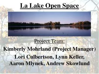
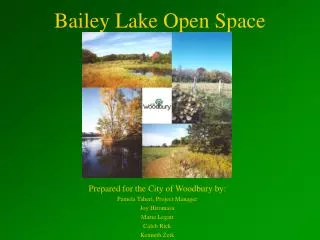
Bailey Lake Open Space. Prepared for the City of Woodbury by: Pamela Taheri, Project Manager Joy Hiromasa Maria Legatt Caleb Rick Kenneth Zeik. Bailey Lake Open Space. located southwest of the intersection of Dale Road and Woodbury Drive

Bailey Lake Open Space
E N D
Presentation Transcript
Bailey Lake Open Space Prepared for the City of Woodbury by: Pamela Taheri, Project Manager Joy Hiromasa Maria Legatt Caleb Rick Kenneth Zeik
Bailey Lake Open Space • located southwest of the intersection of Dale Road and Woodbury Drive • features South Bailey Lake and contains a mix of cover types, including prairie and mixed hardwood forest
Vision • Promote community togetherness • Provide active and passive recreational opportunities • Protect Woodbury’s natural resources
Goals 1. Develop a detailed description of the site 2. Provide management recommendations
Goal 1:Describe the site • inventory vegetation, physical conditions, water resources, and wildlife • evaluate adjacent land use, contaminant sources, infrastructure, and people management
Site A: Description 12 acres adjacent to Dale Road • short to medium grasses and a mix of coniferous and deciduous trees • open water
Site B: Description 40 acres adjacent to Woodbury Dr. • short to medium grasses, a Scot’s Pine stand, and a mix of deciduous trees • South Bailey Lake • pumping station
Site B: Description 40 acres adjacent to Woodbury Dr. • short to medium grasses, a Scotch Pine stand, and a mix of deciduous trees • South Bailey Lake • pumping station
Site C: Description 80 acres SW of Site B • Currently farmed for corn and soybeans
Site C: Description 80 acres SW of Site B • Currently farmed for corn and soybeans
Site D: Description 45 acres NW of Site C • CD-P85 storm-water infiltration basin • contaminants
Site D: Description 45 acres NW of Site C • CD-P85 storm-water infiltration basin • contaminants
Wildlife • diverse group of birds, mammals, amphibians, and reptiles • threatened and endangered species
Adjacent Land Use • agricultural land • private residences • Xcel/NSP power line corridor
Future Planning • residential development and expansion • construction of CD-P86
Goal 2: Provide recommendations • establish a set of recreation options compatible with the site • develop a plan for the restoration of historical vegetation
Recommendation 1:Restore pre-settlement oak savanna • Why? • What sites? • Scot’s pine removal? • Site preparation? • Where do the seeds come from? • Who’s done it?
Recommendation 1:Restore pre-settlement oak savanna • Time Frame • Why start now? • When will it be usable? • Future maintenance?
Recommendation 2:Design Bailey Lake trail system • Overlooks and benches • Signage
Recommendation 2:Design Bailey Lake trail system • Intended users • Accessibility • Bridge • Connectedness
Recommendation 3:Enhance and maintain existing ecosystems SITE A • Visual Park • Enhance current vegetation SITE D • Clean-up • Enhance current vegetation
Recommendation 4:Further research Site C • CD-P86 • Vegetation
Recommendation 5:Future land acquisition • 80 acres North of Site C • Connect present sites • Disc golf • Community gardens