Download
1 / 11
110 likes | 223 Views
This guide, prepared by John McGee and Jennifer McKee, provides step-by-step instructions on how to effectively use the Garmin Venture HC GPS device. It covers essential activities including capturing waypoints, saving tracks, estimating areas, navigating to specific waypoints, and manually inputting coordinates. Learn how to optimize your GPS experience with clear instructions and tips for best practices. With this resource, you’ll be equipped to take full advantage of your GPS device, whether for outdoor adventures or professional tasks.

E N D
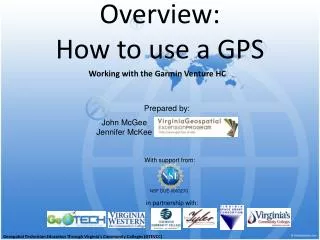
Overview: How to use a GPS Prepared by: John McGee Jennifer McKee Working with the Garmin Venture HC With support from: NSF DUE-0903270 in partnership with: Geospatial Technician Education Through Virginia’s Community Colleges (GTEVCC)
Activities • Using a GPS • Capturing a Waypoint • Saving a track • Estimating area • Navigating to a Waypoint • Inputting Coordinate Location by Hand
Using a GPS Satellite page Map page Compass page Main menu Mark waypoint
Using a GPS • Hold the receiver in front of you, facing sky • Be careful not to place thumb over top area of GPS unit (block antennae reception)
Capturing a Waypoint • To capture a waypoint press & hold the Rocker key straight down • To accept the waypoint select OK or To change the name of the waypoint, highlight the name field* & press Enter to open the on-screen keypad, select OK twice when done *
Saving a Track • Using the Page key, find the Main Menu page • Select the Tracks icon & push enter • Save the entire track...or Select the beginning & ending points for the track 4. Select OK
Estimating Area • Using the Page key, find the Main Menu page • Highlight the Setup icon & push Enter • Highlight “Page Seq. “& push Enter • Highlight <Add Page> & push Enter • Highlight “Area Calculation” • Add Calculate Area page
Estimating Area Continued • Select Start on the Calculate Area page • Walk the area to be measured • Select Stop on the Calculate Area page • Area will be displayed, Units of measurement can be altered • To save the track, select Save
Navigate to a Waypoint • Using the Page key, find the Main Menu page • Highlight Find icon & push Enter • Highlight Waypoints & push Enter • Highlight a waypoint & push Enter • Highlight “Go To” at the bottom right of the page • The compass page will open showing the compass direction & distance to your waypoint
Inputting Coordinate Location by Hand • To input an X,Y coordinate press & hold the Rocker key straight down • Instead of accepting the waypoint you will CHANGE the X,Y coordinate to your desired location • To change the XY info., highlight the Location field* & press Enter to open the on-screen keypad • Input the location using the keypad • When done, highlight OK & press Enter *
Any Questions? John McGee Geospatial Extension Specialist jmcg@vt.edu 540-231-2428 Jennifer McKee Geospatial Project Developer jmckee@vt.edu 540-231-9115