Download
1 / 21
210 likes | 271 Views
Learn about the influence of mountain weather on avalanche and fire weather forecasting. Explore key factors such as precipitation, wind, temperature, and more. Discover how mountain weather events affect real incidents.

E N D
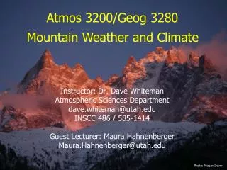
Instructor: Dr. Dave Whiteman Atmospheric Sciences Department dave.whiteman@utah.edu INSCC 486 / 585-1414 Guest Lecturer: Maura Hahnenberger Maura.Hahnenberger@utah.edu Atmos 3200/Geog 3280 Mountain Weather and Climate Photo: Megan Dever
Applications of Mountain Meteorology:Avalanche ForecastingFire Weather Forecasting Atmospheric Sciences 3200/Geography 3280Mountain Weather and Climate Friday, August 24
Who else cares about Mountain Meteorology? • Urban Planning • Wildfire Forecasting • Avalanche Forecasting • Recreation Industry • Air Pollution Scientists • Energy Industry • Water Use/Hydrologists • River Forecasting • Snowpack Scientists • ..... and many more! Photo: KSL.com Brady Harris
Avalanche & Fire Triangles Fire Triangle Avalanche Triangle
What weather factors impact Avalanche Forecasting? • Precipitation • Type • Amount • Rate • Wind • Direction • Speed • Duration • Temperature • Trend • Radiation • > or < 0 º Celsius • Gradient
Components of a Slab Avalanche • Bed Surface • Weak Layer • Slab • Steep Slope • Trigger
A Dozen More Turns Part 1 • http://www.lifeonterra.com/ • Check out Parts 2 & 3 online • HIGHLY RECCOMENDED!!!! • While watching note how mountain weather led to this avalanche incident
What weather factors impact Fire Weather Forecasting? • Precipitation • Rate • Duration • Lightning • Wind • Direction • Speed • Duration • Temperature • Moisture • Relative Humidity
Fire Danger Forecasting © 2002 Regents of the University of Minnesota
Fire Danger Forecasting HIGH © 2002 Regents of the University of Minnesota
Fire Danger Forecasting © 2002 Regents of the University of Minnesota
Fire Danger Forecasting LOW © 2002 Regents of the University of Minnesota
Fire Danger Forecasting © 2002 Regents of the University of Minnesota
Fire Danger Forecasting HIGH © 2002 Regents of the University of Minnesota
Seasonal weather impacts on Fire Weather Forecasting • Temperature • Humidity • Wet/Dry Season • Drought!!!
US Drought Monitor/Fire Weather Forecast • DAY 1 FIRE WEATHER OUTLOOK • NWS STORM PREDICTION CENTER NORMAN OK • 0354 AM CDT TUE AUG 21 2007 • VALID 211200Z - 221200Z • ...CRITICAL FIRE WEATHER AREA FOR SRN WY... • ...SYNOPSIS... RELATIVELY COOL BUT WINDY CONDITIONS WILL PREVAIL ACROSS THE NRN ROCKIES/PLAINS UNDER BROAD UPPER TROUGH WHILE VERY WARM CONDITIONS CONTINUE FROM THE GREAT BASIN/DESERT SW EWD ACROSS THE SRN PLAINS INTO THE SERN STATES. COMBINATION OF LOW RH AND STRONG WINDS WILL RESULT IN LOCALLY CRITICAL CONDITIONS OVER PORTIONS OF WY...WITH DROUGHT...HOT TEMPERATURES AND LOW RH NEARING CRITICAL LEVELS OVER THE CAROLINAS AND GA.
US Drought Monitor/Fire Weather Forecast • DAY 1 FIRE WEATHER OUTLOOK • NWS STORM PREDICTION CENTER NORMAN OK • 0443 AM CDT SUN JUN 24 2007 • VALID 241200Z - 251200Z • ...CRITICAL FIRE WEATHER AREA FOR ERN SIERRA/NV/UT/WRN WY/WRN CO/NRN AZ... • ...SYNOPSIS... CLOSED UPPER LOW NOW OFF PACIFIC NORTHWEST COAST WILL MOVE INLAND TODAY AND WILL BE LOCATED OVER SRN BC BY EARLY MONDAY. STRONG MID LEVEL FLOW WILL CONTINUE ACROSS THE GREAT BASIN WITH SPEEDS OF 40-50 KT LIKELY. SFC BAROCLINIC ZONE WILL EXTEND FROM ND THROUGH WRN WY AND CNTRL NV BY LATE AFTN. AHEAD OF FRONT...STRONG W/SW WINDS AND LOW HUMIDITY VALUES WILL CONTRIBUTE TO CRITICAL FIRE WEATHER CONDITIONS TODAY ACROSS MUCH OF THE GREAT BASIN/UT/AZ/WY. TSTMS ARE NOT EXPECTED ACROSS THE CRITICAL FIRE AREA.
2007 Tahoe Wildfire Flare-Up: News Coverage • Fire Began Sunday June 24, 2007 • News Coverage from Wednesday morning June 27 • Contained on July 2, 2007 • While watching note how mountain weather impacted this wildfire
Fire claims 100 acres near Columbia By MICHAEL R. SHEA The Modesto Bee • Last Updated: August 24, 2007, 05:00:56 AM PDT • COLUMBIA -- Roughly 100 acres of Tuolumne County mountain country burned Thursday after a marijuana farm nestled in the canyons northeast of Columbia State Park caught fire and the flames spread toward nearby homes. Flames were first seen around 11 p.m. Wednesday night and the California Department of Forestry and Fire Protection issued a voluntary evacuation for 30 homes along Yankee Hill and Mountain Boy Mine roads early Thursday morning. • The fire was contained by 5:20 Thursday evening. • The marijuana growers fled as the fire grew, leaving behind bundles of harvested crop and firearms, said Cal Fire spokeswoman Nancy Longmore.