ETA-32 MODEL CHARACTERISTICS
220 likes | 388 Views
ETA-32 MODEL CHARACTERISTICS. For the Lesson: Eta Characteristics, Biases, and Usage December 1998. ETA-32 Job Stream. 48-h forecasts twice a day at 0000 and 1200 UTC 33-h forecast at 0300 UTC 30-h forecast at 1800 UTC. Horizontal Resolution. 32-km replaced the 48-km configuration

ETA-32 MODEL CHARACTERISTICS
E N D
Presentation Transcript
ETA-32 MODEL CHARACTERISTICS For the Lesson: Eta Characteristics, Biases, and Usage December 1998
ETA-32 Job Stream • 48-h forecasts twice a day at 0000 and 1200 UTC • 33-h forecast at 0300 UTC • 30-h forecast at 1800 UTC
Horizontal Resolution • 32-km replaced the 48-km configuration • Was a compromise among several factors • Increasing the resolution of the Early Eta system to be as close as possible to the Eta-29 • Keeping the model horizontal domain size nearly the same as the current 48-km grid • Eta-32 output is available on the same 80-km grids as the Eta-48
Discussion Questions • With 32-km horizontal resolution, what types of phenomena can the Eta be expected to resolve? • What effects does the remapping of model output to an 80-km grid have on the resolution of features?
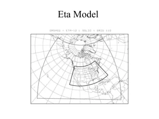
Horizontal Domain • Eastern boundary of 32-km grid captures as much of tropical Atlantic as possible and keeps Puerto Rico inside domain • Northern boundary for Alaska virtually unchanged • Biggest difference - along the western boundary, Hawaii is much closer to the boundary than with 48-km grid
Vertical Resolution • 45 vertical layers • Better distribution of layers over high terrain than Eta-48 (38 levels) • Not as good vertical definition as Eta-29 (50 levels) • Represents a compromise between 38 levels in Eta-48 and 50 levels in Eta-29
Discussion Questions • What considerations should be taken into account about the vertical resolution of the boundary layer when using Eta model guidance within your CWA? • Why is it important to have greater vertical resolution within the boundary layer? • Where else in the atmosphere would model forecasts benefit from greater vertical resolution?
Sigma CoordinateVersus Eta • Characteristics of terrain representation result in computational differences in basic model equations • Compute temperature and pressure gradient terms differently • Can introduce large errors near steep or complex terrain
Sigma Coordinate • Near sloped terrain, temp. changes on a sigma surface are partially a result of hydrostatic temperature changes due to change in elevation • Vertical temperature gradient much larger than horizontal temp. gradient • Vertical gradients have dominating influence on pressure gradient calculation • Leads to large temperature errors, especially near steep terrain in the sigma terrain following coordinate system
Eta Coordinate • Eta coordinate reduces errors in computing PGF, advection, and diffusion near steep terrain • Result of surface terrain heights at discrete sets of values or steps
Eta Coordinate Continued • Values or steps dependent upon vertical resolution of model and mountain height • Terrain appears step-wise rather than smooth and continuous as in the sigma coordinate • For a given range of elevations, the eta coordinate allows the terrain to exist on more than one eta surface • In the sigma coordinate, the terrain can only exist on one sigma surface
Discussion Questions • Why is it important for a model to accurately solve the basic equations of motion and thermodynamics? • What effects can large errors in the temperature advection and gradient fields have on other model forecast fields such as winds, pressure, vertical motion, and precipitation? • What types of adjustments may be necessary to account for computational errors in these fields?
Eta TerrainRepresentation • Model terrain much smoother than in reality, even in the eta coordinate • Terrain smoothing can be large source of error in regions affected by small-scale terrain features • Terrain smoothing done partly because airflow over complex terrain can generate small-scale noise in the model • Small-scale noise can mask larger-scale signal
Eta TerrainRepresentation Continued • Eta model uses step-mountain topography • The step-mountain is raised or lowered to closest vertical interface after interpolation to eta native grid
Eta TerrainRepresentation Continued • Mountains represented as discrete steps whose tops coincide exactly with model layer interfaces
Eta Topography:West U.S. • Model resolution affects depiction of topography • Eta-29 and Eta-32 models show considerably more detail than Eta-48 • Better definition of Sierra Nevada and Cascade ranges in Eta-29 and Eta-32
Eta Topography:West U.S. Continued • Exception - between Eta-29 and Eta-32 in the Great Basin in northern Nevada • Eta-29 terrain shows most of the region at one elevation • Eta-32 depicts this region on 3 different steps
Eta Topography:CONUS • Over the contiguous U.S., mountains spread over a slightly greater horizontal domain than in reality • Terrain averaging over each grid box causes model representation of terrain slope to be too shallow • Can affect model vertical motion and precipitation forecasts
Eta Topography Effects: Vertical Motion • Insufficient terrain slope in model results in vertical motion field’s being shifted away from mountains and steepest terrain • In example, inadequate definition of Sierra Nevada shifted maximum vertical motions westward awayfrom the steepest topography
Eta Topography:Precipitation • Impact of terrain smoothing - misplacement of precipitation in vicinity of complex terrain • For this example, precipitation field shifted west of the highest/steepest terrain • Eta model often predicts precipitation too far west, away from mountain peaks
Precipitation Verification • Observed precipitation greater than Eta forecast • Heaviest amounts concentrated near higher terrain • Much lesser amounts in valleys
DiscussionQuestions • If terrain is a concern in your area of responsibility • How will the Eta’s terrain resolution and treatment of terrain influence its forecasts of precipitation? • What adjustments to the model forecast would be necessary within your forecast area based on known terrain features and Eta model characteristics? • Would the adjustments to model forecasts be regime dependent? If so, how might they vary?