Weather Data Gathering Methods and Analysis for Accurate Forecasts
180 likes | 218 Views
Learn about gathering weather data from Earth's surface and upper atmosphere using tools like thermometers, anemometers, and radiosondes. Discover how weather radar systems and satellites help analyze Doppler radar data and provide insights for short-term and long-term weather predictions. Understand the significance of station models, meteorological symbols, and isobars in interpreting current weather conditions for precise forecasts.

Weather Data Gathering Methods and Analysis for Accurate Forecasts
E N D
Presentation Transcript
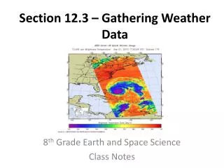
Section 12.3 Section 12.3Gathering Weather Data Gathering Weather Data
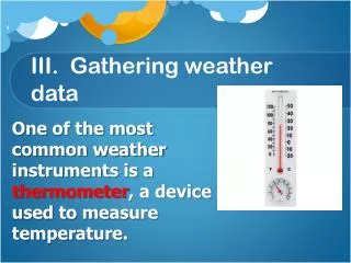
Section 12.3 Data from Earth’s Surface Gathering Weather Data A thermometer measures temperature. A barometer measures air pressure.
Section 12.3 Data from Earth’s Surface Gathering Weather Data An anemometer measures wind speed. A hygrometer measures relative humidity.
Section 12.3 Data from the Upper Atmosphere Gathering Weather Data Radiosonde - instrument used for gathering upper-atmosphere data. A radiosonde’s sensors measure the air’s temperature, pressure, and humidity.
Section 12.3 Weather Observation Systems Gathering Weather Data A weather radar system detects specific locations of precipitation. The Doppler effect is the change in pitch or frequency that occurs due to the relative motion of a wave, as it comes toward or goes away from an observer. Weather radar
Section 12.3 Gathering Weather Data Weather radar Analysis of Doppler radar data can be used to determine the speed and direction at which precipitation moves.
Section 12.3 Gathering Weather Data Weather satellites Some weather satellites use infrared imagery to measure thermal energy at night to map cloud cover or surface temperature. Some satellites use cameras that require visible light to photograph Earth and its clouds
Section 12.3 Gathering Weather Data Weather satellites A 3rd type of satellite imagery is called water-vapor imagery that shows moisture in the atmosphere, not just clouds.
Section 12.4 Section 12.4Weather Analysis and Prediction Weather Analysis and Prediction
Section 12.4 Surface Weather Analysis Weather Analysis and Prediction Station models A station model is a record of weather data for a particular site at a particular time.
Section 12.4 Weather Analysis and Prediction Meteorological symbols are used to represent weather data in a station model.
Section 12.4 Weather Analysis and Prediction Plotting station model data To plot data nationwide and globally, meteorologists use lines that connect points of equal or constant values.
Section 12.4 Weather Analysis and Prediction Plotting station model data Isobars - lines of equal pressure Isotherms - lines of equal temperature
Section 12.4 Weather Analysis and Prediction Interpreting station model data The weather map shows isobars and air pressure data
Section 12.4 Weather Analysis and Prediction Interpreting station model data Using isobars, isotherms, and station model data, meteorologists can analyze current weather conditions for a particular location.
Section 12.4 Types of Forecasts Weather Analysis and Prediction Digital forecasts Digital forecast - created by applying physical principles and mathematics to atmospheric variables to make a prediction.
Section 12.4 Weather Analysis and Prediction Analog forecasts Analog forecast - comparison of current weather patterns to similar weather patterns from the past.
Section 12.4 Short-Term Forecasts Weather Analysis and Prediction Short-Term - most accurate and detailed forecasts because weather systems change directions, speeds, and intensities over time. Long-Term Forecasts Long-Term are less reliable than short-term forecasts.