Download
1 / 43
430 likes | 460 Views
Learn about APRS, or Amateur Position Reporting System, a system for transmitting location and data using low-cost equipment. Explore topics like how APRS works, station types, and applications in various fields.

E N D
Introduction to APRS John Beadles, N5OOM
Expectations for this presentation • This presentation will tell you (briefly) what APRS is and what you can do with it • Mostly we will discuss some parts of APRS that it is important for you to know so you can get started • We will not go over a lot of examples of APRS in action • There is a lot of material here and we may not finish • If we don’t finish, or if you can not make it to other presentations in this series, you can download them from: http://www.n5oom.org/2004_hamcom/presentations.htm
Topics • What is APRS • How does it work • What configuration information do I need • What equipment do I need • Types of APRS Stations • TNCs • GPS • Radios • Computers • Software • How to connect things up • Information resources
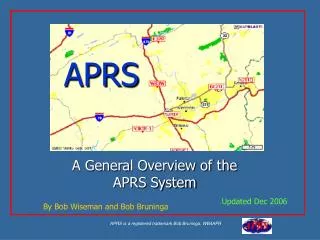
APRS, or Amateur Position Reporting System, developed by Bob Bruninga WB4APR (http://web.usna.navy.mil/~bruninga/aprs.html) is a lightweight system that allows users to transmit location and other data in single data packets. Usually stations being tracked use GPS receivers to provide real time tracking data. APRS uses existing packet TNCs (terminal node controllers) and small, low cost microcontroller driven units to transmit standard AX.25 packets on a ground frequency (in the U.S.) of 144.39 at 1200 baud. APRS can also be used over HF and satellite links. APRS is intended as a short-range tactical system; however, APRS systems can be viewed over broad areas using internet gateways. The gateways can be run on low-cost computers, and can mediate the transmission of packets to and from the international APRS-IS system. APRS augments your voice system and helps reduce voice traffic - but is not a replacement for it! What the heck is APRS?
Search & Rescue Public Service Events Bike rallies Parades Crime prevention patrols Other Repeater advertising Event talk-in Transmitter hunting Skywarn Nets Spotter assignment Storm tracking County alert status Post Disaster Management Damage assessment Liason tracking Logistics management Staging site talk in APRS Applications
How APRS Works • An APRS station broadcasts (beacons) singles packet of information to all stations in range. This packet usually contains GPS coordinates and other information. • The packet may be received and decoded by anybody who hears it. • Digipeater stations hear the packet and rebroadcast it based on rules in the digipeater software and commands that you put in the packet. • Packets that need to travel long distances should be routed across the public internet
Fundamental Principles As described by Bob Bruninga… • The system should provide reliable real time, tactical digital communications • 1200 baud network system operating as an Aloha random access channel • You should hear everything nearby or within 1 digipeater within 10 minutes • You should hear everything within your Aloha circle within 30 minutes
Aloha Circle • In an Aloha network, stations contend for access by waiting to transmit until they have listened to a channel for a random period of time and haven’t heard anybody else. • At 1200 baud, the 144.39 channel can support 50 or so user stations at reasonable packet sizes and beacon rates. • An Aloha Circle is the radius around you that contains enough stations to fully fill up the channel. Will be unique at any location • Want to know more? Look up http://web.usna.navy.mil/~bruninga/aprs/ALOHAcir.txt • See your aloha circle using Findu (www.findu.com). Just search for your SSID, then click on “See nearby stations”.
Potential problems • The Aloha circle definition is based on the premise that APRS packets take a finite amount of time to transmit and so only a limited number of users may operate in a given area. • Poor station configuration can cause packets to travel too far over RF, causing traffic into distant APRS networks, blocking those users. • Also, station configuration can cause digipeaters to ping-pong a packet back and forth, blocking out other users in your area. • In addition, stations that beacon too fast take transmit time away from other users without getting any benefit because the change in location is too small to be seen on a map.
Example (1) – Mobile Station Beacons Step 1. An APRS station beacons and is heard by every other APRS station in direct range
Example (2) - Digipeater relays Step 2. The packet is rebroadcast by every digipeater than can hear it. The packet is heard by every in direct range of the digipeater, including other digipeaters.
Example (3) - Other digipeaters relay Step 3. The packet is rebroadcast by every digipeater that heard the first digipeater. The packet is heard by every APRS station in direct range of this second set of other digipeater, including the original digipeater.
Example (4) – 1st digipeater relays again, etc. Step 4. The packet is rebroadcast by every digipeater that heard the second set of digipeaters, including the original digipeater, unless proper commands are added to stop this. The commands RELAY and WIDEn-n are intended to control this process.
Example (5) – Internet gateway relays to APRS-IS server Step 5. Any packet heard by an internet gateway station is transmitted over the internet to an APRS-IS server. This data is relayed out to any APRS software that is connected to an APRS-IS server. Some internet gateways gate internet traffic out to radio, but care is needed because the volume of traffic can shut everyone else out of an area.
Beacon Rates • The rate at which an APRS station transmits beacons is an important consideration. The faster you beacon, the fewer users can use the system • Your beacon rate should take into consideration what you are intending to accomplish and how fast you expect to be moving • Stations that expect to be moving very slowly over a large area should beacon occasionally. • Stations that are moving rapidly over a small area should beacon more often. If you will be tracked on a high-resolution map and the person tracking you needs to know exactly where you are, beacon faster. • Stationary stations (digipeaters, etc.) should only beacon once every 10-30 minutes
Speed vs Beacon Rate • Mobile stations should generally beacon no faster than once every 3 minutes. With a three minute beacon rate, a station will move the following distances at a given speed:
Configuration Information you’ll need to know • SSID • Latitude and Longitude • Unproto Address • Beacon Comment • Beacon Rate • Status Text • Status Rate
SSID • Your SSID is what identifies you uniquely • Consists of your call at minimum • Is transmitted every time you beacon • And optionally a dash followed by a number from 1 to 15. This is particularly useful if you have more than one station operating. • Example: N5OOM-7 • Some people put a tactical call here and put their call in the status message. This is ok as long as the status msg is transmitted at least every 10 mins
Latitude & Longitude • Latitude and longitude coordinates are angles that describe your location uniquely on the face of the earth • Latitude runs north and south, with values from 0 degrees at the equator to 90 degrees at the poles. Latitudes also need a N/S identifier. This may be done by setting the value negative for south lats or including the letters “N” or “S” • Longitude runs from 0 to +180 degrees starting at a line running through Greenwich, England and going east. It runs from 0 to -180 going west across the US. This may be alternatively noted by including the letters “E” or “W”. • APRS coordinates are expressed in degrees, decimal minutes format (+DD MM.mm). That is, the decimal places of the coordinate value are removed from the degrees and multiplied by 60. In other words, the latitude +32.5000 would be expressed as +32 degrees 30.00 minutes. • If you will have a GPS receiver connected to your station, you may not have to enter these manually
Unproto Address Commands • RELAY – Only use as first entry in path. Tells a relay digi to relay your packet to a wide digipeater • WIDE – Should only appear once as first or second entry. Tells a wide digi to transmit your packet • WIDEn-n – Should only appear once as first or second entry. Entering a number causes each digipeater to count down the number of times the packet will be digipeated. Never use numbers greater than WIDE3-3. • TRACEn-n – For temporary experimentation only • GATE – Means “gate packet to HF” • NOGATE, RFONLY – Means “don’t gate to Internet” • TCPIP, TCPXX, qXX – APRS-IS only, not used on RF
Unproto Paths Generally you want your path to be just long enough so that your packet makes it an internet gateway and no further. • Fixed Stations – Digi,WIDE – Digi = nearest digi • Mobile Stations – RELAY,WIDE • Airmobile Stations – WIDE • Special Event Stations – RELAY • Digis – None Never use a path like wide7-7. This causes huge amounts of congestion
Beacon Comment • The beacon comment is a piece of text that goes out with each beacon • Can be anything you want, as long as it is short • “Monitoring 145.67” • “Howdy from…” • Your email • Your web page • Come to think of it, having your email or web page here is not a bad idea so people can get in touch with you.
Status Message • The status message is a text message that is transmitted with your beacon, • But not necessary every time you beacon • Generally you can set your station to transmit your status once every so many beacons • Can be used to transmit the status of your station • “On duty” • “On station” • Etc • Some people put their call sign here. If you do, be sure to set it to transmit at least every 10 minutes so you are legal from an ID standpoint.
APRS Equipment • There are a number of different types of APRS stations you may want to build. • Before you can start building, you need to have an idea of what you want to do. • The next slide provides some examples of stations
Digipeaters A digipeater is a station that retransmits the packets that it hears. There should only be a few digipeaters in a given area. Internet Gateways An internet gateway relays packets from radio to the internet and vice versa. Can be combined with a digipeater and / or a fixed station. Requires a computer and internet connection Fixed Station A fixed station transmits packets, but remains in one place. Can be used to monitor other stations or to transmit local information objects Trackers A tracker is an APRS station that is capable of transmitting a packet containing location information. Usually small and portable for moving between vehicles. Mobile Station Usually a tracker semi-permanently fixed in a vehicle. Can have a computer for display. Passive Stations A passive station only listens to APRS packets, but doesn’t transmit anything. Used with a computer to see other stations APRS Hardware
Trackers used during the 03 Red Hot Chili Pepper Rally W5ADC Mag-mounted to outside of a vehicle N5OOM Carried in a vehicle W5DCR Dallas REACT WA5KXX Self-contained digipeaters
TNCs • A TNC (Terminal Node Controller) is a basically a packet modem. One end hooks to a radio, the other to a computer (or GPS receiver) • A Windows software package called AGWPE can replicate the functions of a TNC, reducing the cost of a system • There are some dedicated low cost devices that take the place of TNCs. These include the TinyTrak and the OpenTracker, in the $40 range. These devices are attached to a GPS receiver and are only for transmitting location data – they can’t currently receive. • The most common hardware TNC is the Kantronics KPC-3+. Both KPC-3+ and the older, obsolete KPC-3 have built in APRS functions. However, the 3+ unit can connect to a computer and a GPS receiver at the same time, which is a rare feature.
GPS Receivers • There are many GPS receivers to choose from, in many shapes and sizes. Some are more practical than others for specific applications. • Garmin and Magellan are common handheld brands. Prices range from $90 and up. Bargains can be had if you look. • Any GPS receiver used for APRS must have a data connection and must output NMEA format data (most do) • eBay is a good place to get cheap data cables • Consider if you want to have your GPS receiver powered via external power (vs. internal batteries)
Types of GPS receivers • Handheld receivers – These receivers are intended to be carried and used with the included display screen and use internal batteries. 12 channel receivers are common, cheap and tend to provide the best performance. Retail prices run $90 and up. These are fine for APRS use. Garmin eTrex models are common. • Navigation receivers – Some receivers are intended for use only with other equipment or computers, sometimes for navigation. There are some that are sold for use with consumer navigation software (like Street Atlas). Not all are usable for APRS, but many are. Most won’t have a display. • OEM modules – These are intended for inclusion in another piece of equipment. Some are useable for APRS, and can be had quite cheap. You may need to add some RS-232 interface hardware, though. • Survey receivers – These are intended for industrial surveying activies and are very expensive, though very accurate. Not generally used for APRS. • Timing receivers – These receivers are intended to provide timing synchronization to other equipment. Not generally used for APRS.
Radios • Whether you use a mobile or HT depends on how mobile you will want to be • However, our attempts to use HTs have generally been unsatisfactory since they are having to fight mobile stations putting out 20 to 40 watts • Cabling standards are radically different for each radio / TNC combination • Some radios have packet DIN plugs that allow for simple, common connections (but generally not the cheaper 2m radios that we’d really like to use for APRS). • The Kenwood TM-261, now obsolete, allowed for a simple TNC to mic connection. The TM-271 does not have this
Computers • You only need a computer if you want to see other stations or you want to run an internet gateway or smart digipeater • Older laptops tend to work fine with APRS. It’s not a big program • Newer laptops may not have RS-232 ports, which you will need to connect to a TNC. If your laptop has a USB port, you can get a USB to Serial adapter for $20 and higher which should do the job. • If you want to run really portable, consider using a palm device or a pocketPC (such as a Compaq iPaq). These are really good if you want to be foot-mobile but still need to see other stations.
Connecting Things up • GPS to TNC and TNC to Computer connections are generally RS-232 connections (more on this later) • These tend to use either 9 pin or 25 pin “DB” connectors • TNC to radio connections are custom depending on both the TNC and Radio
RS-232 Connections • Most Computer to GPS, GPS to TNC and Computer to TNC connections use RS-232 connections. • RS-232 connections were intended to connect a computer (DTE) to a piece of communications gear (DCE). In these boxes, the connectors were designed so that the TX of one would plug into the RX of the other, and vice versa. • In some cases, the connectors will hook up TX to TX and RX to RX, which will not work. You will need to buy an adaptor or make up a cable to switch the TX and RX lines. This is called a ‘null modem’ or ‘crossover’ adapter. This should be clear in your equipments’ documentation. These are usually cheap ($5 and up) and easily found in computer stores. • There are other signals in the RS-232 spec, but TX, RX and Ground are the important ones for hooking up your GPS. A TNC may require additional signal connections
DB-9, DB-25 Connectors TinyTrak Programming Cable DB-25 Female and Male Solder connectors DB-9 Female and Male Crimp pins Computer to TNC cable
DB-9 Pinouts 1 2 3 4 5 5 4 3 2 1 DB-9 crimp Male Front DB-9 crimp Female Front 6 7 8 9 9 8 7 6 5 4 3 2 1 1 2 3 4 5 DB-9 crimp Male Back DB-9 crimp Female Back 6 7 8 9 9 8 7 6
Connecting a GPS to a TNC • Most GPS receivers that are useable for APRS use an RS-232 connection. • You will need to connect at least 3 wires between your GPS equipment and your APRS station • TX • RX • Ground • See your GPS manual (or maybe download one from the web) • The physical connector at the GPS receiver is often proprietary, forcing you to buy from them. Garmin has a range of 3rd party connectors available (eBay and pFranc). • The physical connector at the computer (or TNC) end is usually a DB-9 9 pin connector • Other connectors are possible (a stereo miniplug, as used by the Kenwood TM-D700). You will need to take into account what you are trying to connect. • You can test your GPS by plugging it into your computer’s RS-232 port and configure a terminal program (such as Hyperterminal) to look directly at the comm port rather than a modem. • The most standard data configuration for GPS is 4800 baud, 8 bits, 1 stop bit, no parity • The most common data standard that your GPS should be configured for is NMEA (maybe NMEA OUT / NMEA IN). NMEA stands for National Marine Electronics Association, and is a standard that defines all sorts of connection standards for shipboard navigation equipment. • The most common datum that your receiver should be configured for is WGS-84 or NAD-83. The two are nearly identical as far as we’re concerned. WGS-84 is the native datum for the Navstar GPS sytem.
GPS Position Accuracy & Precision • Accuracy is how correct a position is • Precision is how finely resolved a position is • GPS positions are often very precise, but not that accurate (sit still and watch the numbers change) • Consumer grade GPS receivers are accurate to 30 meters (90 feet), some are a bit better • Some receivers have WAAS (Wide Area Augmentation System), a separate correction signal that adds additional accuracy, down to abt 5 meters (15 ft) • Accuracy is influenced by environmental factors including ionospheric distortion and satellite geometry • More accuracy (down to millimeters) requires more expensive equipment (up to tens of thousands of dollars)
APRS Software • If you want to see APRS stations, you’ll need some software • There are software packages for most operating systems • Dos: AprsDos • Windows: WinAprs, UIView, APRS+SA, APRSPoint • Mac: MacAprs • Unix: Xastir • PocketPC: APRS-CE • Palm: PocketAPRS, PalmAPRS • And some internet based services • www.findu.com • JavAPRS • For product comparisons, see WE7U’s list at: http://www.eskimo.com/~archer/aprs_capabilities.html • You’ll need maps too, but that’s another presentation…
Information Resources • APRS • Bob Bruninga’s web site • http://web.usna.navy.mil/~bruninga/aprs.html • TAPR • APRS Standards doc and various email discussion lists • http://www.tapr.org/ • NTX APRS Users Group • North Texas (DFW) area APRS Info • http://groups.yahoo.com/group/ntx_aprs_ug/ • GPS • Joe Mehaffey’s huge web site • http://gpsinformation.net/
Hardware sources • TNCs • Kantronics - http://www.kantronics.com/uhfvhf.htm • TinyTrak, WeatherTrak - http://www.tinytrak.com/ • Opentracker - http://n1vg.net/opentracker/ • Tigertronics - http://www.tigertronics.com/ • Rigblaster - http://www.westmountainradio.com/ • GPS • Cables and Connectors • Misc connectors - http://electronics.listings.ebay.com/Gadgets-Other-Electronics_GPS_W0QQfromZR4QQsacategoryZ34288QQsocmdZListingItemList • Bare garmin connectors - http://www.pfranc.com/ • Radio to TNC cables - http://www.packetradio.com/wiring.htm
More presentations in this series available at: http://www.n5oom.org/2004_hamcom/presentations.htm