APRS
APRS. A General Overview of the APRS System. General Topics. APRS Definition & History Typical Equipment Setup Mapping/Tracking Programs Weather Reporting Public Events The Future Question & Demonstration. What is APRS?.

APRS
E N D
Presentation Transcript
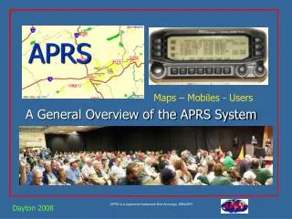
APRS A General Overview of the APRS System
General Topics • APRS Definition & History • Typical Equipment Setup • Mapping/Tracking Programs • Weather Reporting • Public Events • The Future • Question & Demonstration
What is APRS? • APRS stands for Automatic Packet Reporting System (although it is frequently also called Automatic Position Reporting System.) • APRS was developed in the early 1990's by Bob Bruninga, WB4APR, for tracking and digital communications with mobile GPS equipped stations utilizing Amateur two-way radio.
Bob Bruninga – “Father of APRS” • His first experimental protocol was run on a VIC-20 program in 1984 to report the position and status of horses in a cross country endurance run for AMRAD • He developed the current APRS protocol as part of his research for the US Navy while an Instructor at the Naval Academy in Annapolis, MD. to assist in tracking boats in races on the local waterways.
Bob Bruninga – “Father of APRS” • The predecessor to the current “APRS” protocol was named APLS and released in 1991. • He is still very active today, and continues to provide support and set standards. • In the 13 years since its introduction, he has helped APRS to grow to the extent that it now encompasses just about every aspect of Amateur Radio.
What is APRS all about? • The APRS System was developed in order to assist amateur radio operators in tracking and monitoring position data. • APRS is used daily in order to assist in Search and Rescue through its tracking capabilities. • An original intent for APRS is its messaging capabilities, which can work even in a disastrous time when the Internet is down. • APRS can be used to transmit location data, course and speed info, and weather information in a timely fashion using a packet network.
More “About APRS”…. • The Automatic Packet Reporting System consists of a very large land based wireless network. • This network has nodes nearly every 20-30 miles that relay signals through digipeaters. • APRS is used in space to track satellite data and GPS information from onboard GPS receivers. • It is also used to monitor telemetry values of weather stations for the National Weather Service (NWS) • APRS has the capability to quickly relay telemetry values to research centers without the Internet.
Different than Regular Packet • It uses graphical mapping and other data displays. • All communications use a “one-to-many protocol” so everyone is updated in real time. • Generic digipeating so knowledge of the network isn’t required. • APRS turns packet radio into a real-time tactical communications and display system for emergencies and public service applications.
What Equipment is required? • APRS was developed to work in a mobile environment, so it was designed to only use three pieces of hardware. • This consists of a transmitter/receiver (Transceiver), a Global Positioning System (GPS), and a terminal node controller (TNC).
Basic Equipment • A VHF Amateur Radio Transceiver operating on 144.390 Mhz. (USA). • Must be a “transceiver” as APRS uses a collision detection system to know when to send data. • Range of coverage depends on the power of the transmitter.
Basic Equipment • A standard GPS (Global Positioning System) unit. • There are 24 orbiting satellites used to pinpoint anyone's specific geographic location. • They also provide ground speed and altitude measurements. • Current accuracy ranges from 1-5 feet.
Basic Equipment • A TNC which is basically a radio (or “RF”) modem. • The TNC connects the transceiver to a GPS converting it’s data into AX.25 Packet protocol. • “TinyTracs” are simple “Transmit Only” stand alone APRS TNCs
Various Mobile Setups Mobile Tracking Installations utilize a GPS connected to the radio through the TNC interface, The new “APRS Ready” transceivers like Kenwood’s TM- D700 have their own built in TNC.
Various Portable Setups A Portable Tracker is usually low powered and may need a nearby digipeater. These units work well with bike-a-thons, parades and other community events, along with search & rescue operations and weather nets.
Weather Station Setups Weather station setups with APRS are similar to the normal setups, However, the GPS unit is usually replaced by outsideWeather Monitoring Equipment.
Using TNC Function Radios • These radios are specifically designed to support ARPS functions in a single package. Just add a basic GPS unit and it is ready! • Kenwood TM-D700A • Kenwood TH-D7A • Alinco DR-135T MKII with EJ-41U TNC
Kenwood TM-D700A • A Dual band 114/440 MHz 50/35 Watts • Built-in 1200/9600 bps TNC including a “digipeater”. • Built-in screen display of other APRS stations and messaging. • Add a GPS, and the proper cable, or simply key in your position coordinates.
Kenwood TH-D7A(G) • Built-in APRS functions. • Dual band 114/440 MHz. • Basic TNC at 1200 bps. • On screen text monitoring • Plug in a GPS or key coordinates.
Alinco DR-135T/EJ-41U • Allows direct input from any standard GPS. • Basic 1200/9600 bps TNC • Basic 2 M Radio with optional TNC. • Unlike the Kenwood radios, it requires a PC to set it up, and there is no APRS display directly on the radio.
And Another Method… • Uses PC sound card to transmit and receive signals from radio – No TNC required • AGWPE is an excellent Sound card interface for Packet Radio available free on the Internet. • Simple interface circuitry (The same as PSK31). • Requires a modest computer to operate
How does the Signal Travel? Aa Direct Relays
How does the Signal Travel? Aa Relays and DigiPeaters
How does the Signal Travel? Aa Straight through the DigiPeater
How does the Signal Travel? Aa Multiple Hops
How does the Signal Travel? Aa And to the Internet Gateway
Mapping/Tracking Programs • Dos-APRS Bob Bruninga • WinAPRS Mark Sproul • MacAprs Keith Sproul • APRS+SA Brent Hildebrand • UI-View Roger Barker • Xastir Open Source • XAPRS Sproul Brothers • PocketAPRS Mike Musick
WinAPRS and MacAPRS • Separate Windows and Mac programs • Precision Mapping and Tiger Maps • Supports GPS and weather station input • Supports all standard Packet Radio TNCs • Supports all standard callbook CD-ROMs for lookup of call signs
APRS + SA • 32-bit Windows-based • Delorme Street Atlas 4.0 through 9.0 • TNC-2 or AGWPE for RF operation • Standard NEMA GPS and Weather station support • IGate to Internet • Email send and receive • Web Server
UI-View • UI-View uses bitmap images for its maps. Also, the 32 bit version supports Precision Mapping. • It supports TNCs in KISS mode and AGWPE host mode in addition to terminal mode - and host mode allows up to 16 RF ports. • UI-View has a full-featured intelligent digipeater. • UI-View has full support for connecting to APRS servers on the internet. • UI-View is open architecture. A number of other software developers have written add-on applications providing additional functionality.
UI-view • Whether it is used just for WX, or display only, or full TX /RX/internet. UI-View is more than capable. • It can be configured as a digipeater to relay packets. • With plug-ins, UI-View can receive NWS warnings and plot them on the map. • UI-View can really shine in the emergency or event communications role.
UI-view Maps • Full support for Precision mapping, plus you can “capture” many other mapping programs. • SA virtual map. It makes it very easy to grab maps from Street Atlas V4, V5, V6, V7, V8 and V9 • UI-Terra add-on allows you to make maps from Terraserver.
UI-View Events Operation • Exclude/include lists. Here you can choose to exclude everything except mobile stations. • Tactical calls -- you can assign labels to call signs. • With a plug-in, you can draw an object on the map and transmit it over APRS. This is great for a race route.
Xastir • Development is a collaborative effort of programmers from around the world. • Xastir supports many map formats and is highly customizable. • Xastir runs on Windows, MacOSX, Linux, FreeBSD, Solaris, and Lindows, with many more possible . • On Unix-like operating systems, you can run your weather station or GPS on a separate computer as well, which is good for those hams who are already short on serial ports. • Xastir is FREE! under the GPL license and comes with all source code.
Adding an Internet Interface • Allows you to see more than just local RF. • Utilize facilities available only on the Internet. • Low cost backbone between RF networks. • World-wide availability. • Can run stand-alone without a Radio Interface.
Utilizing an IGate • An IGATE is a local APRS station that utilizes the APRSserve network to pass all packets heard on their local RF back to the Internet. • It can also act as a gateway to pass messages addressed to local RF stations from Internet only stations.
Findu.com mapping Internet tracking developed by Steve Demise – K4HG
Findu.com Weather Tables Temperature & Dew Point Rainfall Rates
Aprsworld.com Developed by James Jarvis – KB0THN Field Day 2004 at Beltsville Home Weather Station On my way to Work Allows simultaneous tracking mapping of the various SSID’s used by a station
Citizens Weather Corps The Citizens Weather Observer Program (CWOP) has become an interesting adjunct to the APRS Internet reporting system.
WXNET and CWOP Purpose • Allows non-Amateurs to utilize the APRS network to collect and report on local weather conditions. • Does not require any kind of Radio Interface • This data is available as a public service for any non-commercial use. • Provides feedback and guidance to weather • station operators to help them improve.
APRS for Special Uses • Bicycle rallies, races • Walk-a-thons, Parades • Skywarn • Weather Nets • Crime prevention patrols • Damage assessment • Direction Finding – Foxhunts • Voice for communications, APRS for visual mapping • Now integrating into APRN (Automatic Picture Relay Network)
Into Space..PCSAT • The Prototype Communications Satellite, is a US Naval Academy Aerospace student project. • It was designed to give students real hands on experience in satellite design and operations • APRS space frequency is published as 145.825
PCSAT Satellite • PCSAT was Launched in September 2001 from the Kodiak Alaska Launch Complex. • It was the first APRS satellite, and has since been joined by 3 other such satellites