Download
1 / 14
140 likes | 266 Views
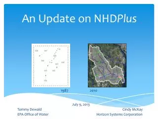
The Future of NHD Plus. 2009 NHD Stewardship Conference Denver, CO April 14-17, 2009. Tommy Dewald USEPA, Office of Water. Vision for a National Geospatial Surfacewater Framework. National Hydrography Dataset. National Elevation Dataset. Watershed Boundary Dataset.

E N D
The Future of NHDPlus 2009 NHD Stewardship Conference Denver, CO April 14-17, 2009 Tommy Dewald USEPA, Office of Water
Vision for a National Geospatial Surfacewater Framework National Hydrography Dataset National Elevation Dataset Watershed Boundary Dataset • Federal Geographic Data Committee • Subcommittee on Spatial Water Data
A National Geospatial Surfacewater Framework (http://www.epa.gov/waters) NHDPlus is a suite of application-ready geospatial products that build upon and extend the capabilities of the National Hydrography Dataset (NHD) by integrating it with the National Elevation Dataset and National Watershed Boundary Dataset. NHDPlus provides: Enhanced NHD Network & Names Value-Added Attributes Catchments With Attributes Flow Direction & Accumulation Grids Flow Volume and Velocity Estimates Updated network relationships enable robust up/downstream navigation. Additional hydrographic feature names enable improved map labeling, query-by-name, and linking of water quality data. Fourteendifferent Value-Added Attributes, including stream order, are derived from the underlying NHD and enable advanced query, analysis and display functionality. Incremental and cumulative drainage areas for each stream segment in the NHD network enable analysis of associated landscape characteristics, including temperature, precipitation and land cover. Flow direction and accumulation grids associate the land surface (topography) with the NHD network enabling landscape analysis and characterization. Mean annual stream flow volume and velocity for each stream segment in the NHD network enable time-of-travel and pollutant dilution modeling. The National Hydrography Dataset is a comprehensive set of digital geospatial data that contains information about surface water features such as streams, rivers and lakes. The NHD provides: A rich set of hydrographic features for making maps. A drainage network for supporting up/downstream query, analysis and modeling. A stream addressing system for linking water quality data to the NHD network.
WATERS Geospatial Data Architecture WQSDB GRTS Water Quality Standards Nonpoint Source Grants National Hydrography Dataset Plus ATTAINS STORET Water Quality Assessments, Impaired Waters & Total Maximum Daily Loads Water Quality Monitoring (Watershed Assessment, Tracking & Environmental ResultS) (www.epa.gov/waters) Reach Address Database (RAD)
NHDPlus Tools Drainage Area Delineator Catchment Allocation and Accumulation Tool Aquatic Exposure Tool WATERS Web services Batch indexing ‘raindrop’ method Up/downstream query of events Build/Refresh Toolset (under development)
NHDPlus Applications • Incident Command tool for protecting drinking water (ICWATER) • Pesticide risk assessments • Assessing recovery potential of impaired waters • Impaired waters / FWS refuges and hatcheries • USGS SPARROW modeling of surface-water quality • And more … • (Share your NHDPlus applications with others • at www.epa.gov/waters)
National Aquatic Resource Surveys NHDPlus served as the basis for establishing the National Lakes Assessment sample frame – from which a representative set of sample sites (right) were randomly selected. NHDPlus will also be used to calculate drainage areas for lake sampling sites (left) to support data analysis. (www.epa.gov/owow/lakes/lakessurvey)
Landscape Metrics Arranged by Hydrological Proximity to Sites on Mississippi, Missouri, and Ohio Rivers Main channel and tributary riparian buffers nested within 10-km network watershed as navigated by hydrological proximity to a site using NHDPlus (USEPA – Office of Research and Development)
Enhancements toMedium Resolution NHDPlus Complete build/refresh toolset (2010) National refresh using: Now completed WBD Latest NHD and NED Additional flow volume estimates? Improved velocity regression equations?
High Resolution NHDPlus Opportunities Prepare HR NHD for NHDPlus processing NHDPlus NHD QAQC tool NHDGeoEdit tool for corrections (enhanced for queued edit?) Included in Maintenance Lite II processing? Compute Value-Added Attributes Complete NHDPlus Build/Refresh toolset (2010) Produce remaining NHDPlus components Modify NHD data model to accommodate geometry and attributes for NHDPlusand WBD Scheme for tagging derived NHDPlus data when underlying NHD/WBD changes between NHDPlus refresh cycles
The Future of NHDPlus Questions? Tommy Dewald USEPA – Office of Water dewald.tommy@epa.gov