0 likes | 1 Views
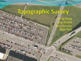
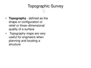
Before you can move forward with land development or construction, you need solid,<br>accurate data. Instead of relying only on time-consuming fieldwork, an aerial topographic<br>survey gives surveyors a faster way to get the information needed. Capturing detailed site<br>data from above helps keep things efficient, accurate, and safer from the start
E N D
Aerial Topographic Survey Essentials Before you can move forward with land development or construction, you need solid, accurate data. Instead of relying only on time-consuming fieldwork, an aerial topographic survey gives surveyors a faster way to get the information needed. Capturing detailed site data from above helps keep things efficient, accurate, and safer from the start. What Makes an Aerial Topographic Survey Essential? This method works by collecting detailed elevation data from above to build topographical maps and 3D surface models. Instead of taking measurements on the ground, it uses tools mounted on small aircrafts or drones (UAVs) to scan the area from the air. The result is a digital model that shows both natural terrain, built structures, and more. In many cases, it offers a clearer, more complete picture than what you'd get from a traditional topographical survey done on foot. That’s why topographic surveying has become a key part of planning and decision-making for various kinds of projects. Key Technologies Driving Precision Modern aerial surveys deliver impressive accuracy and high levels of detail thanks to advanced technology. These methods can quickly collect large volumes of data, using specialized sensors and processing systems. The detailed information they produce is then put to use by experienced Oklahoma land surveying professionals, allowing for greater precision in their work. Photogrammetry Photogrammetry is all about measuring using photos. It usually starts with a drone or small aircraft capturing multiple clear, overlapping shots of the ground. From there, software steps in to stitch those photos together and build 3D models—like elevation maps or corrected images—that show the area in its current state. Photogrammetry offers a simple, effective method for examining the landscape without the hassle that can come with traditional field work. This approach also makes it possible to quickly produce detailed topographic maps and gather a large amount of surface data. LiDAR (Light Detection and Ranging) LiDAR sends out laser pulses from above—usually using drones or aircraft—and measures how long it takes for those pulses to reflect back after hitting the ground. The result is a dense
collection of 3D points that form detailed digital terrain models (DTMs) and digital surface models (DSMs). One of the greatest benefits is that it can still pick up ground elevations even in thick forest, since the laser cuts through the trees. Applications of Topographical Surveys Because a topographical survey is both accurate and efficient, it’s a vital tool across different industries. An experienced land surveyor can tailor the approach and break down the results to meet the specific needs of each project. Land Development and Planning: Gives clear data to help choose sites, plan layouts, and run earthwork and feasibility checks. ● Civil Engineering and Construction: Supports design, accurate earthwork estimates, and helps track progress to stay on spec. ● Environmental Monitoring and Assessment: Useful for spotting changes, mapping ecosystems, and checking for erosion to support both conservation and regulation. ● Infrastructure and Utilities: Helps map out existing utility systems, making it easier to plan maintenance, upgrades, or new installs safely. ● Specialized Uses (e.g., Agriculture, Mining, Forestry): Invaluable for precision farming, timber inventory, volume calculations in mining, and detailed canopy analysis in forestry. ● Why Expertise in Land Surveying Is Crucial While advanced technologies, such as drones and LiDAR, are powerful tools, their actual value is unlocked by expert interpretation and application. That’s when having a professional with real experience in Oklahoma land surveying makes a difference. A local surveyor knows the land, understands the specifications of the soil, and is familiar with state and city rules and regulations. This kind of knowledge helps make sure the information you get is accurate, legally viable, and useful for the work you're planning. Your Partner for Precise Aerial Surveys The benefits of conducting an aerial topographic survey are game-changing, delivering outstanding efficiency, detailed data, and improved safety. This modern method provides a deeper understanding of the terrain, helping guide informed decisions at every phase of a project—from initial planning to completion. When detailed site information is needed, especially over large or complex areas, aerial surveys frequently stand out as the most practical and reliable approach.
At Sisemore & Associates, our experienced professionals utilize state-of-the-art aerial survey technology. We are dedicated to providing exceptionally accurate and comprehensive topographic data, meticulously tailored to your specific project needs across Oklahoma, delivering critical insights for confident and precise project advancement. Ready to gain a new perspective on your project? Contact us today.