Download
1 / 36
380 likes | 678 Views
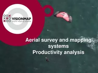
Aerial survey and mapping systems Productivity analysis. The A3 family of Aerial Survey and Mapping Systems. Aerial Survey Digital Frame Camera. Ground Processing System. A3 & A3 EDGE Digital Rotating Frame Cameras. Visionmap A3 Differentiators.

E N D
The A3 family ofAerial Survey and Mapping Systems Aerial Survey Digital Frame Camera Ground Processing System
Visionmap A3 Differentiators • The highest productivityinAerial Survey and Processing • Vertical and Oblique images in one flight by single camera • Fully automaticOrthophoto production
Visionmap A3 Differentiators • Three types of aircraft installation • Three types of aerial survey
FOV FOV 2α 2α Dv Orthophoto area Orthophoto area Qp Q1 Wo W1s/W2s Vertical Flight Scheme FOV - full coverage angle 2α –permissible orthophoto angle W1s/W2s – sweep/photo coverage width Wo–orthophoto width Q1 –orthophoto side overlap Qp– side sweep/photo coverage overlap Do – flight lines distance
βmax βmin Lmax Lmax Do Lmin Lmin Oblique coverage Oblique coverage Q2 Rmin W2o Rmax Two-side Oblique Flight Scheme βmax - oblique max. angle βmin - oblique min. angle Q2 - side oblique overlap Rmax - max. oblique footprint Rmin - min. oblique footprint Lmax - max. oblique distance Lmin - min. oblique distance W2o - oblique coverage width Do - oblique flight lines distance
One-side Oblique Flight Scheme βmax - oblique max. angle βmin - oblique min. angle Q2 - side oblique overlap Rmax - max. oblique footprint Rmin - min. oblique footprint Lmax - max. oblique distance Lmin - min. oblique distance W2o - oblique coverage width Do - oblique flight lines distance βmax βmin Lmax Do Lmin Oblique coverage Oblique coverage Q2 Rmin W2o Rmax
Parameters of different cameras • Comments: • Technical parameters of the cameras are taken from open internet sources; • A3 EDGE - sub-pixelbinningfrom 5.5 um
FOV FOV 2α 2α Dv Orthophoto area Orthophoto area Qp Q1 Wo W1s Flight planning elementsfor A3 FOV–field of view 2α–allowable orthophoto angle W1s–one strip image coverage (SLF/sweep width) Wo–one strip orthophoto coverage Q1– side overlap (~10%)between orthophoto coverages from adjacent strips Qp–side overlap between adjacent strips (~60%) Dv–flight lines distance
Aerial survey productivity comparison Comments: Calculations for different cameras have been made with technical parameters of the cameras published in open internet sources;
Aerial survey productivity comparison • Comments: • Calculations for different cameras have been made with technical parameters of the cameras published in open internet sources; • Image acquisition productivity depends on different camera and flight parameters – flight altitude, ground speed, camera FOV, permissible orthophoto angle, minimal allowable forward and side overlap. • These calculations are based on the following assumptions: • Same ground resolution for all the cameras, • Same ground speed for all the cameras if there is no special speed limitations for the camera mentioned by the camera manufacturer, • Minimal side overlap for A3 camera is 60%. Minimal side overlap for other cameras is 20%, • Same or less permissible orthophoto angle. Less – when the side overlap is getting less then 20%.
Footprint Comments: Calculations for different cameras have been made with technical parameters of the cameras published in open internet sources;
Footprint Comments: Calculations for different cameras have been made with technical parameters of the cameras published in open internet sources;
Distance between flight lines Comments: Calculations for different cameras have been made with technical parameters of the cameras published in open internet sources;
Distance between flight lines • Comments: • Calculations for different cameras have been made with technical parameters of the cameras published in open internet sources; • Distance between flight lines depends on different camera and flight parameters – flight altitude, camera FOV, permissible orthophoto angle, minimal permissible forward and side overlap. • These calculations are based on the following assumptions: • Same ground resolution for all the cameras, • Same ground speed for all the cameras if there is no special speed limitations for the camera mentioned by the camera manufacturer, • Minimal side overlap for A3 camera is 60%. Minimal side overlap for other cameras is 20%, • Same or less permissible orthophoto angle. Less – when the side overlap is getting less then 20%.
Flight Direction Single Frame Lenses Sweep Movement Double Frame Super Large Frame – up to 780 Mpix A3 EDGE SLF – Super Large Frame • Smooth sweep movement; • Up to 31 double frames per sweep; • Along strip overlap between frames 2%; • Cross strip overlap between frames 25%; • Forward overlap between two sweeps – determinable
Frame area Comments: Calculations for different cameras have been made with technical parameters of the cameras published in open internet sources;
Frame area • Comments: • Calculations for different cameras have been made with technical parameters of the cameras published in open internet sources; • Frame area depends on different camera and flight parameters – flight altitude, camera FOV, permissible orthophoto angle, minimal permissible forward and side overlap. • These calculations are based on the following assumptions: • Same ground resolution for all the cameras, • Same ground speed for all the cameras if there is no special speed limitations for the camera mentioned by the camera manufacturer, • Minimal side overlap for A3 camera is 60%. Minimal side overlap for other cameras is 20%, • Same or less permissible orthophoto angle. Less – when the side overlap is getting less then 20%.
A3 Light Speed Ground processing system • A3 DataViewer – a viewer for aerial survey data, images, data processing, reports, absolute orientation, analysis and export. • A3 Light Speed (Processing and Control Center) - an application for cluster management and end-to-end ground processing: • Aerial triangulation, • DSM creation, • Orthophoto production.
Visionmap A3 End-to-end workflow • Aerial survey, • Imagery downloading, • GPS processing is executed by GrafNav program, • Aerial triangulation including matching and bundle block adjustment with self calibration, • DSM creation, • DSM to DTM filtering currently is executed by third party programs, • Orthophoto creation with automatic cut-lines and radiometric adjustment. There is a built-in graph editor for cut-lines editing. • Optional: • Export – single images, SLFs, DSM. • Import – exterior DTM, vector layers, GPS, GCP.
A3 Light Speed Final mapping products • Vertical and Oblique photogrammetrically oriented images, • SLFs – super large photogrammetrically oriented frames for stereocompilation, • DSM – digital surface model, • Orthophoto.
A3 Light Speed Orthophoto processing productivity Comments: Processing productivity is calculated for a fully automatic A3 processing not including DSM calculation and common manual processes like cut-line editing and QA. Processing productivity is calculated for the A3 Light Speed standard cluster, optimal aerial survey parameters and assumes parallel processing of several projects.
Spain S = 504,030 sq.km; Lwe ~ 850 km; Lsn ~ 850 km;
Mapping of Spain with A3 EDGE & A3 LightSpeed Comments: For these calculations the mapping area is presented as a rectangle of size 800 km x 630 km = 504,000 sq.km; Permissible orthophoto angle – 55 degrees; Forward overlap – 50 - 55%; Side overlap – 58 - 68%; Aerial survey day – 6 hours; Aerial survey time per one A3 EDGE camera including time for turns (5 min) between flight lines; Processing time is calculated per one standard A3 LightSpeed processing system supplied by VM; Processing time does not include DTM creation and manual processes like QA;
Camera’s Productivity Comparison Comments: Permissible orthophoto angle – not more than 55 degrees; Side overlap – not less than 20%; Calculations are made for the flight with Ground Speed = 289 knots (535 km/hour) and GSD=25 cm;
Camera’s Productivity Comparison Comments: Permissible orthophoto angle – not more than 55 degrees; Side overlap – not less than 20%; Calculations are made for the flight with Ground Speed = 289 knots (535 km/hour) and GSD=25 cm;
Aerial triangulation accuracies Comments: PPP – Precise Point Positioning GPS processing (without ground reference stations) DGPS – Differential GPS processing (with ground reference stations) GCP (Ground Control Points) = 0 – adjustment without GCPs (only GPS) ChP (Check Points) – GCPs are not participated in the adjustment. All 4 first were flown on test-fields with signalized GCPs. RUSA311 mission was checked with natural GCPs. Strips examples : 3 – three parallel strips; 3*2 - three parallel and 2 cross strips.
Conclusion 1 – A3 camera • Substantial cost reduction in aerial survey • Easy to use • Very high aerial survey productivity • Pre-flight preparation time – 10 minutes • Flight time reduction • Maximal utilization of good weather • Very effective aerial survey in urban areaswith high GSD • Vertical and oblique images in one flight by single camera in the same time
Conclusion 2 – A3 processing • Substantialcost reduction in processing • Very high processing productivity • Fully automatic triangulation, DSM, orthophoto and mosaic of very large blocks • End-to-end workflow in one software solution • Multiple projects parallel processing
Conclusion 3 – A3 SLF • A3 SLF area up to 6 times larger than the frame area of other cameras • A3 SLF is very useful for large area stereo-compilation, monitoring and photo-interpretation
Conclusion 4 – A3 Accuracy • A3 system enables PPP or DGPS processing utilization • A3 system ensures high photogrammetric accuracy with or without GCPs • A3 system does not need IMU
Thank you for your attention ! www.visionmap.com Visionmap video on YouTube: • A3 Digital Mapping System - http://www.youtube.com/watch?v=PDmwSKj38Jw&feature=related • A3 Automatic Processing System - http://www.youtube.com/watch?v=ljWjgoezxsk&feature=related The information contained in this publication is provided for general guidance only and forms no part of the contract and shall not in any circumstances constitute a trade description. The Company reserves the right to change or amend specification without prior notice.