ABSTRACT
10 likes | 182 Views
Exploring the role of global terrestrial ecosystems in the climate-carbon cycle interactions: An Integrated modeling and remote sensing approach Robert E. Dickinson ( robted@eas.gatech.edu ), Qing Liu, Yuhong Tian, Liming Zhou. .

ABSTRACT
E N D
Presentation Transcript
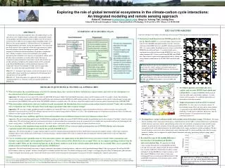
Exploring the role of global terrestrial ecosystems in the climate-carbon cycle interactions: An Integrated modeling and remote sensing approachRobert E. Dickinson (robted@eas.gatech.edu), Qing Liu, Yuhong Tian, Liming Zhou  School of Earth and Atmospheric Sciences, Georgia Institute of Technology, 311 Ferst Drive NW, Atlanta, GA 30332-0340 KEY PAST PROGRESSES • Some key advances were made in the following areas in our past NASA projects in conjunction with our proposed NASA work. OVERVIEW OF SCIENTIFIC PLAN • Derived new land datasets from MODIS products for use in climate models: (1) a new land surface dataset created from the latest MODIS high quality products of LAI, vegetation continuous field, IGBP land cover, and PFTs from the period 2000–2001; (2) a more realistic broadband emissivity dataset created from MODIS thermal infrared bands; (3) a global monthly green vegetation fraction dataset derived from MODIS data; and (4) an annual maximum FVC dataset created from MODIS and AVHRR data. These datasets significantly improved land surface climate and energy balance simulations in the NCAR CLM2 and Noah land model. • ABSTRACT • Terrestrial ecosystems play important role in the global climate system and carbon cycle. Coupled climate-carbon models constrained by remote sensing products provide important means to address how the terrestrial ecosystem affects and reacts to changing climate and global carbon cycle. However, our current capability is still limited because of inadequately developed modeling and remote sensing data approaches. Our current and past NASA projects have improved satellite data representation of global terrestrial properties and are developing new model schemes for the merging of satellite data and climate models. We propose to implement these schemes to explore various terrestrial biophysical coupling mechanisms that contribute to the trajectory of atmospheric carbon, and to develop a data assimilation system that allows direct inference of vegetation dynamical properties from remote sensed radiation fluxes in weather and climate prediction. The proposed work will be conducted using NASA MODIS products and the modeling framework of the Community Climate System Model (CCSM), and will significantly improve the carbon and climate predictability of the CCSM. • Spatial pattern of percent cover difference (new-old) in grass/ crop, tree, shrub, and bare soil at the model spatial resolution as inferred from MODIS land cover classification versus use of AVHRR. Objective 1: To improve and evaluate several terrestrial processes in a coupled carbon climate model that are important for determining future concentrations of CO2 and CH4. Objective 2: To develop and test an approach for the assimilation of vegetation properties as a dynamic system in a climate model from MODIS data. • Spatial pattern of LAI difference between the new and old land surface datasets (new-old as derived respectively from MODIS and AVHRR land products) in winter (DJF) and summer (JJA) . RESEARCH QUESTIONS & TECHNICAL APPROACHES • What determines the seasonal dynamics of leaf level radiation fluxes, how can these be better included in a climate model, and what are the consequences of these fluxes for leaf level carbon assimilation? • Approaches: We continue to revise and test the current CLM-DGVM (Dynamical Global Vegetation Model) phenology scheme and the radiation scheme for complex canopy. The phenology scheme will be strongly constrained by MODIS LAI and EVI data and validated using the MODIS derived Phenology product. The canopy radiation scheme will be evaluated against canopy light measurements from BOREAS, LBA and the Safari 2000 MODIS validation in southern Africa. We will also evaluate the modeled sunlit leaf fraction against climatological data of MODIS fPAR. • What determines soil moisture and water table levels and consequently the distribution of terrestrial seasonal and permanent wetlands? Under what conditions will a wetland dry out? What will make boreal and tropical peatland vulnerable to climate change? • Approaches: We are using a simple groundwater model developed in our current IDS work as an efficient approach to represent groundwater dynamics and will extend it with an inter-grid horizontal water transport for use in GCMs. Methane emissions are to be estimated using models by Walter et al. (2001). The simulated changes in wetland areas and in the net fluxes of carbon and methane over these regions will then be assessed. • What climate processes condition rapid losses from and transitions between different forms of terrestrial biomass carbon stores? • Approaches: We are reformulating modules in the CLM-DGVM by including will adding the current CLM-DGVM fire module fire probability based on the concept of “fuel beds” related to various carbon stores. We will also design some rules to characterize fractions of various carbon stores removed on average by occurrence of fire at model time step based on analyses of climatological and remote sensing indices. The MODIS daily fire product at 1-km will be used to constrain the model simulated timing and spatial distribution of fires. • Can we develop a data simulation framework that could derive MODIS LAI in a forecast mode, prototyped by use of MODIS albedos and a dynamic vegetation model with atmospheric forcing for the period of MODIS data? • Approaches: We will develop and test a canopy radiation model to relate the vegetation dynamical properties with the albedo more realistically for complex canopies. A filter-type assimilation technique will be used to perform data-model fusion. A statistical dynamic vegetation model will be used to validate the physical dynamical vegetation model and to test the developed data assimilation system. • Can we establish proper quantifications of data and model statistics for applications in the global terrestrial ecosystem in which remote sensing data and dynamic vegetation models can be optimally integrated, i.e., What statistics of the albedo do we use as input? How can we compute matching statistics from the dynamic model? What are the statistical properties of the dynamic model we need to have for the model-data fusion to be successful? How can we quantify the albedo statistics of both the dynamic model and the MODIS data? • Approaches:The land surface model uncertainty is largely attributed to uncertainties of model parameters, and hence will be quantified through Monte Carlo-type approach. We will use MODIS pixel albedos to obtain an “optimal” estimate of model grid level albedos and their data errors. The albedo scaling-up can be as simple as averaging the pixel values for homogenous grids and more complex for highly heterogeneous grids. Statistically-based criteria will be used to determine the heterogeneity of each grid cell before computing the “optimal” grid estimate. • Developed spatially and temporally more realistic and accurate MODIS land albedo and LAI products: (1) improved MODIS albedo and LAI retrievals under snowy and cloudy conditions; (2) more realistic LAI seasonality; (3) established global bare soil albedo date set for climate models. • Improved parameterizations of the terrestrial processes:(1) a new snow cover fraction scheme; (2) investigating canopy effects on snow surface energy budget; (3) integration of the MODIS BRDF/albedo data and land modeling; (4) land surface turbulence, bifurcation, and soil moisture memory; (5) parameterization of canopy hydrological processes. • Developed new canopy radiation model with consideration of the plant canopy 3-D effects:We found that the modeling of the canopy light environment as implemented in current CLM is seriously deficient in its partitioning of light between vegetation canopies and underlying surfaces due to its unrealistic assumption of plane parallel canopy geometry, in particular for the semiarid systems with sparse shrubs, and northern forest with winter snow-pack. This consequently leads to the underestimation of the light loading on the canopy, and hence its carbon assimilation. We have been developing a more realistic three dimensional canopy radiation model for climate modeling to describe the canopy geometric (shadow) effect to improve the model climate simulations and energy partitioning between canopy and its underlying surface. • Revealed the cause of the notable differences between the CLM modeled and MODIS observed radiation flux: We found that the FPAR value is mainly determined by LAI in MODIS and both LAI and stem area index (SAI) in CLM. The positive FPAR bias is mainly attributed to CLM SAI of deciduous canopy and higher LAI than MODIS for evergreen canopy as well. The negative FPAR bias results from several factors, including differences in LAI and soil albedo between CLM and MODIS or limitations of the geometric optics scheme used in the model. Collaborators: Rong Fu, Wenhong Li, Qing Liu (Georgia Institute of Technology); Gordon B. Bonan (NCAR); Ruth DeFries, John Townsend, Eugenia Kalnay, Shunlin Liang, Chris Justice (University of Maryland); Mark Friedl, Yuri Knyazikhin, Ranga Myneni, Nikolay Shabanov, Crystal Schaaf, Alan Strahler (Boston University); Nancy Kiang, Randal Koster, Jeffrey Privette (GSFC, NASA); Wenge Ni-Meister (Hunter College); Xubin Zeng (Univeristy of Arizona); Zong-Liang Yang, Guo-Yue Niu (University of Texas at Austin); Hanqin Tian (Auburn University); Yong-Jiu Dai (Beijing Normal University, China); David Erickson, John Drake (Oak Ridge National Laboratory); Xiaowen Li, Qinhou Liu (CAS Institute of Remote Sensing, China) • FPAR differences (FPARαg=0.0-FPARαg=0.23) simulated by the CLM and the MODIS FPAR algorithm with the canopy underlying soil albedo changing from 0 to 0.23 at SZA = 30. Please visit http://climate.eas.gatech.edu/dickinson for more project information and published papers.


