Advancements in NASA's Modeling, Analysis, and Prediction of Climate Variability and Change
The NASA Modeling, Analysis, and Prediction (MAP) Program, led by Don Anderson, focuses on integrating advanced satellite observations and modeling components to enhance our understanding of climate variability and change. Notable achievements include assessing the impact of Antarctic ice shelf break-up on glacial dynamics and leveraging the Earth System Modeling Framework (ESMF) to improve models' interoperability and scalability. This initiative enhances climate forecasting accuracy by incorporating a wide range of environmental data, fostering interdisciplinary collaboration across various scientific domains.


Advancements in NASA's Modeling, Analysis, and Prediction of Climate Variability and Change
E N D
Presentation Transcript
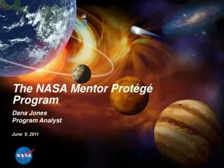
The NASA Modeling, Analysis and Prediction Program Don Anderson NASA HQ Sience Mission Directorate Earth-Sun Division Manager, Modeling, Analysis and Prediction Lead, Climate Variability and Change Focus Area Manager, Atmospheric Effects of Aviation Research My Background: Planetary->Space->Earth Science
Satellite Observations Provide Global Input to Models from Process, t, to Global TRMM Aqua CloudSat GRACE CALIPSO TOPEX Meteor/ SAGE Landsat NOAA/POES SeaWiFS Aura Jason Terra SORCE ICESat
Results from Antarctic Peninsula • Following Larsen ice shelf break-up glaciers accelerated 8x • ICESat shows thinning by 38 m (blue lines) Scambos et al., GRL 2004
10,000 Years of Ice Gone in 1 Month Collapse of the Larsen B Ice Shelf Larsen B breakup, 31 January to 7 March 2002
CAP SURFACE ESM LAND LAKE AGCM DYNAMICS HYDRO OCEAN FVCORE GWD Ocn CHEM VEG DYN OGCM ATM PHYSICS SEAICE GLACIER MOIST RADIATION TURB Atm CHEM SOLAR AEROSOL IR Modeling Paradigm of the Future - Frameworks & Integration The solution Earth System Modeling Framework Brings together major national modeling centers • ESMF - an environment for assembling geophysical components into applications. • ESMF - a toolkit that components use to • increase interoperability • improve performance portability • abstract common services Technological Trends Environmental modeling and prediction (climate, NWP,...) • Science requires detailed representation of individual physical processes - accuracy, compatibility with observations • Systems are integration of diverse components into a comprehensive coupled environmental model and prediction system Computingtechnology... • Science requires use of scalable computing architectures • Hardware advances means that models can run on desktops, even laptops increase in hardware and software complexity GEOS5 AGCM is first model completely implemented with ESMF Platforms
GMI chemistry GMAO LSM GMU ocean GMAO ocean biology LANL sea ice model Where we are going: Modern models integrate components from different sources ESMF accelerates development cycle NASA AGCM for climate and weather GFDL dynamics GMAO physics Add in the assimilation components and the satellite data science + future mission design
Ensemble Member 9 Ensemble Member 14 Ensemble Member 10 Ensemble Member 13 Ensemble Member 11 Ensemble Member 12 Modeling Uncertainty - the need for ensembles Climate Variability and Chaos: Even large scale circulation patterns are influenced by uncertainties - initial conditions, external factors and unresolved scales Model simulations of past droughts over the U.S. Great Plains show substantial sensitivity to initial conditions, reflecting the chaotic nature of climate variability.
Program or Branch #1 Program or Branch #2 Program or Branch #3 Program or Branch #N Modeling 1 Modeling 2 Modeling 3 Modeling N MAP NRA & the MAP Modeling Environment Components Added as Program Evolves MAP Modeling Environment Crosscutting Themes Focus Areas Model, Analysis, Prediction Program / Multi-investigator proposals ESMF Core Integration Team … External NRA Proposals GISS Model E CMAI GMI ECCO II
Data System Architecture for MAP Modeling Environment Flight Operations, Science Data Distribution, Processing, Data Capture, Access, Data Info Mgmt, Data Initial Processing, Transport Interoperability, Backup Archive Data Acquisition to DAACs Archive, & Distribution Reuse Research Users Tracking Spacecraft & Data Relay Satellite DAACs (TDRS) ESIPs NASA Integrated Data Processing & Mission Control Services Network (NISN) Mission Services Education REASoNs Users Ground Stations WWW Value-Added Science Teams Providers Int’l Partners Interagency Polar Ground Stations Centers & Data Data Centers Project Columbia
Long-term data assimilation feeds into climate models Biomass Ocean Carbon Atmosphere CO2 Land Aerosols Clouds Precipitation Long-term Observations Statistics and analysis • Modeled climate forcings and feedbacks • Projections of future climate states • Global & Regional data product for assessments Algorithms Many Runs Large Data Sets Higher Resolution Data assimilation, High-end climate modeling and computing
Integrating Multi-Sensor Observations to Improve Models • Leverage international, multi-agency field campaigns (process-focused intensive observing periods) to test, improve model physics • Cross-reference with multi-year, global satellite data sets to understand, improve coupled model performance, simulations of interactive climate processes, document biases • Regional model development and validation of downscaling of global forecasts for regional climate assessment and decision-making Ocean, Land and Atmosphere Process studies Long-term in-situ Observation Data Satellite Remote Sensing: TRMM rainfall, CERES surface fluxes, AMSR cloud water / ice, Cloudsat and CALIPSO cloud / aerosol vertical profiles, Quikscat wind stress, AIRS, AMSU, HSB thermal & moisture profiles Space / time precipitation distribution atmospheric stability Stratiform cloud production Linkage to National and International Programs… -GCRP GEWEX/CEOP (Land hydrology focus) -WCRP and US CLIVAR (Global oceans and land) Model Problems / Challenges Inter Annual Variability & Dynamical Feedback to Climate System Cloud radiative forcing / feedback Conv / ocean evap feedback, surface wind stress CERES - SW anomaly for Jan 1998
From Precipitation Climatology to Improved Climate Prediction through better closure of water budget & accompanying quantification of accelerations/decelerations in atmospheric & surface branches of water cycle Quantify Storages & Fluxes Incorporating Microphysics Improved Climate Prediction blank
Next Steps: Multi-center/agency ESMF Sensor Web: integration of real time OSSEs toward optimal observations-model=>forecast/prediction SWMF <->ESMF => ‘Mud-to-Sun’ Why? Why Not?