Download
1 / 13
150 likes | 341 Views
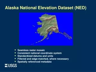
Alaska National Elevation Dataset (NED). Seamless raster mosaic Consistent national coordinate system Standardized datums and units Filtered and edge-matched, where necessary Spatially referenced metadata. The National Elevation Dataset (NED).

E N D
Alaska National Elevation Dataset (NED) • Seamless raster mosaic • Consistent national coordinate system • Standardized datums and units • Filtered and edge-matched, where necessary • Spatially referenced metadata
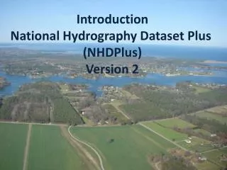
The National Elevation Dataset (NED) • Seamless national coverage of “best available” public domain raster elevation data • Geographic “projection” • Datum: NAD 83 horizontal; NAVD 88 vertical • Elevation units: decimal meters • 1-arc-second (30-meter), 1/3-arc-second (10-meter), and 1/9-arc-second (3-meter) grid spacing • Alaska: 2-arc-second grid spacing • Updated bi-monthly to incorporate all new USGS DEM production and other newly available source data
Multi-resolution NED 1-arc-second (30 meters) 1/3-arc-second (10 meters) 1/9-arc-second (3 meters)
NED Production Flow Source data selection Datum and unit conversion Projection transformation and resampling Artifact removal DEM merge Edge match Shaded relief generation Inspection NED Metadata generation
NED Spatial Referenced Metadata Polygon attributes store information about source DEM and NED processing
Bulk data delivery • Customer provides the hard drives • Data format options are limited to ArcGrid or FloatGrid • Turn around time may be 4-8 weeks • All the data for the customer’s specific resolution will be placed on the hard drive • Possible exception for Alaska • Send requests to: bulkdatainfo@usgs.gov
USGS Seamless Server • pro - standardize seamless product with spatial metadata • pro – offers both customer defined area download and bulk deliver • pro - higher resolution source data is used to improve lower resolutions layers • con- data is modified from original state • con - download data is chipped into 250mb pieces requiring remosaicking • con – bulk delivery output formats are limited to ArcGrid and FloatGrid
Useful links: • http://seamless.usgs.gov • http://ned.usgs.gov • http://ned.usgs.gov/Ned/downloads.asp