Download
1 / 17
170 likes | 303 Views
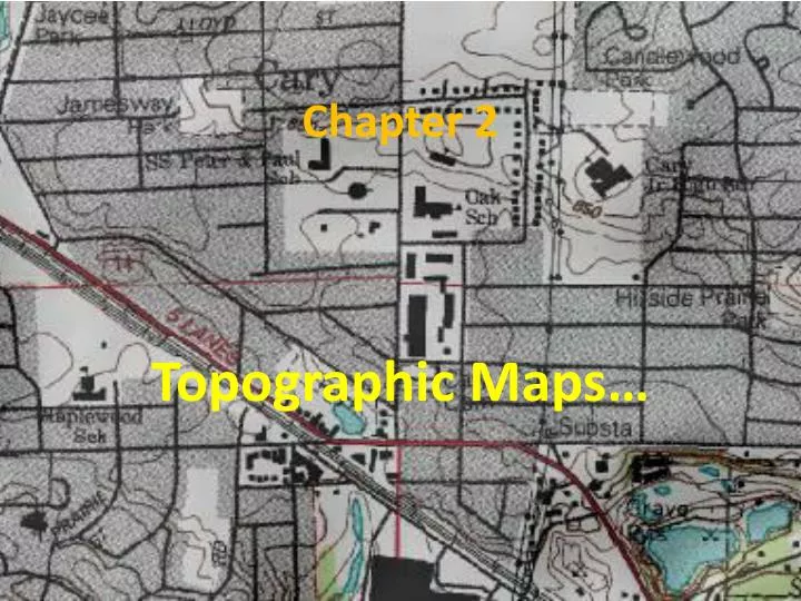
Chapter 2. Topographic Maps…. History……. First topographic maps were made using only ground survey… Today most maps are made by remote sensing, which is collecting data from above the ground……. Quicker and easier,,, More detailed and accurate…. Remote Sensing…. Photogrammetry….

E N D
Chapter 2 Topographic Maps…
History…… • First topographic maps were made using only ground survey… • Today most maps are made by remote sensing, which is collecting data from above the ground……. • Quicker and easier,,, • More detailed and accurate…
Photogrammetry….. • The oldest method of aerial photography
Imaging Radar…. • Sends out a signal, then listens for a return (echo)…
Landsat satellites • Use sensors to detect energy reflected from the ground….
Topographic Maps….. • Topographic maps are detailed maps that use contour lines to represent changes in elevation and features on Earth’s surface.
Contour lines…. • Continuous lines drawn on a map connecting points of the same elevation… • Contour lines show: • Elevation • Shape • Steepness of the land
Contour interval… • The difference in elevation between 2 consecutive contour lines….. • C.I. = 20’
Contour Index…. • Every 4th or 5thline. • Usually darker in color and marked with a number…..
Contour Features…. Hilltops… Plains… Contour lines are spread out and far apart. • Form enclosed circles
Contour Features cont…. Ridges / Cliffs Valleys / Rivers Form a “v” shape and they point upstream • Long, straight lines fairly close together
Depression….. • Depression contour lines have hachures, or short lines at right angles to the contour line. Theseindicate the direction of the depression .
Gradient (Slope)…. • Lines close together = steep slope,,, • Lines farther apart = gentle slope,,,, • Slope = in elevation Distance
USGS….. • The USGS issues standard topographic maps called……… Quadrangles. • 2 main series….. • 15 minute - covers ¼ of a degree of latitude & longitude most of these are 1:62,500 scale • 7.5 minute - 1:24,000 scale, more than 2X as large, there is more detail
Map Legends…. • A map legend explains what the symbols on a map represent.
Map Scale…. • Map Scale – relationship between the distance on the map and real distances on Earth…