Download
1 / 21
210 likes | 300 Views
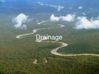
Learn about the water appropriation policy in the Escalante River Drainage, including key features, definitions, establishing water rights, approval criteria, Colorado River policy, hydrology studies, and area boundaries.

E N D
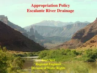
Appropriation Policy Escalante River Drainage Kurt Vest Regional Engineer Division of Water Rights
Prior Appropriation DoctrineMain Features • Divert water to beneficial use. • Priority date. • First in time, first in right. • Loss of right.
Basic Definitions • All water in the state is property of the public (73-1-1). • Beneficial use shall be the basis, the measure, and the limit of all rights to the use of water in the state (73-1-3).
Establishing a Water Right • Diligence Claim. • Surface water uses prior to 1903. • Underground Water Claim. • Ground-water uses prior to 1935. • Court Decreed. • Applications to Appropriate filed with State Engineer.
Approval Criteria (73-3-8) • Unappropriated water in source. • Will not impair existing rights. • Physically and economically feasible. • Not monopolistic / speculation. • In the public interest / welfare. • Will not unreasonablyeffect the natural stream environment or public recreation.
Water Appropriation Policy
Appropriation Policy • Colorado River Policy (March 7, 1990) • Domestic filings, • One Family • Irrigation of 1/4 acre, • 10 heads of livestock (1.73 acre-feet), • Equivalent amount for other uses • Closed area (surrounding Escalante Town)
The only restriction in the 97-area has been to exclude that portion described as “the developed agricultural areas where applications are being held”.
On January 25, 1996, a memorandum was issued specifying the boundary of that excluded area.
Recharge Precipitation Runoff Return flow from irrigation Hydrology • Discharge • Evapotranspiration • Underflow • Springs • Seepage to Rivers • Wells
Studies • 1969 (Goode) Reconnaissance Appraisal of Water Resources near Escalante • 1976 (DWRe) Hydrologic Inventory of the Escalante River Basin • 1986 (Blanchard) Ground-Water Conditions in the Kaiparowits Plateau Area
Geologic Cross Section Navajo Sandstone Carmel Formation Entrada Sandstone Alluvium (Goode 1969)
Town River Escalante Local 1
Town River Moratorium Boundary Escalante Local 2
Town River Moratorium Boundary Escalante Local 3 Hydrographic Boundary
Town River Moratorium Boundary Escalante Local 4 Hydrographic Boundary
Town River Moratorium Boundary Escalante Local 5 Hydrographic Boundary Surface Points of Diversion Underground Points of Diversion
Thank You Comments – July 31th Utah Division of Water Rights PO Box 146300 Salt Lake City UT 84114-6300 www.waterrights.utah.gov