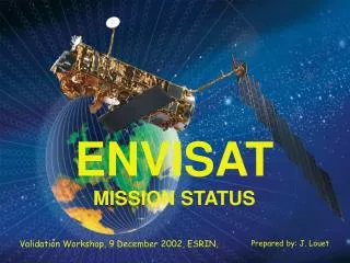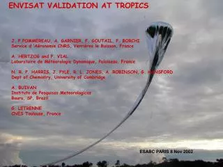
ENVISAT
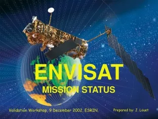
ENVISAT. Burcu Bölükbaşı. Overview. Introduction Mission and System History. Introduction. Launched by the European Space Agency in March, 2002. Measurements of the atmosphere, ocean, land, and ice. Continuity of the data measurements of the ESA ERS satellites. Earth science research

ENVISAT
E N D
Presentation Transcript
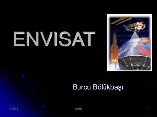
ENVISAT Burcu Bölükbaşı envisat
Overview • Introduction • Mission and System • History envisat
Introduction • Launched by the European Space Agency in March, 2002. • Measurements of the atmosphere, ocean, land, and ice. • Continuity of the data measurements of the ESA ERS satellites. envisat
Earth science research • Monitoring of the evolution of the environmental and climatic changes • Development of operational and commercial applications envisat
Mission and System • The Envisat Space Segment (the satellite itself) including the Polar Platform (PPF) and the payload • The Envisat Ground Segment consisting of the payload data segment (PDS) and the flight operation segment (FOS) envisat
ARTEMIS(Advanced Relay and Technology Mission Satellite) • Testing • Operating New technology systems Launched on 12 July 2001. envisat
Explore advanced technology to transmit data directly from one satellite to another • Observation satellites in low orbit like ERS must use on-board recording and global networks of ground stations envisat
Two payloads for communications directly between satellites: • Receive data from low-Earth orbiting satellites • Transmit them directly to Europe • L-band land mobile payload allows two-way communications, via satellite, between fixed Earth stations and land mobiles - trucks, trains or cars - anywhere in Europe and North Africa. envisat
ARTEMIS Coverage • High and low rate data, including recorder playback, can be received under the Artemis coverage (the on-board Ka-band transmit terminal and data reception with the User Earth Terminal (UET) at ESRIN). • The establishment of the link between the Envisat and Artemis satellites may require up to 3 minutes. envisat
The Ten-thousandth Orbit • The satellite completed its 10,000th orbit in 28 January 2004. • Traveled 450 million kilometers since its launch • Envisat was using all its ten instruments to gather information about the earth and the ground segment was generating about 10,000 Megabytes of data products. envisat
SCIAMACHY total ozone column: • Instrument: Scanning Imaging Absorption Spectrometer for Atmospheric Chartography (SCIAMACHY) • Date of Acquisition: 28 January 2004 • Orbit number: 10000 • Orbit direction: Descending • SCIAMACHY product used: Level 1 spectra envisat
ASAR Global Monitoring Mode over Arctic Sea, north of Greenland: • Instrument: Advanced Synthetic Aperture Radar (ASAR) • Date of Acquisition: 28 January 2004 • Orbit number: 10000 • Orbit direction: Descending • ASAR features: Global Monitoring Mode image (1000 meter resolution) • ASAR mode: Global Monitoring Mode (400 km wide) • ASAR polarization: HH envisat
Synthetic Aperture Radar (SAR) Technical Information: Instrument: Synthetic Aperture Radar (SAR) Dates of Acquisition: Red: 15 July 2004, Green: 6 May 2004, Blue: 22 January 2004 Orbit numbers: 48286, 47284, 45781 Frame: 2781 Instrument features: 25 meter resolution Coordinates: NE Lat/Long: N 41.30 / E 29.86 NW Lat/Long: N 41.48 / E 28.71 SW Lat/Long: N 40.58 / E 28.46 SE Lat/Long: N 40.40 / E 29.60 envisat
MERIS (Medium Resolution Imaging Spectrometer) Technical Information: Instrument: Medium Resolution Imaging Spectrometer (MERIS) Date of Acquisition: 18 November 2004 Orbit number: 14218 Instrument features: FR Coordinates: NE Lat/Long: N 42.47 / E 30.42 NW Lat/Long: N 43.99 / E 23.56 SW Lat/Long: N 38.22 / E 21.63 SE Lat/Long: N 36.79 / E 27.97 envisat
Advanced Synthetic Aperture Radar (ASAR) Technical Information: Instrument: Advanced Synthetic Aperture Radar (ASAR) Dates of Acquisition: Red: 07 June 2004, Green: 06 October 2003, Blue: 15 December 2003 Orbit Direction: Descending Orbit number: 11870, 8363, 9365 Instrument features: Wide Swath Mode (geometric sampling: 1 pixel=75 m.) ASAR polarisation: VV Coordinates: NE Lat/Long: N 42.52 / E 31.00 NW Lat/Long: N 42.51 / E 26.52 SW Lat/Long: N 40.01 / E 26.59 SE Lat/Long: N 40.03 / E 30.54 envisat
ASAR wide Swath Mode over Antarctica, the Ross Sea and giant iceberg B15-A: • Instrument: Advanced Synthetic Aperture Radar (ASAR) • Date of Acquisition: 28 January 2004 • Orbit number: 10000 • Orbit direction: Descending • ASAR features: Wide Swath Mode image (150 meter resolution) • ASAR mode: Wide Swath Mode (400 km wide) • ASAR polarization: HH envisat http://www.esa.int/esaCP/SEMCPWWLDMD_FeatureWeek_0.html
MERIS Reduced Resolution over Texas and Mexico: • Instrument: Medium Resolution Imaging Spectrometer (MERIS) • Date of Acquisition: 28 January 2004 • Orbit number: 10000 • Orbit direction: Descending • Instrument features: Reduced Resolution image (1200-metre resolution) envisat
AATSR Thermal Image over Baffin Island: • Instrument: Advanced Along Track Scanning Radiometer (AATSR) • Date of Acquisition: 28 January 2004 • Orbit number: 10000 • Orbit direction: Descending • Instrument features: Level1b (TOA) image (1 kilometre-scale resolution) envisat
OPERATIONS • Envisat flies in a sun-synchronous polar orbit of about 800-km altitude. • The repeat cycle of the reference orbit is 35 days • Provides a complete coverage of the globe within one to three days • MWR and RA-2 • ERS-1 and ERS-2 envisat
Mission and Operation Requirements • Sun-synchronous polar orbit (SSO): Nominal reference orbit of mean altitude 800 km, 35 days repeat cycle, 10:00 AM mean local solar time (MLST) descending node, 98.55 deg. inclination. • The orbit is controlled to a maximum deviation of +/- 1 km from ground track and +/- 5 minutes on the equator crossing MLST. • Recording of payload data over each orbit for low bit rate (4.6 Mps) on tape recorders or solid state recorder (SSR). • High rate data (ASAR and MERIS) to be accessible by direct telemetry or recording on SSR. envisat
Global Low RateMission andData Recovery Strategy • General operation concept • continuous operation of the low-rate instruments around the orbit (with the exception of MERIS, which is limited by sun-illumination conditions); • on-board recording of all instrument data; • data-recorder playback at least once per orbit in order to ensure availability of fast delivery products within less than three hours from observation • systematic processing of all acquired data. envisat
Processing and Data Distribution Strategy • Low-rate data is systematically processed on the ground and disseminated to users in near real time (NRT). • All data is reprocessed off-line. Nominal off-line distribution is performed on physical media to registered users. • Small products are available for retrieval on line, with the possibility for users to extract partial data sets. envisat
Regional Mission Operations and Data Decovery Strategy • The regional mission includes the full-resolution mode of MERIS and all modes of the ASAR, with the exception of the wave mode. The following sections provide the basic concepts ruling the operations of the regional mission. envisat
ASAR general operation strategy • ASAR offers, by exploiting the combinations of polarizations and incidence angles, 37 different and mutually exclusive operating modes in high, medium (wide swath mode), and reduced (global monitoring mode) resolution. • ASAR high- and medium-resolution imaging modes are either transmitted on a real time link (direct X-band or via Artemis Ka-band link) or recorded on the on-board solid state recorder for ground data recovery. envisat
ASAR processing and data distribution • Browse products are available on-line. • High-resolution products are processed in near real time or off-line, upon user request. • All medium (and high) resolution products are delivered to users on request either in near real time on a dissemination channel or off line on physical media. envisat
MERIS general operation strategy • MERIS operates at full resolution (FR with 300 m resolution at nadir). • The data are averaged on board to produce a separate data stream at reduced resolution (RR with 1200 m resolution at nadir). • MERIS FR is either transmitted on a real time link (direct X-band or via Artemis Ka-band link) or recorded on the on-board solid state recorder for ground data recovery. envisat
MERIS processing and data distribution • MERIS RR data acquired at ESA facilities is systematically processed in near real time to generate MERIS RR Level 1b and 2 products as well as browse products. • Browse products are available on-line. • Upon user request MERIS FR data is processed and distributed either in near real time (dissemination link) or off-line (physical media). envisat
Regional mission data recovery • data over Europe will be acquired directly via X-band links (Kiruna and Matera coverage), • data outside Europe will be acquired whenever possible via Artemis direct transmission to the UET located at ESRIN, • data outside direct coverage of the ESA X-band stations and Artemis, will be recorded on board using the SSR and acquired via deferred dump to one of the ESA stations via X- or Ka-band links, envisat
data requested by a station operator or by the distributing entities on behalf of a station operator will be transmitted in X-band for acquisition by the corresponding station, • if data to be acquired by a station operator are also needed as part of ESA archive, then in parallel with X-band direct data transmission, ESA will acquire the data via combined use of the SSR, X- or Ka-links as appropriate. envisat
On-board Recording Capability • The on-board recording system is composed of two solid state recorders (SSR) with 70 Gbits capacity each, and one tape recorder (TR), 30 Gbits capacity as back up for low rate data recording. envisat
Tape Recorder • One tape recorder (TR) onboard ENVISAT capable of recording the low-rate global data. • The recorder allows to record up to 6500 seconds, which is slightly more than one full orbit of LR data recording. • The TR playback dump is performed at 50 Mbps (half-RF channel) via X- or Ka-band links. envisat
On ground data recovery (data dump) • Two selectable data dump rates are usable on X-band and/or Ka-band RF-channels: • 50 Mbps (half RF channel) dump of 70 Gbits in 23 min 20 sec. • 100 Mbps (full RF channel) dump of 70 Gbits in 11 min 40 sec. (for ASAR HR data only). • Each of the three memory areas can be separately controlled with respect to data dump time and data rate. envisat
Operation strategy and mission impact • One SSR will be used for the global mission, for low rate data recording. • Second SSR will be used for the regional mission (ASAR HR and MERIS FR), with data dump via ARTEMIS to the user Earth terminal (UET). envisat
Data transmission • up to two X-band links operating at a time • up to two Ka-band links operating at a time • X- and Ka-band transmitters operate independently, therefore up to two X-band links and two Ka-band links can be operated simultaneously. envisat
Mission Scenarios envisat
Global mission scenario • continuous operation of the low-rate instrument around the orbit (For MERIS, sun-illumination constraints limit the observation to about 43.5 minutes per orbit); • on board recording of all instrument data; • playback at least once per orbit to ensure availability of FD products within less than three hours from observation; • systematic processing of all acquired data. envisat
Regional mission scenario • the ASAR high-rate operations in wide-swath mode and narrow-swath modes • the MERIS full-resolution (FR) mode envisat
The Envisat Orbit envisat
Orbit selection envisat
Orbit maintenance • The orbit maintenance requirements are that the deviation of the actual ground track from the nominal one is kept below 1 km and that the mean local nodal crossing time matches the nominal one to better than five minutes. • The orbit maintenance strategy aims for minimum disturbance of the payload operation. envisat
History • The development of a multimission Polar Platform for future Earth observation missions, initially started as an element of the Columbus Space Station Programme. • The Polar Orbiting Earth Observation Mission (POEM-1), initially conceived as a combined mission with instruments for scientific application, research, and operational meteorology. This mission, to be based on the Polar Platform, was to be the successor of ERS. envisat
The Polar Platform (PPF) • deletion of multimission requirements and related activities for cost saving reasons; • splitting of the first mission POEM-1 into Envisat (the environmental mission) and METOP-1 (the meteorological mission) in mid-1993; • several iterations on cost savings/descoping actions executed in mid-1993, early 1994, and the end of 1995 to reduce overall programme costs in industry and ESA envisat
The mission • The development of the payload instruments for Envisat started after the split of POEM-1 into Envisat and METOP-1 at the Ministerial ESA council meeting in December 1993. envisat