Download
1 / 39
410 likes | 556 Views
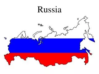
Russia. Geography 200 Dr. Stavros Constantinou. Russia: Location and Size. Russia is the world’s largest country – 17,075,000 sq. km (6,592,819 sq. mi.). It is almost twice as large as Canada, the second largest country.

E N D
Russia Geography 200 Dr. Stavros Constantinou
Russia: Location and Size • Russia is the world’s largest country – 17,075,000 sq. km (6,592,819 sq. mi.). • It is almost twice as large as Canada, the second largest country. • Russia has a tremendous east-west extent – from the westernmost point near Kaliningrad (formerly Königsberg, 20º31’E) in the Baltic Sea; to the easternmost point at Cape Dezhnev (170º W) on the Bering Straits. • These points are separated by approximately 170º of longitude, nearly halfway around the world, and crossing 11 time zones.
Russia: 11 Time Zones! • At the same moment it is: • 6:00 AM in Kaliningrad • 9:00 AM in the Ural Mountains • 1:30 PM in Vladivostok • A little after 5:00 PM at Cape Dezhnev • The time difference between Kaliningrad and Cape Dezhnev is more than twice the difference between New York and London (five hours) and nearly four times the difference between New York and San Francisco (three hours).
Russia: Location and Size • The maximum latitudinal extent of Russia, exclusive of islands in the Arctic Ocean, is about 35º. • The northernmost point is Cape Chelyuskin (77º 44’N); the southernmost is Derbent, on the Caspian sea (42º N), about the same latitude as Cleveland. • Russia is the northernmost large and populous country in the world. • More than 75% of Russia lies polewards of the 49th parallel (north of the U.S.-Canadian boundary). • Moscow is farther north than Edmonton, Alberta, Canada. • Moscow to Vladivostok is 9,332 km (5000 mi.) and it would take seven days and nights on the Trans-Siberian Railway to make the trip.
Russia: Land Frontiers • Russia shares boundaries with twelve countries: • Ukraine, Belarus, Latvia, Estonia, Finland, Norway, Mongolia, North Korea, China, Kazakhstan, Azerbaijan and Georgia. • A boundary that measures 12,880 km (8000 mi.) stretches between the Black Sea and the Pacific ocean. • In the Far East, Sakhalin Island is separated from the northernmost main island of Japan by a 40 km. (25 mi.) strait; even narrower straits separate Japan from the Russian held Kuril Islands
Russia: Physical Geography • The Russian Plain • The Ural Mountains • West Siberian Plain • Central Siberian Plain • The Yakutsk Basin • Eastern Highlands • Central Asiatic Ranges • The Caucasus Mountains • The Caspian Sea – 370,842 sq. km (143,244 sq. mi) • The Aral Sea – 64,472 sq. km. (24,904 sq. mi.) • Lake Erie – 25,655 sq. km. (9,910 sq.mi.)
Russia: Climate • Tundra (ET) • Subarctic (Dwc and Dwd) • Humid Continental (Dfa and Dfb) • Steppe (BSk) • Desert (BWk) • Mediterranean or dry summer subtropical (Csa)
Russia: Vegetation and Soils • Tundra – extensive, treeless plains; inceptisols. • Taiga -- coniferous forest; spodosols, alfisols. • Mixed Forest – coniferous and deciduous trees • Broadleaf Forest – Southern Far East Russia, mostly deciduous trees. • Steppe – Short grass prairie; mollisols, (chernozem –black earth) • Desert – Clump grasses and xerophytic plants; aridisols
Russia: Resources • Russia has a rich resource base. • One of the most important mineral producing countries with widely scattered deposits. • Russia leads the world in the production of natural gas and lead. • Russia also leads the world in iron ore reserves and natural gas reserves. • Russia is second in the production of platinum, tungsten, aluminum and vanadium.
Russia: Resource Regions • The Ural Mountains: • Iron, ferro alloys, copper, aluminum, potash, asbestos, magnesium, low-grade coal • The Volga-Urals and West Siberian Plain: • Petroleum and natural gas • The Caucasus-Caspian Region: • Petroleum, natural gas,nonferrous metals • Middle Asia: • Coal, copper,iron, natural gas, oil, sulfur, lead, zinc, aluminum, uranium, ferro alloys, phosphate, asbestos, mercury, sodium sulfate. More than 90% of Russia’s coal reserves are found in Asiatic CIS.
Russia: Resource Regions • The Kuznetsk Basin (Kuzbas): • Russia’s largest coal producing region, with iron in areas adjacent to the Basin. • The Kolskiy Peninsula: • Phosphate, nickel, other ferro alloys, aluminum, copper, iron, additional iron in nearby Karelia. • The Kursk Magnetic Anomaly: Iron. • Scattered areas in the European Arctic and Siberia: • Coal in the Pechora basin and elsewhere;copper, nickel and aluminum at Norilsk; gold, diamonds, tin, natural gas,other minerals in Central and Eastern Siberia; Kolyma gold field near the Sea of Okhotsk; diamond mines in Yakutiya.
Russia: History Highlights • 1462: Establishment of the Grand Duchy of Muscovy. • Period of eastward expansion by the Cossacks. • 1682-1725: Czar Peter the Great • 1760-1796: Czarina Catherine the Great • Period of colonialism, imperialism. Major expansions in quest of warm water ports. • 1917: Russian Revolution, establishment of Communist government, formation of the USSR. • 1979: USSR invasion of Afghanistan, again in quest of a warm water port. • 1991: Collapse of the USSR, political reorganization, formation of the Commonwealth of Independent States.
Russians in North America • Russians were the first white settlers in what is now Alaska, having come across Siberia and the Bering Strait. • The first Russian settlement in Alaska was established in 1784 on Kodiak island. • They worked their way southward along the Pacific coast of North America, establishing villages and forts to protect their holdings. • They reached the area just north of San Francisco Bay, where they built Fort Ross in 1812. • U.S. Secretary of State William Seward offered to buy Alaska from the government of Russia for $7.2 million – a decision derided as “Seward’s Folly” and “Seward’s Icebox.” • Seward has been vindicated as Alaska’s wealth in gold and petroleum have been discovered, as well as it’s strategic location for U.S. defense.
Russia: Population • Russian population is declining; from 147,300,000 in 1997, down to 145,500,000 in 2002. • Russia rank 8th in population among the countries of the world. • Russia has 2.30% of the world’s population. • A little more than a century ago, Russia had twice as many inhabitants as the U.S.; now Russia has about one-half the U.S. population.
Russia: Population Decline • Almost five million Russians were killed during the collectivization period of the early 1930s because of famines and state directed killings. • World War I, its aftermath of civil war and the attendant famines killed 17 million Russians and about eight million deficit births (i.e., births that would have taken place, but did not due to the dramatic reduction in population). • World War II cost Russia approximately 27 million deaths and 13 million deficit births. • Thus, in the 20th century, Russia lost more than 70 million people. • The effect of deficit births is reflected in a shortage of young people in the labor force; war deaths are reflected in a higher proportion of aging women than men.
Russia: Population Distribution • Russia’s population is unevenly distributed. • Most of Russia’s population is located in “European Russia,” or the western one-fifth of the country. • Overall arithmetic density is very low, 8.5 persons per square kilometer (22 persons/sq. mi.). • The areas of highest population density are the lowland of the Trans-Caucasus, the Moscow area, and the middle Volga lands. • Most of the taiga, tundra, and desert areas have densities of one person per sq.km. (two persons or less per sq. mi.) • Following the collapse of the communist regime of the former Soviet Union, 25,299,000 ethnic Russians found themselves in the minority in the the former Soviet Socialist Republics.
Russians in Near Abroad • RepublicRussiansPercent • Ukraine 11,365,000 22.1 • Kazakhstan 6,228,000 37.8 • Uzbekistan 1,653,000 8.3 • Belarus 1,342,000 13.2 • Kyrgyzstan 917,000 21.5 • Latvia 906,000 34.0 • Moldova 562,000 13.0 • Estonia 475,000 30.3 • Azerbaijan 392,000 5.6 • Tajikistan 388,000 7.6 • Lithuania 344,000 9.4 • Georgia 341,000 6.3 • Turkmenistan 334,000 9.5 • Armenia 52,000 1.6 • Total 25,299,000
Russia: Urban Geography • About 73% of Russians now live in urban centers. • The phenomenon of urbanization is a development of the twentieth century. • 1920s: less than one-fifth of the population was urbanized • 1940s: one-third of the population was classified as urban. • 1960: just under one-half of the population (then 210,000,000) lived in cities and towns. • The former Soviet Union pursued a policy of encouraging people to move eastward. About 25,000,000 people migrated internally from west to east, causing rapid growth in some difficult environments, like Sakha (Yakutiya).
OLD NAME, USSR Gorkiy Leningrad Sverdlovsk Stalingrad Kuybyshev NEW NAME, CIS Nizhniy Novgorod St. Petersburg Yekaterinburg Volgograd Samara Russia: Changing Urban Geography
Russia: Cultural Geography • Russia has an extremely diverse population, varying widely in language, history, religion, physical characteristics, and geographic distribution. • Census authorities recognize about 100 distinct ethnic groups. • Russians form the dominant ethnic group, with about 83% of the population. • During the Soviet years some ethnic rights were allowed: the use of ethnic languages for schools, courts, businesses, newspapers and books; maintenance of ethnic customs, with severe limitations on religious practices.
Russia: Cultural Geography • Indo-European languages of Russia: • The Eastern Slavs – Russians, Ukrainians, and Byelorussians. Found in Central and Northern European Russia; also Siberia and Kazakhstan; 72% of the populace. • Latvians and Lithuanians • Armenians and Tajiks • Altaic languages: Islamic peoples in Turkestan • Uralic Family: Estonians, Finns, Karelians • Other: Jews, Caucasian peoples, Mongols, Koreans, Eskimos.
Russia: Economic Geography--Agriculture • Currently about 14.4% of Russia’s labor force works in agriculture. This is high compared to other industrialized countries (U.S.-- 2%). • Main products: potatoes, wheat, sugar beets, barley, sunflower seeds, corn, peas, buckwheat, millet and rice. • Under communism, Soviet agricultural production was unsuccessful, relative to industrial production.
Soviet Agriculture • Organized along collective lines • Kolkhoz (a collective farm, average size about 900 acres) – the principal element was a peasant family which worked full-time on large tracts of state owned land surrounding the farm. They retained small tracts (mean size was 1.2 acres) of land for personal cultivation of any product desired. • Sovkhoz (a state farm, average size about 49,420 acres) – single purpose units managed by workers but controlled by the state, “factories in the fields.” • The USSR had 73% more cropland sown to crops than the U.S., but produced only 80% of the U.S. yield. • American farmers during the Soviet era were 10 times more productive than Soviet farmers. • Reasons for poor results of Soviet agriculture: • Extreme environmental conditions. • Organization which emphasized industry over agriculture. • Mismanagement.
Russia’s Agricultural Regions • Large scale diversified: extending from the Black Sea to the valley of the Irtysh River in the east. Crops: wheat, sugar beets, potatoes, fruits and vegetables, including grapes. Large herd of cattle, sheep and pigs. • Mixed: Three regions, the large triangular area around Moscow, the mountains and foothills of the Caucasus and small but significant zones of the Far East on the Chinese border and Pacific Ocean. Crops: rye, barley, potatoes, fodder crops and dairy cattle (similar to Great Lakes region). • Irrigated: North and east of Caspian Sea to boundary with China. Crops: cotton, tobacco,fruits and vegetables, some grains including irrigated rice. Sheep and hardy cattle – scattered pastures. • Localized farming: Area of short growing seasons from St. Petersburg to Vladivostok. Farming concentrated near isolated settlements which are local markets for potatoes, rye, barley,oats, hardy vegetables,milk, butter, eggs and cheese. • Arctic-Tundra subsistence: A few root crops manage to mature in the brief, but intense summer. Mainly hunting country. Reindeer help sustain human communities.
Russia’s Industrial Regions • Central Industrial (Moscow) Region • River transport outward from Moscow on the Volga, Oka, Dvina and Dneiper. Roads and railroads also radiate outward from Moscow. • Nizhniy Novgorod – the “Soviet Detroit” because of automobile manufacture; Yaroslavl, the tire center; Ivanovo – the “Soviet Manchester,” due to textile industry; and Tula, mining and metallurgy. • St. Petersburg – high quality machine building, nearby bauxite deposits. Major shipbuilding plants to supply nearby port and naval station, Kronshtadt. • Povolzhye (Volga Region) • Area extends along the Middle and Lower Volga River. Important transport and major oil producing region. The Moscow Canal extends the northern navigability of the system into the heart of the Central Industrial Region. The Mariinsk Canals provide access to the Baltic Sea. The region has 29,000,000 people. Major cities are Samara, Volgograd, Kazan, and Saratov. • Urals • The Ural Mountains are the eastern boundary of Europe. • They are not an obstacle to east-west travel – roads, railways and pipelines cross the mountains in many places. • The Urals are rich in metallic minerals, but poor in coal. • Oil deposits between the Urals and Volga help relieve this deficiency. The preceding three industrial regions are growing towards each other and consolidating Russia’s industrial core.
Russia’s Industrial Regions 4. The Kuznetsk Basin (Kuzbas) • 2000 km (1200 miles) east of the Urals. • Kuznetsk has large deposits of coal and iron. • Leading center is Novosibirsk (Siberia’s Chicago) at the intersection of the Trans-Siberian Railway and the Ob River. • Resources and products include heavy engineering products (railway rolling stock); aluminum from Urals bauxite; hydroelectric power; timber; brown coal; oil is piped from the Volga-Urals fields to be refined at Irkutsk. 5. Baykaliya Region (Lake Baykal Area ) (Mining, lumbering and some farms are the major activities. • Major centers are Bratsk and Irkutsk 6. Far East Region • Russia has 8000km (5000 mi.) of Pacific coastline, more than the U.S. including Alaska. • The port city of Vladivostok (700,000) is the eastern terminus of the Trans Siberian Railway, lies at a latitude midway between Seattle and San Francisco, but must be kept open through the winter by ice breakers – unheard of in Seattle or San Francisco. • The region has huge expanses of forests; lumbering and fishing are major activities. • Coking quality coal deposits are in the Bureya River Valley • Komsomolsk has steel works.
Russia: Political Geography • In 1991, the Union of Soviet Socialist Republics (USSR) was succeeded by the Commonwealth of Independent States (CIS), which included all the former Soviet republics except Lithuania, Latvia, Estonia, and Georgia; these proclaimed their independence. • Following the devolution of the Soviet Union, the map of the Russian Federation comprises 22 federal republics and two federal cities, Moscow and St Petersburg
Russia: Political Geography • Based on relative location, Russia’s internal republics are classified into five groups: • The Republics of the Heartland: Mordoviya,Chuvashiya, Mariy-el, Tatarstan, Udmirtiya, Bashkortostan, and the Urals Republic • The Republics of the Caucasian Periphery: Dagestan, Chechnya, Ingushetiya, North Ossetia, Kabardino-Balkariya, Karachayevo-Cherkisiya, Adygeya, and Kalmykiya • The Republics of the Southeast: Altaya, Khakasiya,Buryatiya, Tyva, Promorskiy Kray (Maritime Republic) • The Republics of the North: Kareliya, Komi, Sakha (Yakutiya) • Yevreskaya(Jewish) Autonomous Region
Russia: Political Geography • Following the election of Vladimir Putin as President in March 2000, one of his first moves was to turn Russia into “a single economic and legal space.” • In May, he issued a presidential decree which divided Russia’s 89 republics and regions into seven new “federal districts.” • Central (Moscow), Far Eastern (Khabarovsk), North Caucasus (Rostov-na-Donu), Northwest (St. Petersburg), Siberia (Novosibirsk), Urals (Yekaterinburg), and Volga (Nizhny Novgorod). • Each of these was to be headed by a plenipotentiary representative appointed by the President.
Russia: Political Geography • The goal was to weaken the regional governors who accumulated significant powers under the Yeltsin presidency. • Security and law enforcement were central to the duties of the presidential appointees; five of the seven came from the army or security services. • Putin relieved the governors of the right to sit in the Federation Council, the upper house of the Russian parliament. • He also stripped them of their immunity from federal prosecution. • Putin passed legislation that gave the president power to dismiss governors and regional legislators if they violated federal law.
Russian Heartlands Theory • Halford Mackinder (1861-1947) foresaw the rise of Russian power. He noted that large areas subject to penetration along river routes were vulnerable to a strong maritime power. • A large area of Eurasia, not penetrated by navigable rivers, would be safe as a fortress and thus, able to develop strength in its secure isolation. • This area, Pivot Area (1904), was located in western Russia, stretching from the Moscow Basin, Across the Volga Valley and the Urals into central Siberia. • The picot area would be of crucial significance in the political geography of the 20th century; moreover he asserted that any power based in the pivot area could gain strength sufficient to eventually rule the world: (continued next slide)
Russian Heartlands Theory • In 1919 Mackinder proposed the Heartland Theory: • Who rules East Europe commands the heartland • Who rules the Heartland commands the World Island • Who rules the World Island commands the World • Nicholas Spykman (1894-1943) emphasized the role of the rimland in controlling the heartland. • David Hoosen (1962) identified a new Central Siberian heartland that is an eastward extension of the original Russian core.
Kaliningrad: Russia on the Baltic • The Russian exclave of Kaliningrad lies wedged between Lithuania and Poland, facing the Baltic Sea, through its giant naval port. • The Russians acquired this bit of Germany at the end of WWII (1945) and expelled virtually all ethnic Germans. This gave the Russians a strategically important warm water port. • Russians replaced the departed Germans, and today Kaliningrad’s population is almost one million, 90% of whom are Russians.
Chechnya • Chechnya is a predominantly Muslim republic that resisted Russian colonization in the nineteenth century. • During the rule of Stalin, Chechens were exiled to Siberia because they collaborated with the Nazis. • They were allowed to return by Khrushchev in the 1950s. • Following the collapse of the Soviet Union in 1991, the Chechen fought the Russians to a stalemate. • For economic and political reasons, Moscow has never granted Chechnya independence (approximately ¼ of the Chechen population is Russian). • Since 1994, there has been a state of warfare between Chechen rebels and Russian troops. Muslim fundamentalism among the Chechens has led to terrorist as well as guerrilla warfare tactics. The capital city of Groznyy was destroyed. • On Oct. 23, 2002, Chechen rebels seized a crowded Moscow theater and detained 763 people, including 3 Americans. Armed and wired with explosives, the terrorists demanded that Russian government end the war in Chechnya. Government forces stormed the theater the next day, after releasing a gas into the theater, which killed not only all the terrorists, but more than 100 of the hostages.
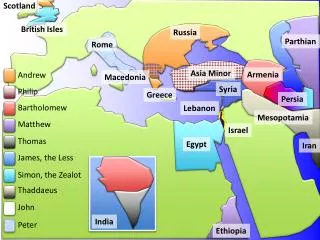
Transcaucasian Transition Zone • Armenia: • Is a landlocked country that occupies some of the earthquake prone regions of Transcaucasia. • It is the smallest of the three countries of the TTZ. • The Armenian enclave of Nagorno-Karabakh is located within Azerbaijan. • Following the genocide of Armenian populations in WW I, by the Turks, Armenia enjoyed a two year period of independence. The soviets took it over in 1920 and in 1936 they proclaimed it one of the 15 Soviet Socialist Republics. • Following the collapse of the Soviet Union, Armenia went to war with Azerbaijan over Nagorno-Karabakh. As a result, Azerbaijan cut the pipeline from the Caspian Sea and pipelines from Georgia stopped because of civil war there. The Armenian economy collapsed. • Armenia is rich in mineral and produces a variety of fruits and vegetables. It has a plentiful supply of hydroelectric power. • Yerevan, the capital city, is within sight of the Turkish border.
Transcaucasian Transition Zone • Azerbaijan • Azerbaijan is the largest in area and population of the three TTZ countries. • Predominantly Shi’ite Muslim (like Iran), it borders on the Caspian Sea and encircles the Armenian/Christian area Nagorno-Karabakh. • Azerbaijan is rich in oil from the oilfields in the region of the county’s capital, Baki (Baku). • Currently, the oil from these fields is exported by pipeline that runs through Dagestan and Chechnya to the Russian city of Novorossiysk.
Transcaucasian Transition Zone • Georgia (Sakartvelo to Georgians) • Is a former republic of the USSR that did not join the Commonwealth of Independent States. • Physiographically, Georgia, which is a little larger than ½ of Ohio, is framed by mountainous terrain and fertile valleys. • The capital city is Tbilisi. • The country has 4,700,000 people, 70% of whom are Georgian. Minorities include Armenians (9%); Russian (7%); Azeris (5%) and smaller proportions of Ossetians,and Abkhazians. (continued next slide)
Transcaucasian Transition Zone • Georgia • Following the breakup of the Soviet Union, Georgia has been subject to internal violence and civil war. The Abkhazan region has fallen into the hands of rebels. • The Georgian regime under Eduard Scheverdnadze (Soviet minister of foreign affairs under Gorbachev) applied for membership in the CIS in hope of salvaging the territorial integrity of the country. • Historically, Christian Georgia has aligned itself with Russia because of its location in the path of Islamic expansion. • Georgia has a Black Sea coast and favorable climate for growing tea, grapes, and citrus fruit. • Georgia produces 5% of the world’s manganese at Chiatura.