Download
1 / 36
360 likes | 559 Views
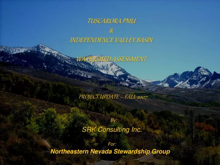
TUSCARORA PMU & INDEPENDENCE VALLEY BASIN WATERSHED ASSESSMENT. PROJECT UPDATE – FALL 2007. By:. SRK Consulting Inc. For:. Northeastern Nevada Stewardship Group. Watershed Assessment. The Approach: Assess the current landscape condition with respect to ecological site potential.

E N D
TUSCARORA PMU& INDEPENDENCE VALLEY BASINWATERSHED ASSESSMENT PROJECT UPDATE – FALL 2007 By: SRK Consulting Inc. For: Northeastern Nevada Stewardship Group
Watershed Assessment The Approach: • Assess the current landscape condition with respect to ecological site potential. • Assess the current riparian area condition with respect to proper functioning condition characteristics. • Identify opportunities for changing management to address landscape scale problems.
Watershed Assessment - Introduction • Assessment Team Members • Gary Back, PhD ~ Principal Ecologist • Ryan Shane ~ Natural Resource & GIS Specialist • Angel Nicholson ~ Staff Biologist • Contributors • Natural Resource Conservation Service • Bureau of Land Management • U.S. Forest Service • Nevada Department of Wildlife • Private Landowners • Northeastern Nevada Stewardship Group
WE ARE HERE • Watershed Assessment Process(RIEC&IAC 1995) 6 1 2 5 3 4
Watershed Assessment Process(RIEC&IAC 1995) • Characterization – Identifying dominant physical, biological, and human processes or features • Issues and Key Questions – Focusing on management questions, objectives, human values, and resource conditions • Current Conditions – Establish the current range, distribution, and conditions of relevant ecosystems
Watershed Assessment Process- Cont’d.(RIEC&IAC 1995) • Reference Conditions – Ecological Site Descriptions, Riparian Proper Functioning Condition • Interpretation – Comparison of ecological site conditions and current conditions; interpretation of differences, similarities, trends, and their causes • Recommendations – Integration of all steps to provide recommendations that are based on data and sound scientifically-supported concepts
Watershed Assessment Process- Cont’d.(RIEC&IAC 1995) • Goal – Enable landowners and land managers to implement ecologically sound management activities to improve and/or sustain watershed health • i.e., identify what is broken, determine ecologically sound fixes, and implement actions to sustain landscape health while maintaining desired land uses.
Watershed Assessment - Process • First, understand the collective ecosystem elements • Which enhances the ability for estimating impacts and benefits of management and use activities, and • Allows for the development and implementation of appropriate resource use, management, and conservation • Maintain “Healthy Landscapes and Quality Lifestyles” for the long-term
Watershed Assessment - Methodology • Coordination • Cooperation • Consultation • Collaboration • Landowner permissions • Landowner and public concerns • Data research and request • Collaboration with similar efforts • Heritage information survey
How long have you lived and worked in the area? Have you witnessed flooding events in area? Has water quantity, quality, or usage changed? Have you seen any issues that pose risks to the health of the watershed? Would improvements, treatments or a management change improve these conditions? Why is the watershed and associated resources important to you and your family? Watershed Assessment – Methodology • Heritage Survey
Watershed Assessment - Methodology • Sub-watershed Delineation
Watershed Assessment - Methodology • Ecological • Soils • Ecological sites • Water Courses • Ditches • Pipelines • Stream • Drainages • Stream Condition • PFC • Stream Survey • Spring Condition • PFC • Data request, organization, and assembly • Roads • Highways • two-tracks • Fires • Size, area, year • Grazing • Use Pattern Maps • Key Areas and Use • Range improvements • Allotments • Topography • 24K, 100K, and 250K • Aerial Photos
Watershed Assessment - Methodology • Field Map Construction
Watershed Assessment - Methodology • Data sheet Construction • Site Assessment • Photo-point • Field Binder Assembly • Reference Collection • PFC for lotic areas 1737-15 • PFC for lentic areas 1737-16 • Applied River Morphology (Rosgen 1996) • Interpreting indicators of rangeland health 1734-6 • reference area worksheets • ecological site descriptions • Utilization studies and residual measurements 1734-3 • stubble height • key species use and browse • Tuscarora PMU sage grouse conservation plan • habitat r-value definitions
Watershed Assessment - Methodology • Site Selection • Assessment Sites • Upland • Riparian • Photo-point Sites
Watershed Assessment - MethodologyScience Background • Uplands – comparison of current conditions with ecological site description; i.e., an assessment of rangeland health (soils, vegetation, and hydrology) • Uplands – use of State and Transition Models to determine if the site is likely to transition to another state; i.e., is the site approaching thresholds • Uplands – use of thresholds to determine if management changes are necessary and what changes are likely to achieve the desired result
MAY REQUIRE THOUSANDS OF YEARS OR MAY NEVER RETURN TO ORIGINAL ECOLOGICAL SITE POTENTIAL. SUCCESSION REQUIRESADDITIONALINPUTS REQUIRES ADDITIONAL INPUTS THRESHOLD THRESHOLD THRESHOLD FIRE OR FIRE SURROGATE UNKNOWN SPECIES COMPOSITION UNDERSTORY ABSENT DECLINING HERBACEOUS UNDERSTORY DECLINING SHRUB UNDERSTORY UNDERSTORY ABSENT HERBACEOUS DOMINANT SAGEBRUSH DOMINANT JUNIPER/PINYON DOMINANT ALTERED SITE POTENTIAL (NEW ECOLOGICAL SITE)
Watershed Assessment - MethodologyScience Background • Riparian Channels - Rosgen Stream Channel Classification – use of the channel morphology to determine potential for change given current conditions • Riparian Systems – Stream Condition Attributes – use of PFC-related attributes to identify specific stream characteristics compromising stream resilience and resistance to disturbances
Watershed Assessment - MethodologyScience Background • Sage-grouse Habitat Assessment –“Restoration Value” or R-value Rating System • R0: Suitable habitat for sage-grouse for one or more seasonal habitats • R1: Perennial herbaceous understory is present, but sagebrush cover is limited or lacking • R2: Sagebrush is present in adequate amounts, but herbaceous understory is limited or lacking • R3: Pinyon and/or juniper are replacing the sagebrush on range sites • R4: Perennial species and sagebrush are lacking; annual grassland (e.g., Cheatgrass)
Waypoint: R098 Direction: East and West Photo Number: 182-184 Description: Road crossing washing out, thistle infestation, uplands barren to sparse cheatgrass GPS Coordinate: 4571988, 577288 10-8-07 R080 0579186 4575708 RSS 136-144 RSS Independence Burns South Slope 14-16 PUTR, ARTRV, ELCI, BASA, PSSP, CHVI, AMAL Grazed moderate to light Critical deer habitat BRTE Sporadic None Grazing Mining Watershed Assessment - Methodology • Field Data Collection • Logistics • ATVs, GPS, Cameras • 8 days • Sites Visited • ~520 sites documented • 350 photo-points • 170 assessments
Tuscarora PMU / Independence Basin Watershed Assessment • Examples of Non-management oriented issues – i.e., things over which the landowner or land manager have no control Geologic Features Climatic Events Vegetation Mortality Events Topographical Effects Channel Types Ecological Sites
Slope: <2% Sinuosity: >1.2 Width:Depth: >12 Entrenchment: >2.2 Slope: 2-4% Sinuosity: >1.2 Width:Depth: >12 Entrenchment: 1.4-2.2 Slope: 4-10% Sinuosity: 1-1.2 Width:Depth: <12 Entrenchment: <1.4 Channel Types A B C
Cover: 30-40% Species: Bluebunch Wheatgrass Thurber’s Needlegrass Big Sagebrush Production: 800 lbs/ac. Composition: 65% grasses 10% forbs 25% shrubs Increasers: Big Sagebrush Rabbitbrush Sandberg bluegrass Bottlebrush squirreltail Invaders: Cheatgrass Annual mustards Cover: 20-30% Species: Bluebunch Wheatgrass Thurber’s Needlegrass Low/Early Sagebrush Production: 600 lbs/ac. Composition: 60% grasses 10% forbs 30% shrubs Increasers: Low/Early Sage Rabbitbrush Sandberg bluegrass Bottlebrush squirreltail Invaders: Cheatgrass Ecological Sites Claypan 10-12 p.z. Loamy 10-12 p.z.
Tuscarora PMU / Independence Basin Watershed Assessment • Example Management-Oriented Issues • Weeds • Fire & Fuels • Vegetation Community Composition • Resource Exploration • Mining • Agriculture • Recreation • Roads • Influential Structures • Buildings and Development • Garbage and Pollutants
Tuscarora PMU / Independence Basin Watershed Assessment • Assessment Results and Provisions • ID and Assessment of Dominant Features • Activities, Uses, Risks • Historical and Present Resources & Processes • Cumulative Impacts • Prioritization for Addressing Issues • Recommendations • General Management Guidelines • Range of Options • Identify Empowered and Responsible Entities • Monitoring Guidelines
Tuscarora PMU / Independence Basin Watershed Assessment • Next Steps • Develop Access Data Base for Data Input • Input Data • Conduct Data Analysis and Spatial Analysis • Develop Management Recommendations • Prepare Landscape Scale Management Plan • Develop Monitoring Guidelines
Tuscarora PMU / Independence Valley Basin Watershed Assessment Healthy Rangelands + Healthy Creeks = Healthy Landscapes
Tuscarora PMU / Independence Valley Basin Watershed Assessment Healthy Landscapes = Quality Lifestyles
Tuscarora PMU / Independence Valley Basin Watershed Assessment Healthy Landscapes = Quality Lifestyles
Tuscarora PMU / Independence Valley Basin Watershed Assessment Healthy Landscapes = Quality Lifestyles
TUSCARORA PMUWATERSHED ASSESSMENT PROJECT UPDATE – FALL 2007 By: SRK Consulting Inc. For: Northeastern Nevada Stewardship Group