Download
1 / 23
230 likes | 511 Views
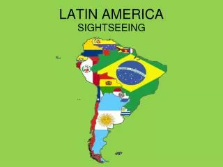
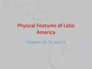
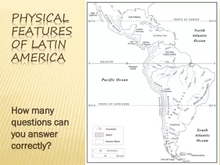
PHYSICAL GEOGRAPY OF LATIN AMERICA. Latin America Physical Geography. Geographers often divide Latin America into three areas – Middle America , the Caribbean, and South America. Middle America consists of Mexico and the seven countries of Central America. Mountains.

E N D
Latin America Physical Geography Geographers often divide Latin America into three areas – Middle America, the Caribbean, and South America. Middle America consists of Mexico and the seven countries of Central America.
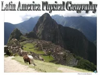
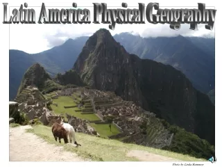
Mountains • The world’s longest mountain range, the Andes Mountains run along the western coast of South America. • The tallest mountain in the regions is located in the Andes is Chile. Mt. Aconcagua is almost 23,000 ft. in elevation.
Mountains • Two prominent mountain ranges in Mexico – the Sierra Madre Occidental and the Sierra Madre Oriental – meet near Mexico to form the sharp peaked Sierra Madre del Sur.
Volcanoes and Earthquakes • Volcanic and seismic (earthquake) activity are common in the region. • Mexico City is threatened by nearby volcanoes and regularly experiences earthquakes. Popocatepetl, Volcano
Volcanoes and Earthquakes • The Caribbean Islands of Montserrat and Martinique were created by volcanoes. • South American countries like Peru and Bolivia are also in seismic zones and suffer damaging earthquakes.
Rivers • The most extensive river system is the Amazon, which drains much of the nearby lands. The Amazon is the longest river in the Western Hemisphere, although it is the largest in terms of water volume.
Rivers • The Parana, Paraguay, and Uruguay Rivers form the second largest river system in South America and its most important commercial waterway. Near the Argentine city of Buenos Aires, the Paraguay and Uruguay rivers join to become the Rio de la Plata, which means “river of silver.”
Rivers • Other important rivers of the regions include the Rio Grande in Mexico and the Orinoco in Venezuela.
Deserts and Highlands • The World’s driest desert, the Atacama Desert lies between the Pacific Ocean and Andes Mountains in Peru and Chile. It is in the rain shadow of the Andes and in the Pacific, a cold ocean currents contributes to the arid climate. • Highlands areas in South America include the Guiana Highlands in Venezuela and the Patagonian Highlands in Argentina.
Waterfalls and Lakes • Angel Falls is the World’s highest uninterrupted waterfall. Located in Venezuela it is over 3,000 ft. from top to bottom.
Waterfalls and Lakes • Lake Titicaca on the border between Peru and Bolivia is famous as the World’s highest navigable lake as well as having a unique native name. • Lake Maracaibo in Venezuela is really an extension of the Caribbean Sea, but is rich in oil reserves.
Plains • Llanos which run along the Caribbean coast of South America, are fertile plains used for raising cattle for hundreds of years.
Plains • Pampas are the grassy, treeless plains of Argentina and Uruguay. The Pampas have the rainfall and fertile soils needed for producing grain and grazing cattle and sheep.
Weather and Climate • The Caribbean and Central America are frequently hit by severe hurricanes. • El Nino is a cyclical climate event that involves the movement of large masses of warm water across the Pacific Ocean. It causes changes in rainfall patterns in Latin America as well as the U.S.
Weather and Climate • The climate is mostly tropical and subtropical but also varies by elevation and position in the rain shadow.
Natural Resources • The region of Latin America is rich in mineral resources. • Oil is a major export of Mexico and Venezuela. • Gold, silver and copper are important resources in Mexico, Brazil and Chile.
Natural Resources • Forest products are produced in the Amazon Basin which boasts the largest tropical rainforest ecosystem in the World – the Amazon Rain Forest.
Panama Canal • Latin America has been a hard physical feature to get around. Magellan was the first European to sail around the end of South America. The very southernmost tip is called Cape Horn and is famous for severe storms. • A shorter and safer route was created with the building of the Panama Canal. This waterway cuts thousands of miles off the trip around South America.
Impact of Panama Canal. • The building of the Panama Canal also brought change to Middle America. • Nearly 75,000 workers from around the world built what is still regarded as one of the engineering wonders of the world. • Completed in 1914 the canal made a huge impact on world trade.