Download

1 / 19
190 likes | 277 Views
This study discusses the development and results of satellite monitoring in Estonian landscapes, including methodology, classification system, mapping accuracy, landscape diversity, main trends, and characterization. The monitoring sites and resources used are detailed, along with the estimation of landscape fragmentation and changes over time. The classification scheme and methodology for processing satellite imagery are explained, providing insights into land cover types, classes, and diversity metrics in different areas. The study also covers the challenges and successes encountered in the monitoring process.

E N D
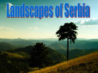
SATELLITE MONITORING ofESTONIAN LANDSCAPES Kiira Aaviksoo and Andrus Meiner Estonian Environment Information CentreMustamäe tee 33, Tallinn 10616 ESTONIA, kiira@envinst.ee, andrus.meiner@ic.envir.ee
BACKGROUND • 1994: Estonian Environmental Monitoring Program • Landscape monitoring was not present in the program. The proposal for development of methodology for landscape monitoring was submitted • 1996: Subprogram: Monitoring of Landscapes • Landscape monitoring was organized by three monitoring projects, incl. Remote Sensing of Landscapes • 2000: Subprogram: Monitoring of Nature biodiversity • Project: Satellite Monitoring of Landscapes
INITIAL TASKS • to elaborate hierarchical land cover classification scheme, which supports on local level pecularities of Estonian landscapes and corresponds on regional level with internationally applied analogues • to produce satellite maps of recent (90/2000s) and historical (80s) environmental conditions • to determine the change of land cover and landscape diversity • to bring forth ongoing trends on class level and give the prognosis
PRESENT STATE OF SATELLITE MONITORING • 6 monitoring sites • Soomaa, Saarejärve, Alam-Pedja, Lahemaa, Vilsandi, Karula • Sites consist of the core area and the buffer zone • the core area is one of the permanent national monitoring sites with mostly natural and semi-natural land cover types, usually a protected area • the buffer is the 3 km wide zone around the core area, containing different land cover types • Resources • 2 fulltime employees • Landsat TM imagery, aerial photos, topographic maps, training areas • Pentium workstations 128Mb RAM, Windows 98 • PCI EASI/PACE, ARC/INFO, Idrisi, ArcView, Fragstats
LOCATION OF MONITORING SITES Lahemaa NP Saarejärve integrated monitoring area Vilsandi NP Soomaa NP Alam-Pedja NR Karula NP
RESULTSI • After 5 years of monitoring work, 4481 km2 (10%) of Estonia has been monitored • Classification system developed so far has: • I level - 8 landscape types • II level - 21 land cover classes • III level - 58 land cover types, with additional IV level subtypes • Mapping accuracy was enhanced by integrating GIS in spectral-based image processing (masking) • Estimation of landscape diversity • used parameters show increase in landscape fragmentation, especially in the buffer zones • the main reason is increase of patch number and decrease of their area
RESULTS II • Main trends in monitoring areas (and in Estonian nature as a whole) can be brought forth: • afforestation • the increasing of coniferous stands in forests (hypothesis) • the decreasing of clear-cut areas in core areas and increasing in buffer zones • the increasing of grassland at the expense of arable land • the increasing of fallow land at the expense of abandoned fields and cultivated grasslands • the overgrowing of natural grasslands and fallow land with shrubs and young trees • the decreasing of arable lands
CHARACTERIZATION OF METHODOLOGYillustrated by Vilsandi monitoring area: • Total area is 467 km2, core area 51% and buffer 49% • Average count of land cover patches was: • 8531(> 1 ha: 2082) in 1980s, and • 10516 (> 1 ha: 2272) in 1990s • Mean patch size (without water in 1986 and 1998): • core area - 5.4 / 5.3 ha • buffer zone - 12.7 / 9.96 ha • In total were mapped 36 land cover (sub)types • Accuracy of change map: overall = 84%, KIA = 73% • Field work on 84 sites (LC description, GPS, photo) • Problematic land cover types: • alvar grasslands, fallow lands, wooded meadows, shrublands
METHODOLOGY IProcessing the satellite imagery • Elaboration of classification scheme • III and IV level - mapping (map) • II level - for monitoring land cover and diversity (map) • Classification masks • forest and natural grasslands • mires (fens, swamps, bogs) • agricultural areas (crops, cultivated grasslands) • water surfaces • Image processing • pre-processing (geometric correction) • histogram normalisation of two dates • pre-classification (hybrid classification with ancillary data) • ground truth (filed visit of training areas, GPS, photography) • final classification under masks and accuracy assessment
LAND COVER TYPES (III, IV level) in Vilsandi (1986 and 1998)
METHODOLOGY IIEstimation of landscape diversity • Landscape diversity parameters: • Measured parameters • general: count, average, maximum and total size, perimeters • Computed parameters • representing shape: edge index, shape index • representing neighbourhood: mean distance between patches of the same class • diversity metrics: Shannon diversity index (only landscape level) • Minimum size of patch for diversity analysis - 1 ha
METHODOLOGY IIIChange detection • Change (or stability) of each class within the monitoring area - comparison of classification results for 2 dates • change database computed: 2 attributes per pixel (T1 and T2) • tally matrix: class changes (off-diagonal elements) and no-changes (diagonal) pixels • percent changes per class • Change in landscape diversity - comparison of diversity metrics for 2 dates • core area • buffer zone • change statistics • Change prognosis
MAIN TRENDS IN LAND COVER CLASSESVilsandi monitoring area 1986 - 1998, %
AREAS OF LAND COVER CLASSES IN VILSANDI 1986, 1998, 2010* • Land cover class • 2 - coastal reedbed • 3 - barren coast • 4 - till coast with sparse vegetation • 5 - natural grassland • 6 - open mire • 7 - treed mire, mire forest • 8 - alvar grassland • 9 - coniferous (juniper) shrubland • 10 - coniferous forest • 11 - deciduous forest • 12 - mixed forest • 13 - arable land • 14 - cultivated grassland • 15 - fallow land • 16 - settlement, artificial areas • V2010 = M8698 * V98
Satellite remote sensing is a good tool for regular searching and updating of landscape state information Digital satellite remote sensing data have direct input to GIS congruous with raster and vector coverages Landsat TM and ETM satellite data have the best quality/cost ratio for environmental monitoring good spectral, temporal, spatial and radiometric resolution 0.30 EEK/km2) Satellite maps in context of GIS help to resolve the problems of everyday tasks in management qualitative maps (land cover) quantitative (statistical) data Landsat satellite data is greatly dependent from: clouds water content in soil and vegetation Satellite mapping does not replace geobotanic mapping Spectral and spatial resolution is too rough for detail habitat mapping ADVANTAGES AND DISADVANTAGES of SATELLITE REMOTE SENSING
WHY MASKS? • Spectral signatures of land cover types are too similar • Number of classes and accuracy of map is too small • Spectral similarity was avoided by using GIS coverages as binary masks
NORMALIZATION OF TWO SATELLITE IMAGES OF THE SAME FENOLOGICAL STATE • Landsat TM • 08.06.1988 • 12.06.1995 • Normalisation of histograms around mean using value of standard deviation • normalisation by channel pairs • TM2 1988 and TM2 1995 a.s.o