Download

1 / 13

E N D
Hydrology of Tibet, China • Hydrology administration in Tibet is undertaken in both central and local levels. There are seven departments in Bureau Hydrology of Tibet(BHT). BHT is an agency affiliated to Tibet Water Conservancy with administrative functions. BHT takes following responsibility: managing hydrological sector over Tibet; organizing and providing guidance to monitoring and analysis of water quantity and quality of surface water, groundwater as well as water resources evaluation; collecting, processing and forecasting water regime and precipitation information for key flood control areas and providing support for decision-making of State Flood Control and Drought Relief Headquarters.
There are 278 professionals and technicians working in BHT, including 150 gauging staff work in different stations, the others work in central.
Water resources evaluation institution Hydrological information central Finance administration Water environment monitor central Field investigation team Hydrological data management central Bureau Hydrology of Tibet Evaporation testing station
Since 1952, the first of hydrologic station of Tibet was built in Chamdo prefecture to now a perfect hydrologic station network has been gradually established. • There are about 25 gauging stations, 4 stage gauging stations, 40 rain gauging stations, 32 water quality stations, 18 observation wells of groundwater, 2 evaporation testing stations. There are 27 stations collecting and providing hydrological information for flood control, in which 15 hydrology stations provide data directly to Central Government.
THE HYDROLOGY STATION NETWORK 拟建水文站 已建水文站
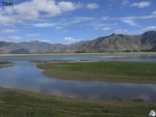
In Tibet there are over 20 rivers that have a drainage area of more than 10000 square kilometers. The Tibetan lakes have area of 24188 square kilometers, and the glaciers cover an area of 34000 square kilometers. The total amount of water resources of Tibet is 4482 hundred million cubic meters.
Now there are 3 International Water Regime Station lying on the mainstream of the Yaluzangbu river, namely Nugesha(East Longitude 89º42‘, North Latitude 29º21‘), Yangcun(East Longitude 91º52‘, North Latitude 29º16‘) and Nuxia(East Longitude 94º34‘, North Latitude 29º28‘). The hydrological information of rainfall, water level and discharge of the above three stations will be provided in the flood season from June first to October 15th every year,
Hydrometric items include : • discharge, water level, precipitation, evaporation, sedimentation, water quality, groundwater, water temperature and ice run, etc. • These stations keep informed on process of rainfall and flood through standard observation performed. Generally, most of peak discharge are observed.
Water environment monitoring: • From 1955, hydrology agency has carried out river water chemical supervision basing on hydrological network, there are 32 water quality monitor spots, 5000km of rivers under monitor, 300,000 square kilometers drainage area under control, 11 types of monitor items and 73 parameters in Tibet. • Monitoring has been extended to all of water environment elements including various water bodies, aquatic organs and bed material. The monitoring of water quality and quantity can also be implemented simultaneously.
At present, the hydrological information is transmitted through the common communication network of the post and telecommunications departments in the form of telephone. In order to improve the reliability and effect, the BHT has established short-waves and communication network and telemetering system in key flood control area and key reaches for flood control. In addition, using the specific micro-wave or short-waves communication line, the direct exchange of information can be made between hydrological stations and central, which played a good role in the transmission of the hydrological information about the mainstream of the Lhasa river during the emergency period.
The real-time hydrological information processing is performed on VAX or network system. • For key flood control area, such as Lhasa, Shigatse and Lhuntse, various forecasting programs have been established to make on-line flood forecasting. At present, there are two methods of flood forecasting are often used in BHT as fellow:the one method is to establish the corresponding experiential relationship among various factors and make operational forecasting scheme for various conditions, based on the observed data of rainstorms and floods; the other methods is to establish mathematical model for flood forecasting according to the formation factors of flood.
At 8 p.m of April 9th 2000,the highest peak of the Layonggabu Mount collapsed suddenly .Millions of cubic meters of landslide materials fell with quantities of energy and scared mountains on both sides of the Gully. In several minutes, the materials passed 8km with a drop of 3300 meters. The huge accumulation body of about 300 million cubic meters blocked up Yigong Tsangpo River. Seven kilometers of the river course and road were stuffed and covered. In the process of disaster-relief and rescue, Tibet Hydrology Bureau sent 26 persons headed by Gong Tongliang to go to the disaster areas. When they arrived, they established six survey stations and a hydro-info network centered by Tongmai. In the period of their stay, they provided many valuable analysis reports to the headquarters. At midnight of June 10th , the water smashed the embankment of Yigong Lake and the discharge of the flood reached to 124,000 cubic meters per second. And the water level of Palung Tsangpo rose for 50 meters. Yigong disaster-relief and rescue