Download
1 / 47
550 likes | 955 Views
Global Positioning System (GPS). Introduction. The current global positioning system (GPS) is the culmination of years of research and unknown millions of dollars. Navigational systems have been and continue to be developed and funded by the U.S. government.

E N D
Introduction • The current global positioning system (GPS) is the culmination of years of research and unknown millions of dollars. • Navigational systems have been and continue to be developed and funded by the U.S. government. • The current system is managed by the U.S Air Force for the Department of Defense (DOD). • The current system became fully operational June 26, 1993 when the 24th satellite was lunched. • While there are millions of civil users of GPS worldwide, the system was designed for and is operated by the U. S. military.
Introduction-History http://www.kowoma.de
Introduction-History http://www.kowoma.de
Introduction--cont. • GPS provides specially coded satellite signals that can be processed with a GPS receiver, enabling the receiver to compute position, velocity and time. • A minimum of four GPS satellite signals are required to compute positions in three dimensions and the time offset in the receiver clock. • Accuracy and precision of data increases with more satellites.
Three Parts • Space segment • Control segment • User segment
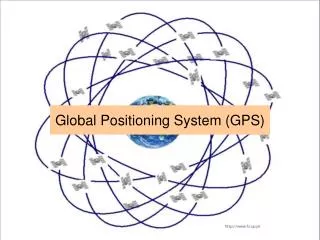
Space Segment • The Air force insures that at least 24 satellites are operational at all times. • There are six orbital planes (with nominally four space vehicles (SVs) in each), equally spaced (60 degrees apart), and inclined at about fifty-five degrees with respect to the equatorial plane. • The satellite orbits are controlled so that at least six should be available, unobstructed location, at all times. • Each satellite circles the earth twice a day. http://www.colorado.edu/geography/gcraft/notes/gps/gps_f.html • Each satellite broadcasts a unique signal that tells the receiver its location and the exact time.
Control Segment The Master Control facility is located at Schriever Air Force Base (formerly Falcon AFB) in Colorado. Originally Schriever AFB and four other stations monitored and controlled satellite positions. During August and September 2005, six more monitor stations of the NGA (National Geospatial-Intelligence Agency) were added to the grid. Now, every satellite can be seen from at least two monitor stations. The monitoring stations compute precise orbital data (ephemeris) and SV clock corrections for each satellite and update each satellite.
Control Segment--cont. • The Master Control station uploads ephemeris and clock data to the SVs. • The SVs then send subsets of the orbital ephemeris data to GPS receivers over radio signals.
User Segment • The primary use of GPS is navigation. • Navigation receivers are made for aircraft, ships, ground vehicles, surveying, and for hand carrying by individuals. • The accuracy of a receiver depends on the number of channels, compatibility with other navigational systems (WAAS, GLONAS, etc.) and design of the receiver (cost). • Most civilian hand held units have an accuracy of 10 meters. • Survey quality GPS units may be as good as one centimeter.
User Segment--cont. • The GPS User Segment consists of all GPS receivers. • Surveying • Recreation • Navigation • GPS receivers convert satellite signals into position, velocity, and time estimates. • Four satellites are required to compute the four dimensions of X, Y, Z (position) and Time.
User Segment--cont. • Time and frequency dissemination, based on the precise clocks on board the SVs and controlled by the monitor stations, is another use for GPS. • Astronomical observatories, telecommunications facilities, and laboratory standards can be set to precise time signals or controlled to accurate frequencies by special purpose GPS receivers. • The GPS signals are available to everyone, and there is no limit to the number and types of applications that use them.
Principles • The GPS system operates on the principles of trilateration, determining positions from distance measurements. • This can be explained using the velocity equation. • Rearranging the equation for distance: • If the system knows the velocity of a signal and the time it takes for the signal to travel from the sender to the receiver, the distance between the sender and the receiver can be determined.
Trilateration Example • The signals from the GPS satellites travel at the speed of light--186,000 feet/second. • How far apart are the sender and the receiver if the signal travel time was 0.23 seconds? • We know that trilateration requires three distances. • In the GPS the satellites are at known positions and the receiver calculates its position by knowing the travel time for the signals from at least four satellites.
Satellite Signals • Each satellite has its own unique signal. • It continuously broadcasts its signal and also sends out a time stamp every time it starts. • The receiver has a copy of each satellite signal and determines the distance by recording the time between when the satellite says it starts its signal and when the signal reaches the receiver.
GPS Trilateration • Each satellite knows its position and its distance from the center of the earth. • Each satellite constantly broadcasts this information. • With this information the receiver tries to calculate its position. • Just knowing the distance to one satellite doesn’t provide enough information.
GPS Trilateration--cont. • When the receiver knows its distance from only one satellite, its location could be anywhere on the earths surface that is an equal distance from the satellite. • All the receiver can determine is that it is some where on the perimeter of a circle that is an equal distance from the satellite. • The receiver must have additional information.
GPS Trilateration--cont. With signals from two satellites, the receiver can narrow down its location to just two points on the earths surface.
GPS Trilateration--cont. • Knowing its distance from three satellites, the receiver can determine its location because there is only two possible combinations and one of them is out in space. • In this example, the receiver is located at b. • Most receivers actually require four to insure the receiver has full information on time, and satellite positions. • The more satellite positions that are used, the greater the potential accuracy of the position location.
Factors Influencing Position Accuracy The number of satellites (channels) the receiver can track. • The number of channels a receiver has is part of it’s design. • The higher the number of channels---the greater the potential accuracy. • The higher the number of channels---the greater the cost. The number of satellites that are available at the time. • Because of the way the satellites orbit, the same number are not available at all times. • When planning precise GPS measurements it is important to check for satellite availability for the location and time of measurement. • If a larger number of channels are required (6-10), and at the time of measurement the number available was less than that, the data will be less accurate.
Factors Influencing Position Accuracy--cont. • The system errors that are occurring during the time the receiver is operating. • The GPS system has several errors that have the potential to reduce the accuracy. • To achieve high levels of precision, differential GPS must be used. • Differential GPS uses one unit at a known location and a rover. • The stationary unit compares its calculated GPS location with the actual location and computes the error. • The rover data is adjusted for the error. • Real Time Kinematic (RTK) • Post processing
Location Once the GPS receiver has located its position it is usually displayed in one of two common formats: • Latitude and longitude • Universal transverse mercator (UTM).
Latitude and Longitude Latitudes and longitudes are angles. Both use the center of the earth as the vertex, and both utilize the equator, but they use a different zero reference.
Latitude Latitude gives the location of a place on the Earth north or south of the Equator. Latitude is an angular measurement in degrees (marked with °) ranging from 0° at the Equator to 90° at the poles (90° N for the North Pole or 90° S for the South Pole) The earth’s circumference is approximately 24,859.82 miles around the poles. Each degree of latitude, at the equator, equals 69 miles.
Latitude--cont. • Each latitude north and south of the equator forms a circle with declining diameter. • For each degree of longitude north and south of the equator the number of miles per degree decreases.
Latitude--Equator • The Equator is an imaginary circle drawn around the planet at a distance halfway between the poles. • The equator divides the planet into a Northern Hemisphere and a Southern Hemisphere. • The latitude of the equator is, by definition, 0°.
Latitude--cont. Four lines of latitude are named because of the role they play in the geometrical relationship with the Earth and the Sun. • Arctic Circle — 66° 33′ 39″ N • Tropic of Cancer — 23° 26′ 22″ N • Tropic of Capricorn — 23° 26′ 22″ S • Antarctic Circle — 66° 33′ 39″ S
Longitude Longitude describes the location of a place on earth east or west of a north-south line called the Prime Meridian. • Longitude is given as an angular measurement ranging from 0° at the Prime Meridian to +180° eastward and −180° westward. • In 1884, the International Meridian Conference adopted the Greenwich meridian as the universal prime meridian or zero point of longitude.
Longitude--cont. The circumference of the earth at the equator is approximately 24,901.55 miles. A longitude of 134o west would be 9,246 west of the prime meridian.
Longitude--cont. • There is an important difference between latitude and longitude. • The circumference of the earth declines as the latitude increase away from the equator. • This means the miles per degree of longitude changes with the latitude. • This makes determining the distance between two points identified by longitude more difficult.
Mercator Projection • A Mercator projection is a ‘pseudocylindrical’ conformal projection (it preserves shape). • Points on the earth are transferred, on an angle from the center of the earth, to the surface of the cylinder. • What you often see on poster-size maps of the world is an equatorial mercator projection that has relatively little distortion along the equator, but quite a bit of distortion toward the poles.
Mercator Projection • What a transverse mercator projection does, in effect, is orient the ‘equator’ north-south (through the poles), thus providing a north-south oriented swath of little distortion. • By changing slightly the orientation of the cylinder onto which the map is projected, successive swaths of relatively undistorted regions can be created. This system is very accurate for narrow zones of longitude.
UTM Zones These zones begin at 180o longitude and are numbered consecutively eastward. The world is divided into 60 zones of latitude, each 6o wide at the equator, that extend from 84o N to 80o s.
UTM Zones--cont. The conterminous United States is covered by 10 UTM grid zones. In the Northern Hemisphere each zone's northing coordinate begins at the equator as 0,000,000 and is numbered north in meters. The easting coordinates are measured from an artificial reference line drawn perpendicular to the equator and centered in the zone at the equator.
UTM--cont. • The UTM system uses a different grid for the polar regions. • These areas are covered by a different conformal projection called the Polar Stereographic. • Since compass directions have little meaning at the poles, one direction on the grid is arbitrarily designated "north-south" and the other "east-west" regardless of the actual compass direction. • The UTM coordinates are called "false northing" and "false easting.”
Using Location Information Each system has its advantages and disadvantages. UTM Latitude and longitude Advantages • With the proper instruments, a person can determine their position at the site without using GPS. • Used by most maps Advantages Best method for determining distances between two points. Disadvantages Not very useful for finding a location. Disadvantages • Difficult to determine distances between two or more points.
Determining UTM Zone • Treat west longitude as negative and east as positive. • Add 180 degrees; this converts the longitude to a number between zero and 360 degrees. • Divide by 6 and round up to the next higher number. • Example: • The location of the intersection of Hall of Fame and Virginia on OSU campus is 56 7 23.71 N and 97 05 16.079 W.
Determining a UTM Grid Value for a Map Point • The UTM grid is shown on all quadrangle maps prepared by the U.S. Geological Survey (USGS). • On 7.5-minute quadrangle maps (1:24,000 and 1:25,000 scale) and 15-minute quadrangle maps (1:50,000, 1:62,500, and standard-edition 1:63,360 scales), the UTM grid lines are indicated at intervals of 1,000 meters, either by blue ticks in the margins of the map or with full grid lines. • The 1,000-meter value of the ticks is shown for every tick or grid line. http://erg.usgs.gov/isb/pubs/factsheets/fs07701.html
Determining a UTM Grid Value for a Map Point--cont. • To use the UTM grid, you can place a transparent grid overlay on the map to subdivide the grid, or you can draw lines on the map connecting corresponding ticks on opposite edges. • The distances can be measured in meters at the map scale between any map point and the nearest grid lines to the south and west. • The northing of the point is the value of the nearest grid line south of it plus its distance north of that line; its easting is the value of the nearest grid line west of it plus its distance east of that line.
Determining Distance Using UTM • In the illustration the UTM coordinates for two points are given. • The distance can be determined using Pythagorean Theorem because UTM is a grid system.
UTM Example--cont. • Subtracting the easting proved the length of the horizontal side: 208,000 meters. • Subtracting the northing proves the length of the vertical side: 535,000 meters. • The distance between the two points is: Note: this is the plane distance. To find surface distance a curve equation must be used.
GPS Errors • Noise • Biases • Blunder • Clock
Noise Error • Noise errors are the combined effect of code noise (around 1 meter) and noise within the receiver noise (around 1 meter).
Bias Error • Selective Availability (SA) • SA is the intentional degradation of the SPS signals by a time varying bias. SA is controlled by the DOD to limit accuracy for non-U. S. military and government users. • Selective availability is turned off. • Ephemeris data errors: 1 meter • Satellite orbits are constantly changing. Any error in satellite position will result in an error for the receiver position. • SV clock errors uncorrected by Control Segment can result in one meter errors. • Tropospheric delays: 1 meter. • The troposphere is the lower part (ground level to from 8 to 13 km) of the atmosphere that experiences the changes in temperature, pressure, and humidity associated with weather changes. • Complex models of tropospheric delay require estimates or measurements of these parameters.
Bias Error--cont. • Unmodeled ionosphere delays: 10 meters. • The ionosphere is the layer of the atmosphere from 50 to 500 km that consists of ionized air. The transmitted model can only remove about half of the possible 70 ns of delay leaving a ten meter un-modeled residual. • Multipath: 0.5 meters. • Multipath is caused by reflected signals from surfaces near the receiver that can either interfere with or be mistaken for the signal that follows the straight line path from the satellite.
Blunder • Blunders can result in errors of hundred of kilometers. • Control segment mistakes due to computer or human error can cause errors from one meter to hundreds of kilometers. • User mistakes, including incorrect geodetic datum selection, can cause errors from 1 to hundreds of meters. • Receiver errors from software or hardware failures can cause blunder errors of any size.