Download
1 / 42

E N D
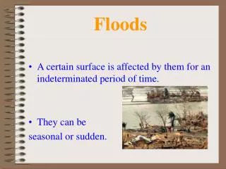
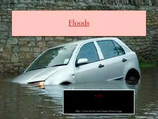
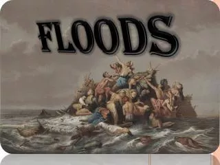
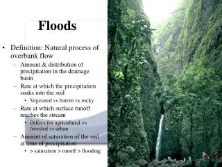
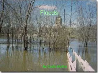
A flood is an overflow of water that submerges land which is usually dry. The European Union (EU) Floods Directive defines a flood as a covering by water of land not normally covered by water.[2] In the sense of "flowing water", the word may also be applied to the inflow of the tide. Flooding may occur as an overflow of water from water bodies, such as a river or lake, in which the water overtops or breaks levees, resulting in some of that water escaping its usual boundaries,[3] or it may occur due to an accumulation of rainwater on saturated ground in an areal flood. While the size of a lake or other body of water will vary with seasonal changes inprecipitation and snow melt, these changes in size are unlikely to be considered significant unless they flood property or drown domestic animals. Floods can also occur in rivers when the flow rate exceeds the capacity of the river channel, particularly at bends or meanders in the waterway. Floods often cause damage to homes and businesses if they are in the natural flood plains of rivers. While riverine flood damage can be eliminated by moving away from rivers and other bodies of water, people have traditionally lived and worked by rivers because the land is usually flat and fertile and because rivers provide easy travel and access to commerce and industry. Some floods develop slowly, while others such as flash floods, can develop in just a few minutes and without visible signs of rain. Additionally, floods can be local, impacting a neighbourhood or community, or very large, affecting entire river basins.
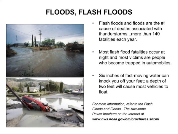
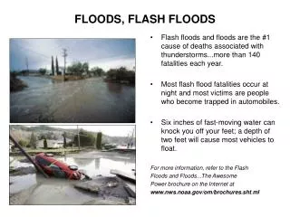
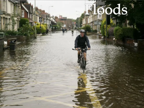
Floods are one of the most common hazards in the United States, however not all floods are alike. Some floods develop slowly, while others such a flash floods, can develop in just a few minutes and without visible signs of rain. Additionally, floods can be local, impacting a neighborhood or community, or very large, affecting entire river basins and multiple states. Flash floods can occur within a few minutes or hours of excessive rainfall, a dam or levee failure, or a sudden release of water held by an ice jam. Flash floods often have a dangerous wall of roaring water carrying rocks, mud and other debris. Overland flooding, the most common type of flooding event typically occurs when waterways such as rivers or streams overflow their banks as a result of rainwater or a possible levee breach and cause flooding in surrounding areas. It can also occur when rainfall or snowmelt exceeds the capacity of underground pipes, or the capacity of streets and drains designed to carry flood water away from urban areas. Be aware of flood hazards no matter where you live or work, but especially if you are in low-lying areas, near water, behind a levee or downstream from a dam. Even very small streams, gullies, creeks, culverts, dry streambeds or low-lying ground that appear harmless in dry weather can flood.
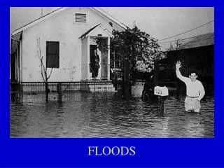
Even if you feel you live in a community with a low risk of flooding, remember that anywhere it rains, it can flood. Just because you haven't experienced a flood in the past, doesn't mean you won't in the future. Flood risk isn't just based on history; it's also based on a number of factors including rainfall , topography, flood-control measures, river-flow and tidal-surge data, and changes due to new construction and development. Flood-hazard maps have been created to show the flood risk for your community, which helps determine the type offlood insurance coverage you will need since standard homeowners insurance doesn't cover flooding. The lower the degree of risk, the lower the flood insurance premium. In addition to having flood insurance, knowing following flood hazard terms will help you recognize and prepare for a flood.
An earthquake (also known as a quake, tremor or temblor) is the result of a sudden release of energy in the Earth'scrust that creates seismic waves. The seismicity, seismism or seismic activity of an area refers to the frequency, type and size of earthquakes experienced over a period of time. Earthquakes are measured using observations from seismometers. The moment magnitude is the most common scale on which earthquakes larger than approximately 5 are reported for the entire globe. The more numerous earthquakes smaller than magnitude 5 reported by national seismological observatories are measured mostly on the local magnitude scale, also referred to as the Richter scale. These two scales are numerically similar over their range of validity. Magnitude 3 or lower earthquakes are mostly almost imperceptible or weak and magnitude 7 and over potentially cause serious damage over larger areas, depending on their depth. The largest earthquakes in historic times have been of magnitude slightly over 9, although there is no limit to the possible magnitude. The most recent large earthquake of magnitude 9.0 or larger was a 9.0 magnitude earthquake in Japan in 2011 (as of October 2012), and it was the largest Japanese earthquake since records began. Intensity of shaking is measured on the modified Mercalli scale. The shallower an earthquake, the more damage to structures it causes, all else being equal.[1] At the Earth's surface, earthquakes manifest themselves by shaking and sometimes displacement of the ground. When the epicenter of a large earthquake is located offshore, the seabed may be displaced sufficiently to cause a tsunami. Earthquakes can also trigger landslides, and occasionally volcanic activity. In its most general sense, the word earthquake is used to describe any seismic event — whether natural or caused by humans — that generates seismic waves. Earthquakes are caused mostly by rupture of geological faults, but also by other events such as volcanic activity, landslides, mine blasts, and nuclear tests. An earthquake's point of initial rupture is called its focus or hypocenter. The epicenter is the point at ground level directly above the hypocenter.
One of the most frightening and destructive phenomena of nature is a severe earthquake and its terrible aftereffects. An earthquake is the sudden, rapid shaking of the earth, caused by the breaking and shifting of subterranean rock as it releases strain that has accumulated over a long time. For hundreds of millions of years, the forces of plate tectonics have shaped the earth, as the huge plates that form the earth’s surface slowly move over, under and past each other. Sometimes, the movement is gradual. At other times, the plates are locked together, unable to release accumulated energy. When the accumulated energy grows strong enough, the plates break free. If the earthquake occurs in a populated area, it may cause many deaths and injuries and extensive property damage. All 50 states and 5 U.S. territories are at some risk for earthquakes. Earthquakes can happen at any time of the year. The 2011 East Coast earthquake illustrated the fact that it is impossible to predict when or where an earthquake will occur, so it is important that you and your family are prepared ahead of time.
A volcano is an opening, or rupture, in the surface or crust of the Earth or a planetary mass object, which allows hot lava, volcanic ash and gases to escape from the magma chamber below the surface. On Earth, volcanoes are generally found where tectonic plates are diverging or converging. A mid-oceanic ridge, for example the Mid-Atlantic Ridge, has examples of volcanoes caused by divergent tectonic plates pulling apart; the Pacific Ring of Fire has examples of volcanoes caused by convergent tectonic plates coming together. By contrast, volcanoes are not usually created where two tectonic plates slide past one another. Volcanoes can also form where there is stretching and thinning of the Earth's crust in the interiors of plates, e.g., in the East African Rift, the Wells Gray-Clearwater volcanic field and the Rio Grande Rift in North America. This type of volcanism falls under the umbrella of "Plate hypothesis" volcanism.[1] Volcanism away from plate boundaries has also been explained as mantle plumes. These so-called "hotspots", for example Hawaii, are postulated to arise from upwelling diapirs with magma from the core–mantle boundary, 3,000 km deep in the Earth.
The most common perception of a volcano is of a conical mountain, spewing lava and poisonous gases from a crater at its summit. This describes just one of many types of volcano, and the features of volcanoes are much more complicated. The structure and behavior of volcanoes depends on a number of factors. Some volcanoes have rugged peaks formed by lava domes rather than a summit crater, whereas others present landscapefeatures such as massive plateaus. Vents that issue volcanic material (lava, which is what magma is called once it has escaped to the surface, and ash) and gases (mainly steam and magmatic gases) can be located anywhere on the landform. Many of these vents give rise to smaller cones such as PuʻuʻŌʻō on a flank of Hawaii's Kīlauea. Other types of volcano include cryovolcanoes (or ice volcanoes), particularly on some moons ofJupiter, Saturn and Neptune; and mud volcanoes, which are formations often not associated with known magmatic activity. Active mud volcanoes tend to involve temperatures much lower than those of igneous volcanoes, except when a mud volcano is actually a vent of an igneous volcano.
Blizzards are characterized by low temperatures (usually below 20°F) and accompanied by winds that are at least 35 mph or greater, there must also be sufficient falling and/or blowing snow in the air that will frequently reduce visibility to 1/4 mile or less for a duration of at least 3 hours. A severe blizzard is considered to have temperatures near or below 10°F, winds exceeding 45 mph, and visibility reduced by snow to near zero. Blizzard conditions often develop on the northwest side of an intense storm system The difference between the lower pressure in the storm and the higher pressure to the west creates a tight pressure gradient, which in turn results in very strong winds. These winds combine with snow and blowing snow to produce extreme conditions. Storm systems powerful enough to cause blizzards usually form when the jet stream dips far to the south, allowing cold air from the north to clash with warm air from the south. With the colder and drier polar air comes atmospheric temperatures cold enough for the development of snow, sleet, or freezing rain. The Dakotas and parts of Minnesota were pounded by a succession of blizzards in the winter of 1996-1997. With few trees or other obstructions to reduce wind and blowing snow, this part of the country is particularly vulnerable to blizzards. A continuation of the broad central plains that run from the Gulf of Mexico into Canada, this area often experiences severe blizzard conditions, with wind chills of 40°F below or more and whiteout conditions.
1. Cold air (below freezing) is needed to make snow.For snow to fall to the ground, the temperature must be cold both up in the clouds where snowflakes form, and down at ground level. If the air near ground level is too warm, the snow will melt on its way down, changing to rain or freezing rain. 2. Moisture is needed to form clouds and precipitation. Moisture in the air is called water vapor. Air blowing across a body of water, such as a large lake or the ocean, is an excellent source of water vapor. As wind moves air over the water, some water evaporates from the surface, putting vapor into the air. This is how “lake effect snowstorms” and “Nor’easters” pick up so much moisture. However, cold air is not able to hold much water vapor. In fact, very cold air does not make very much snow. 3. Warm, rising air is needed to form clouds and cause precipitation. For a blizzard to form, warm air must rise over cold air. There are two ways that this may happen. Winds pull cold air toward the equator from the poles and bring warm air toward the poles from the equator. When warm air and cold air are brought together, a front is formed and precipitation occurs. Warm air can also rise to form clouds and blizzard snows as it flows up a mountainside.
Another scenario occurs when a cold core low over the Hudson Bay area is displaced southward over southeastern Canada, the Great Lakes, and New England. As rapidly moving short waves, or areas of upward vertical motion and energy, move around the low, they collide with warmer air coming north from the Gulf of Mexico. This produces strong surface winds, lots of cold air advection, and extensive wintry precipitation. In the southern central Great Plains, rapidly intensifying low pressure systems moving out of the Rocky Mountains can cause heavy snows and strong winds to the north, while to the south and east are thunderstorms and rain. When cold, moist air from the Pacific Ocean makes it over the Rockies and into the Plains and warmer, moist air moves north from the Gulf of Mexico, all that is needed is a cold closed low aloft and a strong polar jet for potential blizzard conditions that may extend from the panhandle of Texas to the Great Lakes.
Drought is an extended period when a region notes a deficiency in its water supply whether surface or underground water. A drought can last for months or years, or may be declared after as few as 15 days.[1] Generally, this occurs when a region receives consistently below average precipitation. It can have a substantial impact on the ecosystem and agriculture of the affected region. Although droughts can persist for several years, even a short, intense drought can cause significant damage[2] and harm to the local economy.[3] Prolonged drought has caused cause mass migrations and humanitarian crises. Many plant species, such as cacti, have adaptations such as reduced leaf area and waxy cuticles to enhance their ability to tolerate drought. Some others survive dry periods as buried seeds. Semi-permanent drought produces arid biomes such as deserts and grasslands.[4] Most arid ecosystems have inherently low productivity.
Generally, rainfall is related to the amount and dew point [determined by air temperature] of water vapour carried by regional atmosphere, combined with the upward forcing of the air mass containing that water vapour. If these combined factors do not support precipitation volumes sufficient to reach the surface, the result is a drought. This can be triggered by high level of reflected sunlight, and above average prevalence of high pressure systems, winds carrying continental, rather than oceanic air masses (i.e. reduced water content), and ridges of high pressure areas from behaviors which prevent or restrict the developing of thunderstorm activity or rainfall over one certain region. Oceanic and atmospheric weather cycles such as the El Niño-Southern Oscillation (ENSO) make drought a regular recurring feature of the Americas along the Midwest and Australia. Guns, Germs, and Steel author Jared Diamond sees the stark impact of the multi-year ENSO cycles on Australian weather patterns as a key reason that Australian aborigines remained a hunter-gatherer society rather than adopting agriculture.[35] Another climate oscillation known as the North Atlantic Oscillation has been tied to droughts in northeast Spain.[36] Human activity can directly trigger exacerbating factors such as over farming, excessive irrigation,[37]deforestation, and erosion adversely impact the ability of the land to capture and hold water.[38] While these tend to be relatively isolated in their scope, activities resulting in global climate change are expected to trigger droughts with a substantial impact on agriculture[39] throughout the world, and especially in developing nations.[40][41][42]Overall, global warming will result in increased world rainfall
A tornado is a violently rotating column of air that is in contact with both the surface of the earth and a cumulonimbus cloud or, in rare cases, the base of a cumulus cloud. They are often referred to as twisters or cyclones, although the word cyclone is used in meteorology, in a wider sense, to name any closed low pressure circulation. Tornadoes come in many shapes and sizes, but they are typically in the form of a visible condensation funnel, whose narrow end touches the earth and is often encircled by a cloud of debris and dust. Most tornadoes have wind speeds less than 110 miles per hour (177 km/h), are about 250 feet (76 m) across, and travel a few miles (several kilometers) before dissipating. The most extreme tornadoes can attain wind speeds of more than 300 miles per hour (483 km/h), stretch more than two miles (3.2 km) across, and stay on the ground for dozens of miles (more than 100 km). Various types of tornadoes include the landspout, multiple vortex tornado, and waterspout. Waterspouts are characterized by a spiraling funnel-shaped wind current, connecting to a large cumulus or cumulonimbus cloud. They are generally classified as non-supercellular tornadoes that develop over bodies of water, but there is disagreement over whether to classify them as true tornadoes. These spiraling columns of air frequently develop in tropical areas close to the equator, and are less common at high latitudes. Other tornado-like phenomena that exist in nature include the gustnado, dust devil, fire whirls, and steam devil; downbursts are frequently confused with tornadoes, though their action is dissimilar.
Tornadoes have been observed on every continent except Antarctica. However, the vast majority of tornadoes occur in the Tornado Alley region of the United States, although they can occur nearly anywhere in North America.[6] They also occasionally occur in south-central and eastern Asia, northern and east-central South America, Southern Africa, northwestern and southeast Europe, western and southeastern Australia, and New Zealand.[7] Tornadoes can be detected before or as they occur through the use of Pulse-Doppler radar by recognizing patterns in velocity and reflectivity data, such as hook echoes or debris balls, as well as through the efforts of storm spotters.There are several scales for rating the strength of tornadoes. The Fujita scale rates tornadoes by damage caused and has been replaced in some countries by the updated Enhanced Fujita Scale. An F0 or EF0 tornado, the weakest category, damages trees, but not substantial structures. An F5 or EF5 tornado, the strongest category, rips buildings off their foundations and can deform large skyscrapers. The similar TORRO scale ranges from a T0 for extremely weak tornadoes to T11 for the most powerful known tornadoes.[8] Doppler radar data, photogrammetry, and ground swirl patterns (cycloidal marks) may also be analyzed to determine intensity and assign a rating
Destructive FireForest fires always start by one of two ways - naturally caused or human caused. Natural fires are generally started by lightning, with a very small percentage started by spontaneous combustion of dry fuel such as sawdust and leaves. On the other hand, human-caused fires can be due to any number of reasons. Some classifications include smoking, recreation, equipment, and miscellaneous. Human-caused fires constitute the greater percentage of forest fires in our forests, but natural fires constitute the great majority of the total area burned. This is because human-caused fires are usually detected early in their duration, and therefore they are usually contained easily. Natural fires, on the other hand, can burn for hours before being detected by firefighting authorities.How Forest Fires BurnSurface FireThere are three elements that are required for a forest fire to burn: Heat, Oxygen, and Fuel. This is the so-called "fire triangle". Without all three of these elements, the fire will go out. Furthermore, the fire will spread in the direction of the most abundant supply of the three elements, while its rate of combustion is usually limited by one of the three elements. Once the fire enters the combustion stage, there are three main types of classifications for the fire. A smoldering fire is one that emits smoke but no flame and is rarely self-sustained. A fire is classified as flaming combustion when flames are present. Charcoal can be formed in the absence of oxygen with this type of fire. Glowing combustion is a later stage of the fire and is characterized by a slower rate of combustion and blue flame. Forest fires can also be classified by what part of the forest they burn in:
Ground fires occur on the ground, often below the leaves.Surface Fires occur on the surface of the forest up to 1.3 meters high.Crown fires are the most dangerous fires and can spread the fastest. They occur in the tops of the trees. They can be: (a) dependent upon surface fires to burn the crowns, (b) active in which they occur at the same rate as surface fires, or (c) the most destructive, independent, where fire can "jump" from crown to crown.It is not uncommon for two or three types of fires to occur simultaneously.Holding the LineFighting Forest FiresPerhaps the most overlooked aspect of fighting forest fires is communication. It is vital that the proper authorities be notified as soon as possible when a fire occurs. Obviously, a fire that is detected in its early stages will be much easier to extinguish than a fire that has been burning for some time but has only just been disovered because of lack of communication. Once a fire has been detected, the fire fighters must be transported to the fire and then apply suppression methods.
Transport and SuppressionOne difficulty in fighting forest fires is transporting the firefighters to the fire. Obviously, wildland fires often occur in rather rugged terrain, so fire fighters often have to be transported in by air and then walk with their equipment overland. Once crews are to the fire, the suppression method they use depends on the type of fire.Ground fires are often best controlled by digging trenches in the soil layer.Portable water backpacks and firebreaks are often the most effective methods at controlling surface fires.Lastly, if a fire escalates to a crown fire, aerial support is used to suppress the fire with fire retardant chemicals and/or water. However, these fires are often very dangerous and human life always comes first in fire fighting; sometimes these fires are just allowed to burn until they run out of dry fuel.