Download

1 / 20
200 likes | 384 Views
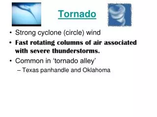
GIS Helps Americus Respond to Tornado. March 1, 2007. Thursday, March 1, 2007. 9:15 pm – F3 tornado hits Sumter County and Americus, Georgia Destroys local hospital Destroyed and damaged many businesses and homes Two deaths. 11:15 pm

E N D
GISHelps AmericusRespond to Tornado March 1, 2007
Thursday, March 1, 2007 • 9:15 pm – F3 tornado hits Sumter County and Americus, Georgia • Destroys local hospital • Destroyed and damaged many businesses and homes • Two deaths
11:15 pm Developed temporary GIS station at command post located at Public Safety Building Connected to server in Atlanta where GIS files are stored by BinaryBus using Lap Top with wireless connection Started providing critical information to officials Example – once we knew that streets were destroyed, I could determine how many homes were involved
2:00 am Able to relocate to GIS office in City Hall Was given one of the few generators available at that time to start printing maps Printed about 100 maps per hour until 7:00 am 7:00 am Had briefing meeting with local officials and emergency personnel to put in action to restore city Continue to print maps all day and most of the night Friday, March 2, 2007
5:00 pm Local officials flew over area, viewed the damages, marked map of path the tornado took 7:00 pm Began creating layer indicating the path of tornado through Sumter County 11:00 pm Head home – 24 hours later
Saturday, March 3, 2007 • 8:00 am – Morning briefing with representatives of GEMA, FEMA, and local officials • Provide representative with maps of tornado path • GEMA and FEMA identified information they needed for me to compile • Needed to compile addresses of businesses and residences within the path
Recovery Begins • Sunday, March 4, 2007 • Started compiling data and photos of damaged properties in the path of tornado. During the next days and weeks, we identified and assessed damages to each site and collected GIS data • Also began looking for available property owned by the city or county for use as dump sites
We had to find site for the recovery center that would house responding agencies and a distribution site for supplies
Help came on Monday, March 5, 2007 • BinaryBus (who houses our server and GIS website) contacted me about taking all the disaster data I had compiled and develop a disaster website for all GEMA, FEMA, local officials, public, etc. could use to help in the recovery • This site was up and running by Tuesday afternoon – March 6
We had addresses of damaged properties • Layer indicating the type of damage – such as roof or structural • Information as to type of property – such as business, residence, church, park, etc • Level of damage – destroyed, major, moderate or minor • Path of tornado • Information developed on tornado
Americus-Sumter County Damages • Minor – 681 • Businesses – 88 • Residents – 586 • Recreation Facilities / Parks – 2 • Churches – 2 • Schools – 1 • Cemeteries – 1 • Fire Stations -1 • Total Businesses w/ Damages – 217 • Total Residents w/ Damages - 993 • Total Cemeteries – 3 • Total Churches – 10 • Total Fire Stations – 1 • Hospitals – 1 • Recreation Facilities / Parks – 8 • Schools – 2 • Damaged area inside City of Americus 3.43 square miles • Damaged area in Sumter County 13.98 square miles • Total 17.41 square miles • As of April 26, 2007 • Total Damages – 1235 • Destroyed – 75 • Businesses – 42 • Residents – 31 • Hospital – 1 • Churches – 1 • Major – 148 • Businesses – 27 • Residents – 116 • Recreation Facilities / Parks – 3 • Churches – 2 • Moderate - 331 • Businesses – 60 • Residents – 260 • Recreation Facilities / Parks – 3 • Churches – 5 • Schools – 1 • Cemeteries – 2
BinaryBus Site Helps – March 6, 2007 • Link posted on website of local newspapers, radio and TV stations • 1,600 maps were printed since tornado hit • New website cut printing in half