Download
1 / 20
200 likes | 344 Views
SPSRB Project Plan “Arctic Composite Satellite Imagery”. IPT Lead: Jeff Key (STAR) IPT Backup Lead: Richard Schreitz (OSPO) Science lead: Matthew Lazzara (CIMSS) August 10-11, 2011. Outline. Integrated Product Team (IPT) Requirements Capabilities Assessment IT System Architecture

E N D
SPSRB Project Plan “Arctic Composite Satellite Imagery” IPT Lead: Jeff Key (STAR) IPT Backup Lead: Richard Schreitz (OSPO) Science lead: Matthew Lazzara (CIMSS) August 10-11, 2011 V14.2 12 Jan 2010
Outline • Integrated Product Team (IPT) • Requirements • Capabilities Assessment • IT System Architecture • Plan of Operations • Project Milestones • Funding • Spending Plan and Tasks V14.2 12 Jan 2010
Integrated Product Team (IPT) V5.3 12 Jan 2010 • IPT Lead: Jeff Key (STAR) • IPT Backup Lead: Richard Schreitz • NESDIS Team: • STAR: Jeff Key • OSPO: Richard Schreitz, Antonio Irving • OSD: Tom Schott • Data Center: NCDC (TBD) • Others: Science lead: Matthew Lazzara (CIMSS) • User Team • Lead: Matt Glazewski, OPC • Others: Dave Novak, HPC; Gary Hufford, NWS AK • Oversight Panel (OP) lead: ICAPOP • Other OPs involved: None
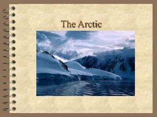
Arctic Composite Satellite Imagery Requirement V5.3 12 Jan 2010 • Requirement • SPSRB #1008-0012, Arctic Composite Satellite Imagery • Infrared and visible satellite imagery composites of the Arctic Ocean and Northern Polar region in the US Arctic, as well as the Northern Atlantic Arctic region. • User community: • Ocean Prediction Center, Hydrometeorological Prediction Center, NWS Alaska, National Ice Center (NIC), GOES-R Proving Ground program • Benefit to user: • Improves operational forecasting for the North Pacific and North Atlantic from 60oN to 90oN for maritime and aviation operations (Weather and Water, Local Forecast and Warning, Commerce and Transportation). Time-lapse imagery of the Arctic aids in understanding weather patterns and phenomena, ultimately improving forecasts. • NOAA Mission Goal supported: • Climate (Climate Observations and Monitoring) • Weather and Water (Local Forecast and Warnings; Coasts, Estuaries & Oceans) • Commerce and Transportation (Marine Transport Systems, Marine Weather and Surface Weather) • This product directly addresses goal #3 in NOAA’s Arctic Vision and Strategy (“Improve Weather and Water Forecasts and Warnings”) • Mission priority: Mission Critical (User), Optimal (SPI WG)
Capabilities Assessment V5.3 12 Jan 2010
Capabilities Assessment (Continued) V5.3 12 Jan 2010 • Current Operational Shortfalls • The current operational NESDIS product, “Polar Mapped Mosaic Composites” (http://www.osdpd.noaa.gov/ml/imagery/mosaics.html) is a once-daily, multi-channel, polar-obiting-only product with a spatial resolution of 15 km at the equator and 36 km at the poles. The spatial resolution and temporal frequency are inadequate for HPC & OPC purposes. • Define how product development addresses shortfalls • Arctic composite will utilize all available geostationary and polar orbiting satellites, providing the best possible imagery within constraints and at a higher spatial and temporal resolution. • Impact if not funded • Negative impact for operational forecasting and warning the North Pacific and North Atlantic • Existing research composites funded by NSF will cease to be produced.
Algorithm Status and Approach V14.2 12 Jan 2010 • Current status of algorithms being considered in your project • The method being considered has been applied to Antarctic (south polar region) data and used by forecasters for many years. The National Science Foundation supported a “proof of concept” for an Arctic product. • The Arctic composites are currently being generated on an hourly basis in a research environment. Additional satellites, such as Metop-B and NPP, will be added when available. • With some relatively minor enhancements, the current product will meet user needs. (See Capabilities Assessment table.) • No other reasonable options exist that can meet user requirements.
Algorithm Status and Approach (continued) V14.2 12 Jan 2010 • Overview of technical approach of the algorithm and its implementation • Description: The product is an hourly mosaic of geostationary and polar-orbiting satellite data over the Arctic region. A time series of images provides for animations, which can be used to examine the evolution of weather phenomena. • Ancillary data requirements: None • Concept of operations: • Arctic composites are currently generated with GOES, Meteosat, MTSAT, NOAA, and Aqua/Terra with plans to add Metop-A this spring. Metop-B, NPP, and future GOES & MTSAT satellites will be incorporated as available. NPP will launch in October 2011; Metop-B will launch in April 2012. Others used in research product but not yet operational in NESDIS: FY-2(D,E), INSAT. • Composite images are generated every hour. • Channels used: Infrared window (~11.0 μm); longwave infrared (~12.0 μm), water vapor (~6.7 μm), and shortwave infrared (~3.8 μm). Visible (0.6 μm) is under development now. Not all sensors have all channels. • Spatial resolution is 5 kilometers nominal at 60o North. • Images are available in McIDAS AREA and can be made available in netCDF4, binary or ASCII flat file output, as well as standard PNG, JPEG, etc. formats.
Algorithm Status and Approach (continued) • Briefly describe the validation concept • No validation is necessary. This is an imagery product that provides brightness temperatures and brightness. It does not provide any higher-level geophysical parameters. • Quality is assessed through visual inspection of the product (e.g., the lack of or limited seams where the satellites overlap), and through quantitative metrics. • The primary metric is the percentage of the Arctic area coverage with imagery each hour, within time and data availability constraints. V14.2 12 Jan 2010
(Animation is available at http://amrc.ssec.wisc.edu/arcticcomposite.gif) V5.3 12 Jan 2010
Dissemination User System Backup ESPC Red Hat Linux Various h/w systems Operational ESPC Red Hat Linux ESPC Red Hat Linux Development STAR or OSPO One multi-core Linux workstation at CIMSS IT System Architecture Satellite Data (see below) Ancillary Data: none Satellite Data (see below) Input Data Includes: GOES, Meteosat, MTSAT, NOAA, Metop-A, and Aqua/Terra. To be added when available: Metop-B, NPP. Others used in research product but not yet operational in NESDIS: FY-2(D,E), INSAT. V14.2 12 Jan 2010
Research and Operational System Environments * ESPC Target Architecture is either IBM P-series or X86 with virtualization ** ESPC target OS is either AIX, AIX with a Red Hat Linux LPAR (64-bit), or Red Hat Linux for X86 (64-bit) *** IDL and MATLAB are not supported in ESPC for science algorithm processing, only for post-processing tasks Red font indicates new IT resource requirements for this project Blue font indicates existing IT resources will be used for this project 12 V16.0 July 2010
Operational Agency System Requirements Red font indicates new IT resource requirements for this project Blue font indicates existing IT resources will be used for this project 13 V16.0 July 2010
Plan of Operations V14.2 12 Jan 2010 • Product Retirement Plan • We do not anticipate retiring the Arctic composites product under this project. • Archive Plan • Assuming that this product is planned for inclusion into AWIPS-2, NWS will automatically archive it at NCDC. • Deliverables to archive include the imagery, documentation, and software. • Cost requirements: No additional costs to this project. • The current Product Archive System is a collection of procedures used to archive satellite imagery and data to the repository at NCDC. The datasets have specially formatted dataset names and are registered with the Product Archive System. Each hour, files that are ready to be collected are placed in a Transfer List File. The Transfer List File is then read by NCDC remotely and used as a master list to transfer application datasets. Each day a backup of the previous day is needed to ensure restore procedures can be completed during an emergency. • Long Term Maintenance Plan • A STAR science maintenance plan and funding is TBD. No STAR funding currently exists for product maintenance. • Ordinary and reactive maintenance will be performed by ESPC contractors with funding from base.
Plan of Operations (continued) • Quality Monitoring Plan • Visual inspection of the composites will be the primary quality monitoring plan. • McIDAS is the common tool used in the generation of the composites, and used by both CIMSS and OSPO, and will be used in quality control efforts. • Quality control efforts will include evaluating the percentage of Arctic area coverage, verification of maximized use of all available satellites, minimize the seams between satellites, etc. • Documentation/Metadata Plan • CIMSS and STAR will provide documentation and metadata. • User Involvement Plan • The primary users; OPC, HPC, and NWS Alaska; are already involved and have helped define requirements. Information on quality, timeliness, and applications is exchanged via phone and email. The dialogue will continue as necessary. V14.2 12 Jan 2010
Project Milestones and Key Tasks Product Delivery/Tracking Name: Arctic Composite Imagery • MAR 12: Development Phase Begins • MAR 12: IPT Lead informed to begin product development • APR 12: Initial Archive Requirements identified • MAY 12: Quality Monitoring Concept Defined • MAY 12: Long-term Maintenance Concept Defined • JUN 12: Preliminary Design Review • AUG 12: Development processing system defined • AUG 12: Initial Information Technology (IT) Security concept defined • SEP 12: Test case processed • OCT 12: Critical Design Review • DEC 12: Code is prepared for implementation • JAN 13: Software Code Review • JAN 13: Final Archive requirements identified • JAN 13: Operational and backup processing defined • FEB 13: Pre-operational Phase Begins • MAR 13: Operational and backup processing capabilities in place • APR 13: Final IT Security Concept Defined • MAY 13: Pre-operational product output evaluated & tested • JUN 13: Code transitions to operations; all documentation is complete • AUG 13: Operational and backup capabilities reach ops status • SEP 13: Brief SPSRB Oversight Panel(s) on product status • SEP 13: Brief SPSRB capability is ready to go operational • OCT 13: Operational Phase Begins • OCT 13: SPSRB declares product operational • SPSRB Secretaries/manager update the SPSRB product metrics web pages • OSD updates Satellite Products database V14.2 12 Jan 2010
Product Deliverable Details N=New E=Enhanced R=Replacement T=Tailored O=Other V14.2 12 Jan 2010
Funding (K) Arctic Composite Satellite Imagery V14.2 12 Jan 2010
Arctic Composite Satellite ImageryFY12 Purchases and Tasks V14.2 12 Jan 2010 • (10K of Geo-PSDI): STAR/CIMSS hardware for 1 computer system. • (60K of Geo-PSDI): CIMSS Grant for 1 person at 50% time from MAR 12 to FEB 13 • Continue development of Arctic composites and tailor to user needs. • Update processing to build a 4 kilometer composite. • Continue development of visible composite imagery. • Set projection and navigation to meet user needs. • Develop netCDF output of the Arctic composite. • Work with NCDC on data archive plan. • Lead the Preliminary and Critical Design Reviews (PDR, CDR). • Add code for metrics. • Develop product documentation. • Include internal documentation within the software • Include documented metadata information • (5K of Geo-PSDI): OSPO contract for one person 3% time from MAR 12 to FEB 13 • Design reviews, documentation preparation and initial IT support. • (5K of Geo-PSDI): OSPO hardware for computer storage.
Arctic Composite Satellite ImageryFY13 Purchases and Tasks V14.2 12 Jan 2010 • (30K of Geo-PSDI): CIMSS Grant for 1 person at 20% time from MAR 13 to FEB 14 • Add additional satellite to composite, e.g., NPP. • Work with OSPO on STAR-provided code • (15K of Geo-PSDI): OSPO contract for 1 person at 10% time from MAR 13 to FEB 14 • Implement STAR-provided code at CIP and ESPC. • Implement quality control web interface. • Update documentation and continue generation of operational products. • (10K of Geo-PSDI): OSPO hardware for CIP and/or ESPC computer system