
Project Context
E N D
Presentation Transcript
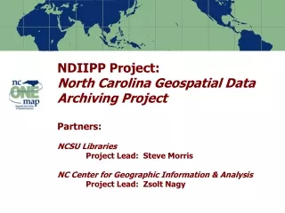
Content and Practice:Background to the NC Geospatial Data Archiving ProjectSteve MorrisNCSU Libraries
Project Context • Partnership between university library (NCSU) and state agency (NCCGIA) • Focus on state and local geospatial content in North Carolina (statedemonstration) • Addressing the NC OneMap objective “Historic and temporal data will be maintained and available • One of eight projects in the first NDIIPP funding round: “Building a Network of Partners” Note: Percentages based on the actual number of respondents to each question
Targeted Content • Resource Types • GIS data • Digital orthophotography • Digital maps • Tabular data (e.g. assessment data) • Content Producers • Mostly state, local, regional agencies • Some university, not-for-profit, commercial • Selected local federal projects Note: Percentages based on the actual number of respondents to each question
Value of Content • National State Geographic Information Council estimate for NC: $162 million (2003) • Local content also forms basis of many state/federal data resources • Value over time: • Greatest demand for current data • Increasing (yet still small) demand for older versions of data • Older versions impossible to replace once lost Note: Percentages based on the actual number of respondents to each question
Large scale, current, attributed vector data Note: Percentages based on the actual number of respondents to each question
High resolution digital orthophotography Note: Percentages based on the actual number of respondents to each question
County Digital Orthophotography Specifics Note: Percentages based on the actual number of respondents to each question Source: NC OneMap Data Inventory 2004
Value as part of cultural heritage Note: Percentages based on the actual number of respondents to each question
Data Quantity • County Digital Orthophotos • 88 counties with, estimated 154 flights by 2006 • Estimated 30 gb/flight – 4.6 TB total • County, City, COG Vector Data • Variable mix of layers; some continuous update • 92 of 100 counties with GIS systems • 51 municipalities with GIS systems • State Agency Data • 1993 and 1998 statewide orthos – 800 gb • Terabytes of vector data and other imagery • 17-20 TB of LIDAR data Note: Percentages based on the actual number of respondents to each question
NC OneMap Initial Data Layers Produced by Cities and Counties Note: Percentages based on the actual number of respondents to each question Source: NC OneMap Data Inventory 2004
Content Organization (tiling, etc.) • State agency data • Vector data: statewide, river basin, quarter quadrangles, counties • Imagery: quarter quadrangles, local images • County data • Vector data: county, tax map units • Orthophotos: tax map units, county mosaics • Increasing: spatial databases (SDE, PostGIS, etc.) • Municipal data • Vector data: city, tax map units Note: Percentages based on the actual number of respondents to each question
Metadata • FGDC CGDSM implemented by major state GIS agencies starting in 1994 • NC CGIA Metadata Outreach: regional workshops, phone support, training materials • Adoption • Some adoption by county agencies (21 of 92 county GIS systems as of Spring 2004) • Some adoption by municipal agencies and COGS (13 of 51 municipal GIS systems by Spring 2004) • Rare adoption by private, university, NGO’s Note: Percentages based on the actual number of respondents to each question
Local Agency Geospatial Metadata Note: Percentages based on the actual number of respondents to each question Source: NC OneMap Data Inventory 2004
Versioning and Updating • Orthophotos • County digital orthophotos reflown every 2-7 years • Statewide digital orthophoto plan: every 5 years (alternating B&W and color infrared) • Vector Data • State agency vector data: some static, some periodically updated, relatively fewer continuously updated • County/City/COG vector data: many data layers continuously or periodically updated • Old versions supplanted, exist on relatively inaccessible backups Note: Percentages based on the actual number of respondents to each question
Time series – vector data Parcel Boundary Changes 2001-2004, North Raleigh, NC Note: Percentages based on the actual number of respondents to each question
Content Use • Much sharing between agencies (all levels) • Municipal agencies use county data (orthos, centerlines, parcels) as base layers • State and federal agencies use local data to improve their own data (linework adoption/improvement or attribute conflation) • Local agencies use LIDAR (control points, etc.) • Problems with different data structures, naming, coding schemes (e.g. parcels) • NC OneMap framework data standards in development Note: Percentages based on the actual number of respondents to each question
Local Applications Where GIS Is Used Note: Percentages based on the actual number of respondents to each question Source: NC OneMap Data Inventory 2004
Knowledge Required for Use • Most data published in widely used formats • Vector: shapefile, coverage, geodatabase, MIF • Image: TIFF, MrSID, BIL • LIDAR data: range of early/middle/late stage products requiring different skills • Semantic issues: different naming schemes across counties; need data dictionaries and ancillary documentation • Early stage image products (e.g. pre-rectification orthos) require greater knowledge, but are not widely available Note: Percentages based on the actual number of respondents to each question
Associated Applications/Web Services • Largely compatible with predominate commercial software packages • Exception: several counties using Understanding Systems GIS software • NC OneMap viewer system: Cascading map server based on drawing on local/state/federal WMS sources • Geocoding function on the NC OneMap map viewer uses the commercial geocoding web service Note: Percentages based on the actual number of respondents to each question
GIS Software Used Note: Percentages based on the actual number of respondents to each question Source: NC OneMap Data Inventory 2004
Note: Percentages based on the actual number of respondents to each question
Note: Percentages based on the actual number of respondents to each question
Note: Percentages based on the actual number of respondents to each question
Note: Percentages based on the actual number of respondents to each question
Note: Percentages based on the actual number of respondents to each question
Note: Percentages based on the actual number of respondents to each question
Note: Percentages based on the actual number of respondents to each question
Data/Metadata Workflow: Community • Data • Orthophoto work contracted out to commercial firms • Some vector data contracted out (notably parcels) • Most other vector data produced in-house • Early, middle, late, and late-late stage products • Metadata • Metadata published by producer, with NC Metadata Outreach Program support • Metadata published to NC NSDI clearinghouse, Geospatial One-Stop, and NC OneMap Note: Percentages based on the actual number of respondents to each question
GIS Data Management Note: Percentages based on the actual number of respondents to each question Source: NC OneMap Data Inventory 2004
County Street Centerline Specifics Note: Percentages based on the actual number of respondents to each question Source: NC OneMap Data Inventory 2004
County Cadastral Specifics Note: Percentages based on the actual number of respondents to each question
County Surface Water Specifics Note: Percentages based on the actual number of respondents to each question
Data/Metadata Workflow: Project • Data identified through a mix of eight different existing inventory processes • NC OneMap Inventory starting from 2004 • Data acquired through a variety of means • Download, WAN, CD/DVD, external drives, tapes • Will experiment with OGC technologies for identification and transfer of data • Ingest existing metadata and augment • Normalize existing FDGC and create minimal if none • Wrap descriptive, adminstrative, technical metadata into METS records; links to services Note: Percentages based on the actual number of respondents to each question
Data/Metadata Workflow: Project • Ingest into Dspace open source digital repository software • Explore issues surrounding ingest of geospatial content into generic, widely available repository environments • Maintain independence of preservation object from ingest object of a given repository environment • Explore re-ingest into a different repository environment – avoid “imprinting” on a single environment • Explore a mix of federal/state/local options for longer-term archiving Note: Percentages based on the actual number of respondents to each question
Is Content Being Archived Now? • Records retention requirements don’t necessarily ensure preservation • A wide range in practice – in general custodian and consumer energies are focus on current data • Where archiving is occurring “permanent access” is generally not supported • A variety of different state/regional/local approaches (focus of project site visits) Note: Percentages based on the actual number of respondents to each question
Integrating with NGDA? • Community: Would need to be relatively effortless and inexpensive • local GIS shops are small, strapped for staff time • long-term access is a low priority • need automation, web services–based archive development (and GeoDRM?) • Rights issues must be cleared; need to address concerns about disclaimer provision, liability, etc. • Project: Interest in exploring re-ingest into a separate repository environment Note: Percentages based on the actual number of respondents to each question
Intellectual Property Rights Issues • Subject to Public Records Law • Public record: no privacy issues … • … but records for some individuals may be filtered • Disclaimer viewing important (liability) • Restrictions on commercial reuse – desire for downstream control of data • Great deal of variability in access/use policy • Trust between agencies is important; interpersonal and interorganizational relationships a key part of the infrastructure Note: Percentages based on the actual number of respondents to each question
Obtaining Local GIS Data Source: NC OneMap Data Inventory 2004 Note: Percentages based on the actual number of respondents to each question
NC OneMap Data Sharing Agreements • NCCGIA working to clarify legal issues surrounding redistribution • Striking MOAs with local agencies as part of NC OneMap framework for open access • One of stipulations: “…AGREE that the data shared under this agreement may be further redistributed with applicable metadata by either agency WITHOUT FEES in the public domain and without restriction, unless otherwise noted herein and/or unless otherwise subject to public laws of governing authorities … • As of 2004 MOAs distributed to 55 counties in draft form, 24 signing with option for redistribution Note: Percentages based on the actual number of respondents to each question
Transition Plan for Content • NCSU/CGIA NDIIPP Project • Project timeline: 3 years, 2004-2007 • Commitment to retain data 5 years after project termination • State/Regional/Local Agencies • Variable • NC OneMap and other initiatives evolving • Role of State Archives? Note: Percentages based on the actual number of respondents to each question
Questions? Contact: Steve Morris Head of Digital Library Initiatives NCSU Libraries Steven_Morris@ncsu.edu Phone: (919) 515-1361 Note: Percentages based on the actual number of respondents to each question