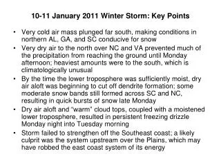
Download
1 / 6
60 likes | 183 Views
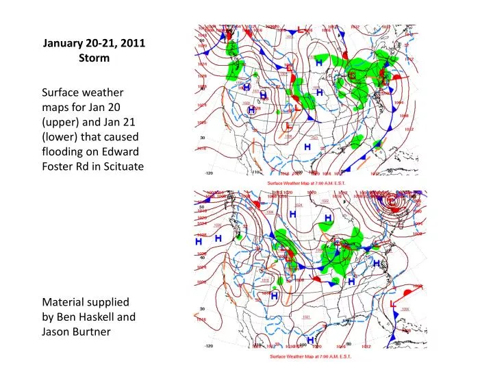
January 20-21, 2011 Storm. Surface weather maps for Jan 20 (upper) and Jan 21 (lower) that caused flooding on Edward Foster Rd in Scituate. Material supplied by Ben Haskell and Jason Burtner. Observed total water level record measured at Scituate harbor water level gauge January 17-21, 2011.

E N D
January 20-21, 2011 Storm Surface weather maps for Jan 20 (upper) and Jan 21 (lower) that caused flooding on Edward Foster Rd in Scituate Material supplied by Ben Haskell and Jason Burtner
Observed total water level record measured at Scituate harbor water level gauge January 17-21, 2011
Scituate, MA Bridge on causeway where flooding occurs Edward Foster Road
Nor’easter 10/16/2009 NOAA Boathouse 3/1/10, high tide Edward Foster Rd. 1/21/11, 12.8” high tide First Cliff