Download
1 / 34
340 likes | 497 Views
Forecasting in the Field: How to read the weather without a TV or computer. What Conditions Do We Consider Hazardous?. http://www.photos12-vintage.com/images/Explorateur_Latreille.jpg http://www.alpine-guides.com/images/ski%20avalanche%20safety.jpg http://www.co.cumberland.nc.us/

E N D
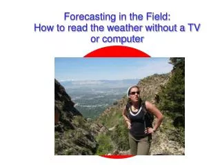
Forecasting in the Field: How to read the weather without a TV or computer
What Conditions Do We Consider Hazardous? http://www.photos12-vintage.com/images/Explorateur_Latreille.jpg http://www.alpine-guides.com/images/ski%20avalanche%20safety.jpg http://www.co.cumberland.nc.us/ http://www.utahweather.org/
Outline • Some weather basics • Know Before You Go • Ok, so I see this cloud... • Practice Scenarios
Weather Basics- Solar Radiation The sun shines... Rock heats faster than grass/trees/bushes. clouds! What happens when you heat the ground? Warm air rises!
Weather Basics- Fronts What does this mean for us? Weather changes depending on where you are in relation to the fronts.
Weather Basics- Fronts • Cold Front Clues • Increased winds from the south • Increase in temperature, “muggy” feeling • Air pressure begins to drop • Clouds thick, merge, lower, and get darker http://apollo.lsc.vsc.edu/classes/met130/notes/chapter11/graphics/cf_xsect.jpg
Weather Basics- Fronts • Warm Front Clues • Approaching high clouds • Stratus clouds • Surface winds from east to southeast • Increase in air temperature • Thickening, lowering clouds http://www.physicalgeography.net/fundamentals/images/warmfront.GIF
Know Before You Go! “We thought we had a window in the weather, but we were wrong.”
Know Before You Go! The local National Weather Service webpage is a good place to start. Discussion is written by a NWS forecaster- it explains why they created the forecast the way they did. http://www.weather.gov/
How to Build a General Idea of What Is Going to Happen Check the NWS forecast to get a basic idea (read the forecast discussion- pay attention for forecast uncertainty) If no storm systems (fronts) are forecast, check Mesowest to see if there are any weather stations in the area you plan to visit. If you want, look at the RAP site to see satellite imagery- see if there are clouds, afternoon thunderstorms, etc. (Do this the day before to see what time thunderstorms develop) Check sites for the area you’re visiting (park websites, etc.). See if they have a webcam- these can give you a good idea of what is going on.
Uncertainty in Forecasting There is ALWAYS some uncertainty in forecasting. Summer hazards (afternoon thunderstorms) tend to be localized, short-lived, and very difficult to predict. Winter hazards tend to occur on a larger scale, but these events (cold fronts) are more predictable.
Summer Hazards Desert: Flash floods Mountains: Lightning (and rain) Bottom line: How do we tell if there’s going to be a thunderstorm?
North American Monsoon What is a monsoon? A seasonal wind shift. Moist air moves into the Western US in July, August, and September. http://www.cpc.noaa.gov/products/outreach/Report-to-the-Nation-Monsoon_aug04.pdf The NAM acts as a moisture source for afternoon thunderstorms.
Mountain Thunderstorms Afternoon What time of day do they form? Why do they form some days and not others? Where do they form? Moisture Generally, over the peaks. May move in direction of mean flow.
Mountain Thunderstorms First, pathetic little clouds of the day! Few hours later
Mountain Thunderstorms Still later.... what differences do you see?
Mountain Thunderstorms Cumulus clouds as they continue to grow vertically.
Mountain Thunderstorms anvil Sometimes thunderstorms go so high that they hit the tropopause- which is the layer between the troposphere and stratosphere. Clouds can’t continue to grow into the cold air of the stratosphere, so the top of the cloud spreads out.
Mountain Thunderstorms Will I be endangering my life if I go into an area and thunderstorms occur? Were there thunderstorms yesterday? When did they occur? What time? Are there clouds in the sky now? What do they look like. Continue to monitor the development of cumulus clouds- if they continue to grow, there could be thunderstorms. Have a plan in case thunderstorms occur.
Winter Hazards Desert: Flash floods (to some extent) Mountains: Snow, ice, wind, lightning leading to avalanches, hypothermia, etc. Bottom line: Look at the weather before you go!!!
Winter Hazards Many of these hazards come from storm systems moving into the western US. Whether or not a storm will happen is not difficult to predict- after all, they are fairly large and obvious. The timing of these storms is another story.
Winter Hazards Above: Visible satellite Top Right: Radar Left: View from campus as the front approaches Salt Lake. Photo by Greg West
Signs of an Approaching Front Cirrus clouds Indication of upper-level moisture These clouds frequently precede a storm by 24-48 hours. http://www.theweather.com.au/uploads/sundog_tn.jpg
Signs of an Approaching Front Lenticular Clouds Another indicator of moisture Can be followed by precipitation in 24-48 hours www.livingwilderness.com “When Mt. Rainier wears a hat, rain is likely to soon follow.” http://thudhead.blogspot.com/2007_02_01_archive.html
Signs of an Approaching Front Other signs that a front could be approaching Clouds that get lower with time (like cirrus turning to altocumulus turning to stratus) Gusty winds, especially from the south Listen to your instinct- if it’s a big storm, you will feel the energy of the atmosphere.
Other Helpful Resources Mountain Weather- Jeff Renner Book about backcountry forecasting and weather safety Mountain Meteorology- Dave Whiteman The textbook on mountain meteorology Jim Bishop’s Mountain Thunderstorm Document (http://www.fs.fed.us/psw/cirmount/wkgrps/gloria/publications/pdf/Bishop_mtn_thunderstorms_031607.pdf) U of U Meteorology Department! http://www.met.utah.edu