Download
1 / 5
50 likes | 177 Views
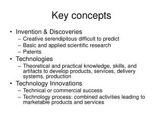
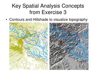
This document explores the process of Digital Elevation Model (DEM) reconditioning through quantitative raster analysis. It covers the conversion of vector data to raster, calculation of distance, and volume removal analysis by modifying stream grid cells. The analysis includes steps such as filling, calculating flow direction, flow accumulation, and stream definition. Additionally, it discusses converting catchments to vector, using attribute features, and applying zonal statistics. Tools for online hydro basemap services and watershed delineation from a point are also outlined.

E N D
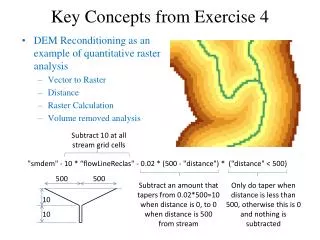
Key Concepts from Exercise 4 • DEM Reconditioning as an example of quantitative raster analysis • Vector to Raster • Distance • Raster Calculation • Volume removed analysis Subtract 10 at all stream grid cells "smdem" - 10 * “flowLineReclas" - 0.02 * (500 - "distance") * ("distance" < 500) 500 500 Subtract an amount that tapers from 0.02*500=10 when distance is 0, to 0 when distance is 500 from stream Only do taper when distance is less than 500, otherwise this is 0 and nothing is subtracted 10 10
3D Analyst Profiles smdem diff smrecon
Construct the Analysis Layer • Fill • Flow Direction • Flow Accumulation • Stream Definition • Stream Links • Catchments
Convert to Vector • Vector streams • Vector catchments • Attribute feature with raster zonal statistics • Geometric Network • Tracing • Selection statistics
Online Hydro Basemap and Wateshed Delineation Services • Global Hydro Reference Overlay map in AGOL • Watershed delineation from a point as a geoprocessing service