Download
1 / 34
340 likes | 440 Views
This text outlines the USGS response to the Deepwater Horizon oil spill, including sampling data, InSitu measurements, and collaborative efforts with agencies. The USGS conducted extensive sampling and established protocols to assess environmental impact and aid mitigation and restoration.

E N D
USGS Response to Deepwater Horizon Oil SpillUSGS/NWS/COE Tri-Agency Coordination MeetingOctober 5-6, 2010Brainerd, MNGeorge Arcement, Jr.Louisiana Water Science Center
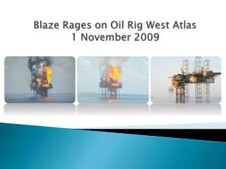
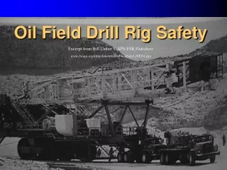
Explosion on the Deepwater Horizon Oil Rig occurred at 9:45 pm April 20.
Well located about 50 miles southeast of mouth of Mississippi River Well at depth of about 5,000 feet below water surface Oil reserve being tapped was more than 3 miles below water surface
At 9:45pm gas, oil, and concrete from the Deepwater Horizon well explode onto the deck and then catches fire. 115 platform workers survive , 17 with serious injuries The day after the explosion it is estimated that 8,000 barrels of crude oil are leaking per day? How many gallons are in 1 barrel of crude oil? It has recently been estimated that the oil well was leaking about 56,000 to 68,000 barrels per day It is estimated that approximately 4.4 million barrels of oil leaked from the well, about 185 million gallons About 800,000 barrels were recoveredThe explosion kills 11 platform workers
Well blowout occurs April 20, 2010 Well cap installed July 15, 2010 “Static Kill” completed August 4, 2010 Relief well intersects well on September 16, 2010 Well is officially declared “Dead” September 20, 2010
The USGS Response USGS Director Dr. Marcia McNutt served as chairperson of the National Incident Command’s Flow Rate Technical Group Collecting satellite imagery to assess the impact on wetlands and coasts Developing maps showing NOAA projections of spill trajectory with respect to DOI Lands Collecting samples to ascertain source and levels of toxicity to soils and water systems Conducting tests to determine cause of mortality of wildlife Providing decision support tools to help DOI land managers mitigate the effects of the oil spill and assist in restoration efforts
Sampling efforts: The USGS established baseline conditions in water chemistry, bottom sediments, and aquatic invertebrates prior to landfall of the oil spill. Teams collected samples in Texas, Louisiana, Mississippi, Alabama, and Florida at over 60 locations These locations included barrier islands and coastal wetlands These areas are critical to fish and wildlife in the Gulf of Mexico and could suffer severe environmental damage from oil coming ashore.
Semi-Volatiles • PAH Whole Water/Bottom Material • Oil & Grease Whole Water/Bottom Material • Volatiles • BTEX/VOC’s Whole Water • DOC Whole Water • Toxicity Whole Water • Surfactant Whole Water • Trace Metals Whole Water/Bottom Material • Nutrients Whole Water • Bacteria Whole Water • Oil finger printing Bottom Material • Isomeric fingerprinting Whole Water/Bottom Material
InSitu Measurements pH Dissolved Oxygen Salinity Temperature Specific Conductance Turbidity
LWSC response Help develop protocol for sampling Sample 15 sites prior to landfall of oil Prepared proposals for U.S. Coast Guard and U.S. Army Corps of Engineers for monitoring of oil
Preparing for post-landfall sampling
So what is happening next? A second round of sampling began October 4 Sample collection will be repeated at 50 sites from Texas to Florida In the Future?