RIG MOVES
RIG MOVES. Step 1: Boat Shape Editor. Create your boat shape. The Boat Origin Reference Point is at the X=0, Y=0 point. Set 1 or 2 anchor points. One Anchor Point: SURVEY will determine the final rig position using the Anchor Point and the heading.
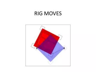

RIG MOVES
E N D
Presentation Transcript
Step 1: Boat Shape Editor • Create your boat shape. • The Boat Origin Reference Point is at the X=0, Y=0 point. • Set 1 or 2 anchor points. • One Anchor Point: SURVEY will determine the final rig position using the Anchor Point and the heading. • Two Anchor Points: SURVEY will determine the final rig position using the two Anchor Points.
Anchor #1 Anchor #2
Step 2: HYPACK HARDWARE • The actual position of the Rig is the ‘Boat’ mobile. • In this case, we are positioning the rig with an RTK GPS with directional antenna, using the GPS.DLL. • The final target position of the Rig is the ‘Rig Site’ mobile. • We will use the BARGE.DLL to set the final target position for the rig.
BARGE.DLL • In the ‘SETUP’ for the BARGE.DLL: • To position the rig using one Anchor Point and a heading, click just the ‘Anchor 1’ box and enter final position and heading (below). • To position the rig using two Anchor Points, click both the Anchor 1 and Anchor 2 boxes and enter the final positions.
Step 3: SURVEY • The final position of the rig will be drawn in Blue. • This is determined based on the information in the BARGE.DLL. • The current position of the rig is currently shown in Red. • We have set the Fill Color for the main ‘Boat’ mobile to red. Your color may be different. • We have also set the transparency for the boat shape so that we can see the final target position (blue) beneath the current position (red). (Done in the Vessels menu.)
Vessel Settings: Current Position Select Primary Vessel: Make Opaque Set Color:
Vessel Settings: Final Position Select Rig Vessel: Set Transparency Set Color:
SURVEY: Barge Info Window • Displays the distance and bearing each Anchor Point needs to move. • Displays the current heading and the required heading.
Barge Management in HYPACK • The main Barge wants to see Tug1, Tug2, Tug3 and Tug4. • Tug1 wants to see the Barge, Tug2, Tug3 and Tug4. • Etc., etc., etc.
Hardware Requirements: • Main Barge: • GPS with Directional Antenna. • Wireless router with omni-directional antenna • Computer with HYPACK SURVEY capability. • Tugs • GPS with Directional Antenna. • Notebook Computer with HYPACK SURVEY and WiFi capability. • Network Setup: • Each computer needs a Static IP address on a common sub-net. • See the example below for sample settings. Vessel IP Address Subnet Main Barge (Boat): 192.168.5.101 255.255.255.0 Tug 1: 192.168.5.102 255.255.255.0 Tug 2: 192.168.5.103 255.255.255.0 Tug 3: 192.168.5.104 255.255.255.0 Tug4: 192.168.5.105 255.255.255.0
Setting a Static IP Address • Open the Network and Sharing Center and click on your Wireless Network Connection. The window on the left will appear. • Click the ‘Properties’ button. The window in the center will appear. • Click on ‘Internet Protocol Version 4 (TCP/Pv4) and then ‘Properties’. The window on the right will appear. • Enter the appropriate IP address and subnet address for the computer.
HYPACK HARDWARE • Create a separate mobile for each vessel. The vessel set-up on the Barge is shown to the right. • On each vessel: • Use the GPS.DLL to determine your position and heading. • Use the NMEAOUTPUT.DLL to output your position and heading to the other vessels. • To see the other vessels: • Use the GPS.DLL to read their position and heading. Vessel Set-Up on Barge Vessel Set-Up on Tug 1
Configuring the NMEAOUTPUT.DLL NMEAOUTPUT.DLL Type Client/Server Read/Write Port Barge (Boat) UDP Server 9101 Tug2 UDP Server 9102 Tug3 UDP Server 9103 Tug4 UDP Server 9104 Tug5 UDP Server 9105 • On each vessel, we will configure the NMEAOUTPUT.DLL to broadcast its position and heading data using a UDP connection. • Each vessel will use a separate Read/Write Port value.
Configure the NMEAOUTPUT.DLL • Settings Window: Output GGA & HDT.
Configure the NMEAOUTPUT.DLL • Set the update rate at 1Hz.
Reading the Broadcast from Each Vessel We are just reading the Position and Heading data from each vessel’s broadcast. On the Barge, we will use the GPS.DLL to read the position data from Tug 1 We’ll specify a Network connect, using UDP protocol and acting as a Server. Set the Read Port and Write port to the proper value for the vessel.
Future Changes • We will be modifying the routine to put a big red ‘X’ over a vessel that has not received an update within a specified time. • We will be modifying the routine in order to transmit anchor positions to each vessel.