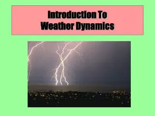
Understanding Earth’s Climate and Weather Dynamics
This chapter delves into the Earth's unique axial tilt, rotation, and elliptical revolution around the sun, which influence global weather and climate patterns. It distinguishes between weather—daily atmospheric conditions—and climate—long-term averages. Key geography concepts such as latitude, longitude, and significant circles like the Tropics and Arctic Circle are outlined. The chapter also explores the Earth's energy balance sourced from solar radiation, detailing methods of energy transfer like conduction, convection, and radiation, as well as how energy is reflected and absorbed by different surfaces.

Understanding Earth’s Climate and Weather Dynamics
E N D
Presentation Transcript
The Earth: • The earth is tilted on a rotating axis by 23.5o (the axis is a line from N to S pole). • Earth revolves around the sun in an elliptical path. • 70% of the earth’s surface is water. 320 million cubic miles. • 30% is land with varying landforms. • Has an atmosphere that contains air, water vapor, particles of dust and chemicals.
Weather and Climate: • Weather – is a set of environmental conditions encountered from day to day. • Eg. A week’s weather in St. John’s in January could be mild, rainy, with a temperature of 2OC • Climate – is a set of environmental conditions averaged over many years. • Eg. The climate in St. John’s in January is cold, snowy, windy, with an average day time temperature of -5 OC (averaged from years of data)
Global Geography: • Longitude – angle measured east or west of line zero that passes through Greenwich, England. (Cape Breton Island is 60O West longitude) • Latitude – angle measured north or south of the equator. Canada/US border lies along the 49O north latitude.
Northern hemisphere • Tropic of Cancer – 23.5O N latitude is the most northerly latitude reached by the sun’s vertical rays. It is reached on the first day of summer in the Northern hemisphere, approx. June 21st. • Arctic Circle – 66.5O N latitude. Most northerly latitude reached by the sun’s rays on the first day of winter in the Northern hemisphere, approx. December 21st.
Southern Hemisphere • Tropic of Capricorn is the most southerly latitude reached by the sun’s vertical rays. It is reached on the first day of summer in the Southern hemisphere, approx. December 21st. • Antarctic Circle – 66.5O S latitude. Most southerly latitude reached by the sun’s rays on the first day of winter in the Southern hemisphere, approx. June 21st.
World Regions • The Tropics -between the Tropic of Cancer and Capricorn. • Polar Regions - north and south of the Arctic and Antarctic Circles. • Mid-Latitudes - between the Tropics and the Polar Regions.
Earth’s Energy Balance • Almost all the energy necessary to sustain life and influence weather comes from the sun. Without this energy life could not exist. • Some of this energy is used by plants to grow and plants are the basic energy source for all life on earth.
Energy Balance • This incoming energy is equally balanced by energy leaving earth and going out into space. • This energy balance keeps the average surface temperature of the earth at about 15OC, which is high enough to allow for the wide diversity of living creatures on earth.
Energy transfer and Radiation • Energy transfer can occur in any of 4 different ways. They are all involved in the earth’s weather. • This is the transfer of energy by waves. • This is the only type that does not require a medium like air or water to carry the waves.
Electromagnetic Spectrum • They can travel through space therefore this is the method by which the sun’s energy reaches us here on earth. • There are many forms of radiant energy that reaches us (note the electromagnetic spectrum in the text p. 504). Eg. Visible light, microwaves, infra-red, ultraviolet, X-rays
Conduction and convection • Conduction: Conduction is the transfer of energy through the collision of particles in a solid It occurs most easily through metals but to a lesser extent in other substances. Eg rock, soil, water • Convection: Transfer of energy in a liquid. This liquid could be either a gas or water. The energy in convection is transferred vertically.
Advection • Advection: Transfer of energy in a liquid. This liquid could be either a gas or water. The energy in advection is transferred horizontally • All of these methods are important in understanding how weather systems operate and it is through these methods of energy transfer that help maintain the earth’s energy balance and distribute energy around the world.
Reflection and Absorption of Energy: • What happens to the radiant energy from the sun that reaches the earth? Fig. 4, p. 506 • 27% is reflected by clouds and never reaches the earth’s surface. • 3% is reflected off the earth’s surface back into space. • The land and oceans absorb 50% of the sun’s energy. • The clouds absorb 20% of this energy.
Continued • Much of the energy that reaches the earth is reflected back and some is absorbed. How much is reflected back depends on the albedo of the material the radiant energy hits. (albedo– ability to reflect radiant energy). Eg. White snow – high albedo, Black soil – low albedo • Objects that absorb energy and become warmer are known as heat sinks. Some materials are better than others. • Example – water is better than land at absorbing, and retaining heat energy.
Heat Capacity • How good a heat sink a substance is depends largely on its heat capacity. • Heat capacity – a measure of how much heat energy it must absorb to increase its temperature or how much energy it lost when it decreases in temperature. Fig. 5, p. 506
Heat Sinks • Soil and rock are poor heat sinks – low heat capacity • Water is a good heat sink – high heat capacity because it can hold a lot more heat. Because of this large bodies of water greatly affect weather and climate.
Seasons. • Seasons and the Angle of Sunlight: Our changing seasons and the resulting weather changes depend upon the Earth’s revolution around the sun combined with the tilt of the earth’s axis. Fig. 1, p. 508 • Summer Solstice: Occurs around June 21 and it occurs when the northern hemisphere has summer and it is winter in the southern hemisphere. The earth is tilted towards the sun. The Sun is over the Tropic of Cancer. The longest day of the year in the northern hemisphere.
Winter Solstice • Winter Solstice: Occurs around December 21 and it is winter in the northern hemisphere and it is summer in the southern hemisphere. The earth is tilted away from the sun. The sun is over the Tropic of Capricorn. The shortest day of the year in the northern hemisphere. • Vernal Equinox: Occurs around March 21 and it is spring in the northern hemisphere Sun hits the earth at the equator. Equal length day and night.
Autumnal Equinox • Occurs around September 21 and it is fall in the northern hemisphere Sun hits the earth at the equator. Equal length day and night.
Atmosphere • The Atmosphere: the blanket of air and moisture that surrounds the earth. • The atmosphere’s composition • 78% Nitrogen • 21% Oxygen. • 1% are other gases • (Carbon Dioxide, Argon, Neon, Helium, Krypton, Hydrogen, and Ozone. • Air also contains water vapour which can be as high as 3% at sealevel. • The atmosphere has a number of layers each with its own properties. As the altitude (distance above sea-level) increases we move into these different layers • It is most dense at sea level because of the pressure of pushes the molecules closer together.
The Troposphere: • Layer closest to the earth’s surface it extends to an altitude of about 16 km at the equator and about 8 km at the poles The atmosphere is thicker at the equator than at the poles due to the warmer temperatures which causes the are to expand and to the spinning of the earth on itsaxis. The temperature is from 15oC at the surface to -50oC at the top. • It contains most of the atmosphere’s moisture and is responsible for our weather patterns.
The Tropopause • This is a very thin layer that separates the troposphere from the stratosphere. Here the temperature increases rather than decreases due to the amount of ozone, which absorbs more ultraviolet radiation and therefore increase the temperature. • This increased temperature in the Tropopause is important because the higher this temperature the more separation there is between the troposphere and the next layer.
The Stratosphere: • This layer contains very little moisture and extends for some 50 Km. It exists from about 12 Km to 50 Km. It contains more Ozonethan any other layer. • Ozone is the gas which absorbs most of the ultraviolet radiation from the sun and prevents it from reaching the earth’s surface where it can cause great damage to living creatures. • The temperature in the stratosphere increases rather than decreases to a value of approx. 10 degrees C.
The Mesosphere: • This is the middle layer (meso – means middle) of the earth’s atmosphere. Concentration of this layer is similar to the others with the exception of a lack of ozone and water vapor. • The temperature in the mesosphere is very cold reaching as low as -75 degrees C. The density of the gases at this level is very low, and this layer extends from about 50 to 80 km.
The Thermosphere: • As its name implies the temperature in the thermosphere is much higher. Its average temperature is around 30 degrees C. This increased temperature is due to the fact that this layer absorbs x-rays (the highest energy electromagnetic radiation). • It is also called the ionosphere because the radiation from the sun causes the molecules to become ionized. This produces the auroras, the northern lights and southern lights. This layer extends from 80 to 500 km.
Exosphere: • Very thin outer layer where there is almost no atmosphere at all. The most common element in this layer is hydrogen. The temperature is cold and it can be called outer space. • Notice that in each layer the temperature will either increase or decrease. The change in temperature over a distance is known as a temperature gradient. • Eg. The temperature gradient for the troposphere is about -6 oC for every 1000 metres.
Supporting Life on earth • The atmosphere makes life possible because: • Oxygen and Nitrogen in the atmosphere are needed to support life. • Carbon Dioxide is needed for green plants. Ozone (in the upper atmosphere) absorbs UV radiation which prevents the burning of plants and animals. • It plays an important role in the water cycle – all organisms require clean water. • It protects the earth’s surface from meteors, most will burn up as they enter the atmosphere. • It regulates temperature by keeping the average temperature within a life supporting range because water vapor and gases like carbon dioxide trap energy during the day and release it slowly during the night. • The air circulates around the globe and helps maintain a fairly constant balance.
Atmospheric Pressure: • - is the pressure the air exerts as gravity pulls it towards the center of the earth. • It is greatest at sea level since the height, and therefore weight, of the atmosphere is greatest. As altitude increases, for example climbing up a mountain, the height of the atmosphere decreases, which means the weight of the air above is less and pressure is less. • Other factors which affect atmospheric pressure is whether the air is rising or falling. Rising air has less pressure than falling air.
Aneroid Barometer • Atmospheric pressure or barometric pressure is measured with a Barometer - an instrument that detects the changes in the atmospheric pressure. • The most common type of barometer is called an aneroid barometer - a sealed chamber with flexible sides (or an aneroid cell) connected to a scale. The term aneroid refers to the fact that it does not use water to help determine pressure. It is sensitive to changes in the atmospheric pressure. Fig. 5, p. 512
Atmospheric Pressure • Pressure is measured in KPa (Kilopascals) • Standard Atmospheric Pressure is the normal atmospheric pressure at sea-level. It is assigned a value of 101.3kPa. • Low Pressure weather systems have atmospheric pressures less than 101.3kPa. • High Pressure weather systems have atmospheric pressures greater than 101.3kPa. • Pressure Gradient - A measure of the amount the atmospheric pressure changes across a set distance.
Prevailing Wind Patterns: • The winds are one of the most important features when discussing weather. • Wind - the movement of air in the atmosphere. • Some winds are local while others are prevailing. • Local winds – occur in a fairly small region. • Prevailing winds – affect large areas of the earth.
Corolis Effect • In any rotating system anything that moves long distances appear to change direction. http://www.youtube.com/watch?v=mcPs_OdQOYU
Prevailing Winds • Points on the earth at different latitudes to be moving west to east at different speeds. • A person standing on the equator, where the earth’s circumference is 40000km, is traveling west to east at approximately 1700km/h • A person at 60o north latitude, where the earth’s circumference is only 20000km, is traveling west to east at only approximately 850km/h. • The earth’s rotation underneath its own atmosphere causes a Coriolis Effect in the atmosphere resulting in special wind directions in the northern and southern hemispheres.
Prevailing Winds • In the northern hemisphere, The Coriolis effect causes winds to twist to the right of the direction of flow. • In the southern hemisphere, The Coriolis effect causes winds to twist to the left of the direction of flow. Causes of Prevailing Winds: • There are combinations of things that cause prevailing winds. They are: • Convection currents set up in the atmosphere • Earth’s west to east rotation
Jet Streams • Jet streams occur about 7000m up in the troposphere. There are 2 in the northern hemisphere and 2 in the southern hemisphere that stretch all the way around the earth. • The atmosphere is thicker at the equator than at the poles. At the equator, where the troposphere is about 14000m thick, at an altitude of 7000m there is still another 7000m of atmosphere above this point therefore the atmospheric pressure is relatively high. • However at 30o north latitude, where the troposphere is only 12000m thick, there is only 5000m of atmosphere above the 7000m altitude which results in lower atmospheric pressure.
Effects of Prevailing Winds: • They help to distribute large amounts of energy around the globe. For example in the northern hemisphere warm air flows north carrying energy and colder air flows south. • They also carry moisture that helps to distribute a variety of precipitation types around the world. Remember – rising air is warm and moist while falling air is cool and dry
At The Equator • Near the equator, where two sets of convection currents meet (from north and south hemispheres) and rise weather tends to be cloudy and rainy. • At about 300 N latitude the falling air is very dry and we get desert conditions. • At 600 N latitude, two air systems meet and rise and again this produces more rain and cloudy conditions.
At The Polar Regions • In the Polar Regions the air pressure is greater and the air colder and more dense. This produces faster falling air, higher pressure systems, and the great temperature differences between these polar regions and regions further south. This results in very large pressure gradients and stronger winds. Also the Polar Regions have much less precipitation than expected.
The Hydrosphere • The hydrosphere - all the water that exists on the planet. It includes water in the oceans, lakes, rivers, underground, trapped in glaciers, and in the atmosphere. It covers 70% of the earth’s surface. 320 million cubic miles.
Water Distribution • 95.5% of the earth’s water is salt water contained in the oceans. • Of the remaining 4.5% is fresh water and is distributed as follows: • Glaciers and polar ice caps 87.3% • Underground water 12.3% • Surface and atmospheric water 0.4%. • This supply is further divided as follows: • Lakes 90%Atmosphere 9%Rivers 1%