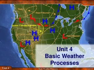
Unit 4 Weather Dynamics
Unit 4 Weather Dynamics. Chapter 13 & 14. Global Weather Dynamics. Weather dynamics is the study of how the motion of water and air causes weather patterns. Energy from the Sun drives the motion of clouds, air, and water.


Unit 4 Weather Dynamics
E N D
Presentation Transcript
Unit 4 Weather Dynamics Chapter 13 & 14.
Global Weather Dynamics Weather dynamics is the study of how the motion of water and air causes weather patterns. Energy from the Sun drives the motion of clouds, air, and water. A globe is tilted to represent Earth’s tilt at an angle of 23.5 degrees to the plane of its orbit around the Sun. The major components of Earth that influence weather are the atmosphere, the land forms, and water in its solid, liquid and vapour forms. About 70% of Earth’s surface is covered by oceans.
The atmosphere above the oceans and continents contains air, water vapour, and particles of dust and chemicals, all of which affect weather, especially when the atmosphere is in motion.
Weather and Climate Weather is the set of environmental conditions encountered from day to day. Climate is the set of environmental conditions averaged over many years. A city may have a January climate that is cold, but you could have a week of mild weather. Weather-1206-GF-Ch13
Global Geography Longitude is the angle measured east or west from the 0 degree line which passes through Greenwich, England. The eastern tip of Cape Breton Island is at 60 degrees west longitude. Latitude is the angle measured north or south of the equator. The border between the US and our western Canadian provinces is along the 49 degree north latitude line. Weather-1206-GF-Ch13
The Tropic of Cancer is at 23.5 degrees north latitude. It is the most northerly location reached by the Sun’s vertical rays on the first day of summer, June 21, each year. The Arctic Circle is at 66.5 degrees north latitude. It is the most northerly location reached by any of the Sun’s rays on the first day of winter, December 21. In the southern hemisphere we have the Tropic of Capricorn and the Antarctic Circle. The region between the Tropic of Cancer and the Tropic of Capricorn is referred to as the tropics. Polar regions occur north of the Arctic Circle, and south of the Antarctic Circle. Most of Canada’s population lives in the mid-latitude region. Weather-1206-GF-Ch13
Earth’s Energy Balance Section 13.2
Earth’s Energy Balance Almost all of the energy used on Earth to sustain life and cause our changing weather systems comes from the Sun. Different types of EM energy are emitted from the Sun. Without this energy plants would not grow, and the land water and air would not be warm enough for people to survive. The average surface temperature is 15 degrees C. Energy can be transferred from one place to another by 4 methods: Radiation Conduction Convection Advection Weather-1206-GF-Ch13
Radiation is the transfer of energy by means of waves. Unlike water and sound waves, radiation does not need a medium. The waves can travel from the Sun, through space, and reach Earth. Visible light is an example of energy that can travel through space. Other examples are: Radio waves Microwaves X-rays Gamma rays Infrared rays These travel at 300,000 km/s in a vacuum.
The set of waves that can travel through empty space at the speed of light is called the electromagnetic spectrum.
The other methods of energy transfer require particles of matter. Conduction is the transfer of energy through the collision of particles. Conduction occurs most easily in metals , but also to a smaller extent in rock, sand soil and water.
Convection and advection are the transfer of energy by the movement of particles in a fluid. A fluid is either a liquid (water) or a gas(atmosphere). Convection transfers energy vertically . Advection transfers energy horizontally. Weather systems involve convection and advection.
Reflection and Absorption of Energy When the EM waves from the Sun reach Earth, some is reflected off the atmosphere and clouds back into space; some pass through the atmosphere and bounce off Earth’s surface; some get absorbed by the atmosphere, the ground, or the water at the surface.
For earth materials, the portion of energy reflected depends on the albedo of the material. Clean snow has a high albedo, it reflects a lot of incoming energy. Black soil has a low albedo, it absorbs more energy than it reflects. Any object or material that absorbs energy and becomes warmer is called a heat sink. Even though water has a higher albedo than land and soil, the oceans are good heat sinks. When solar energy hits water , the water begins to move(convection), and transfer energy deep into the oceans. Soil and rock are poor heat sinks. Heat is conducted slowly into these materials.
An important property of all substances is their heat capacity, which is the measure of how much heat a substance requires to increase its temperature or how much heat it releases as its temperature decreases. Water has a high heat capacity. This means it can hold a lot of heat.
The Atmosphere Section 13.4
Atmosphere • The thin layer of gases that surround the earth is the atmosphere. • The atmosphere is where all the weather happens. • The atmosphere acts like a blanket which controls the temperature of the earth.
Earth’s atmosphere: • The earth's atmosphere is made up of dust and a mixture of invisible gases. Some of these gases include: • Nitrogen (N2) 78% • Oxygen (O2) 21% • Other gases: 1% combined [water vapour, argon, carbon dioxide, neon, helium, krypton, hydrogen, ozone...]
Some of these gases have very important roles in the atmosphere. • Nitrogen and ozone act as a protection shield that blocks out harmful radiation from space. • Oxygen is essential for life. Plants produce oxygen and we breathe it in. • Carbon dioxide is essential for life too. We breathe out carbon dioxide and plants breathe it in.
Water vapour is essential to the water cycle and weather patterns. • Water vapour is responsible for clouds, fog, rain and snow. • Note: Even though there is not much water vapour in the atmosphere it has the greatest effect on the weather.
Layers of the Atmosphere • The atmosphere can be divided up into distinctive layers. The farther we travel from the earth the thinner the atmosphere gets. • Exosphere • Thermosphere • Mesosphere • Stratosphere • Tropopause • Troposphere
Troposphere • The atmospheric layer closest to Earth’s surface • Up to 16 km at equator, 8 km at the poles • Contains most of the atmosphere’s moisture • Responsible for most of our weather • Tropopause • Troposphere ends in this thin boundary • Temperature no longer decreases with increasing altitude • Temperature rises here, contains ozone which absorbs UV from the Sun • Higher temperature here helps divide troposphere from stratosphere
Stratosphere • Dry layer • From 12 to 50 km • Highest ozone levels • Protects Earth from harmful UV • Temperature increases with altitude O3 • Mesosphere • Temperatures are low (-75oC) • Density of gases is low • 50 km to 80 km
Thermosphere • Low density • Molecules have higher energy • Higher temperatures than mesosphere • Temperatures up to 30oC • X-rays absorbed, causing high temps • 80 km to 500 km • Sometimes called ionosphere • Particles charged and produce auroras
Exosphere • Outermost layer • Can be called space • Few particles, mainly hydrogen Note that the temperature of the atmosphere is different at different altitudes. Change in temperature over a distance is called a temperature gradient. The temperature gradient of the troposphere is -6 oC per 1000 meters.
Atmospheric Pressure Atmospheric pressure is the pressure the air exerts as gravity pulls it toward the center of Earth. It is greatest at sea level, where the molecules are closet together. At higher altitudes atmospheric pressure decreases. Atmospheric pressure at a particular altitude depends on whether the air is rising or falling. There are two variations to consider : vertical and horizontal. Pressure gradient is a measure of the amount the atmospheric pressure changes across a set distance. Pressure gradients can be vertical or horizontal.
Atmospheric pressure decreases rapidly as the altitude increases. Mountain climbers and air travellers know about atmospheric pressure. Weather maps show lines of constant pressure. The gradient is greatest where the lines are closest together. High and low pressure systems are identified on these maps.
The most common instrument used to measure atmospheric pressure is the aneroid barometer. The word aneroid means without liquid. This instrument consists of an enclosed container with thin metal walls that are sensitive to pressure changes. A needle attached to the container indicates the pressure. (air pressure drops and the container expands) An aneroid barometer uses a small, flexible metal box called an aneroid cell. This aneroid capsule (cell) is made from an alloy of beryllium and copper.
A barometer is commonly used for weather prediction, as high air pressure in a region indicates fair weather while lowpressure indicates that storms are more likely. If the barometer is falling then deteriorating weather or some form of precipitation will fall, however if the barometer is rising then there will be nice weather or no precipitation.
Atmospheric Pressure Recap • Gravity pulls down on all matter. • Gases are matter and gravity pulls down on them. • This is why the troposphere (layer closest to the earth) has 99% of all the gases in the atmosphere.
The atmosphere is made up of areas of different densities. • In some areas the air is compacted very tightly (dense) and is very heavy causing a high pressure area. • Other areas the air is not compacted much at all and the air is very light (less dense) creating a low pressure area.
The air at high altitudes is much thinner (less dense) creating low pressure and cooler temperatures.
Prevailing Wind Patterns Section 13.6
Early 1800s • Sailors discovered that in certain areas the winds tend to blow in the same directions most of the time. • They found that if they sailed south close to the equator the winds would blow to the west (from the east). • As they traveled further north they found that the winds would blow most often to the east (from the west). • This regular pattern of winds is known as prevailing winds.
A wind is a movement of air in the atmosphere. Major wind patterns cover large areas and are called prevailing winds. These winds affect weather around the world.
Prevailing Winds • Winds that affect large areas in regular patterns. • Blowing to the east they called the Northeast trade winds. • The winds blowing from the west (taking them back home) were called the mid-latitude Westerlies(prevailing Westerlies).
Heat and Spin Heat • As the sun heats the air over the equator strong convection currents form. • The hot air rises up and air rushes in from the north and south creating winds toward the equator. • This huge convection current billows out and the air begins to cool and fall down around 30o latitude.
As the air falls some of it returns to the equator but some is deflected northward. • This north flowing air is once again heated and rises up at about 60o latitude. • This rising air then flows to the north pole where it cools and drops flowing back to the 60o latitude. • We now have three convection currents set-up with air flowing in opposite directions at the surface of the earth.
Spin • The earth rotates east to west. • As the earth spins it deflects the wind. • Winds blowing north get deflected to the right. • Winds blowing south get deflected to the left. • The deflection of the wind caused by the earth's rotation is called the Coriolis effect.
The Coriolis Effect Earth’s rotation causes anything that moves long distances, such as prevailing winds, to appear to change direction. This apparent change of direction of a moving object in a rotating system is called the Coriolis effect. Viewed above the North pole, Earth rotates eastward or counter clockwise. Objects in the Northern hemisphere appear to move to the right. In the Southern hemisphere moving objects appear to move to the left. From some point in the northern hemisphere, fire a rocket at a target south of your position. Because the Earth is rotating the target moves and the rocket will miss its target.
Early explorers like Columbus used trade winds to cross the Atlantic Ocean.
Prevailing winds are caused by a combination of convection currents and Earth’s eastward rotation. • In the Northern hemisphere.... • Solar energy strikes the equator, heating the air, land, water • This warmed air becomes the equatorial convection current • The warm air rises and expands, leaving a low pressure area • Rising air reaches the troposphere, moving northward • At 30 degrees latitude the cooled air sinks, creating high pressure • Air moves from high to low pressure areas at the equator • The moving air is twisted right as it moves south (Northeast Trade Winds)
In the Northern hemisphere..... At 30 degrees latitude some descending air from the equatorial convection current is deflected northward, to an area of low pressure at 60 degrees latitude. This low pressure area is formed by the mid-latitude convection current. The surface air moving northward to the low pressure area twists to the right causing the mid-latitude westerlies.
At the North Pole the air is cold and dense, so it sinks, creating a high pressure region at the surface. This surface air moves south, twisting to the right and creating the polar easterlies.
Jetstream (Overview) • A narrow band of spinning air is created in the places where these convection currents rise and fall. • The spinning causes the air to speed up creating a tube of fast moving air known as a jet stream. • The winds of the jet stream travel from west to east and can reach speeds of up to roughly 500 km/h.
Aircraft use this to their advantage when flying form west to east. • pick up to a 500 km/h tail wind which saves time and fuel. • Going from east to west pilots try to avoid the jet streams. • Jet streams go right around the globe and generally steer major weather systems.