Download
1 / 23
230 likes | 315 Views
Explore how GIS technology is revolutionizing fishing in South Louisiana, leveraging data to pinpoint prime fishing spots and improve consistency in catches. Discover the impact of sport fishing and how GPS technology plays a crucial role in data collection and analysis. Uncover the potential of bird colonies as fishing hotspots and the future possibilities of this innovative approach.

E N D
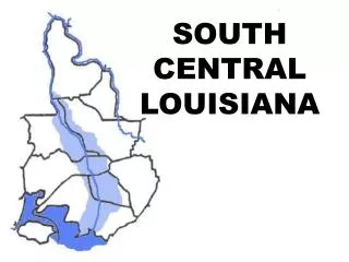
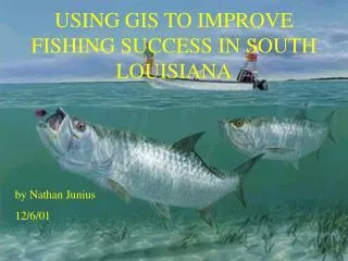
USING GIS TO IMPROVE FISHING SUCCESS IN SOUTH LOUISIANA by Nathan Junius 12/6/01
IMPACT OF SPORT FISHING • Sportsman’s Paradise • 1996 – 1.5 billion dollar impact from gas to camps to bait-Wildlife and Fisheries • Guide services • Tournaments
GENERAL EQUATION CONSISTENCY + LUCK =MORE FISH
GPS-Collecting Data • Handheld or Permanent • 24 Satellites • 7000 mph • Connect to at least 3 satellites • A 4th for altitude
CONVERT COORDINATES TO DECIMAL DEGREES • Degrees and Decimal Minutes to Decimal Degrees
USING EDITOR, FILL IN TABLE • DIFFERENT FIELDS • VERY TEDIOUS
FISHING SPOTS PLOTTED NEW ORLEANS
QUERIES • Spots were I caught 25 or more trout • Can use this for wind types, temperatures, different times of the year…etc
MULTIPLE QUERIES • Now the really cool stuff!! • Set “Day” “Month” and “Year” • View each trip • Look for days with the same current conditions
BIRD COLONIES • Study of bird colonies by LSU • Bird and fish share food source • Fishing technique-fish under birds
KNOWN BIRD SPOT • Breton Island • Great spot to fish under the birds
EXPERIMENT? • Deadman Island • Tried this spot over Thanksgiving…22 trout!!! • Use this to find future spots
CAN THIS IDEAWORK ON A LARGER SCALE??? PROBABLY NOT!!
FUTURE POSSIBILITIES • Eventually complete inputting all data • Use editor to create centerline to help navigate? (GPS gives only straight lines) • Pattern fish through seasons MY VISION • Something like this might replace log books
DATA • Louisiana's Geospatioal Metedata Catalog • http://lagic.lsu.edu/datacatalog/ • Louisiana State University