Download
1 / 21
210 likes | 395 Views
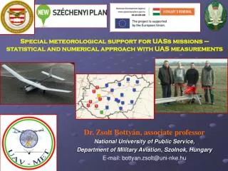
Special meteorological support for UA S s missions – statistical and numerical approach with UAS measurements. Dr. Zsolt Bottyán, associate professor National University of Public Service, Department of Military Aviation , Szolnok, Hungary E-mail: bottyan.zsolt @ uni-nke.hu.

E N D
Special meteorological support for UASs missions – statistical and numerical approach with UAS measurements Dr. Zsolt Bottyán, associate professor National University of Public Service, Department of Military Aviation, Szolnok, Hungary E-mail: bottyan.zsolt@uni-nke.hu
Ars Poetica and Main topics Challenges in the meteo support for UAVs A complex approach of the meteo support Data base and a usable analog statistical prediction method Dynamical weather prediction for UAVs – WRF model About our produts and experimental website Summary „Although meteorology has applications of vast economic importance to a wide variety of human activities the connexion is nowhere so intimate or so vital as with aviation. The element of the aviator is the atmosphere and the study of that element is meteorology; weather science is therefore an essential part, and a large part, of the basic science of aviation.” (Meteorology for Aviators, 1940.) by R. C. SUTCLIFFE
Special challenges in the meteo support for UAVs The mentioned system have to give an adequate meteo support during the planning and the flying phases of the UAV missions, too (decision making); • The operational working during 0-24 hours (always accessible); • Be readily accessible over the large geographical regions as far as possible via internet connection (essentially everywhere). • Be simply installed in the other geographical regions (flexibility); • In the final form will contain a flight path optimization routine based on actual and predicted weather (future plan); Important: thesystemcaneasily be implementedall over theworldbecausetheapplieddata and modelsystemaremainlyopenaccess!!
A complex approach of the meteo support for UAVs IAWPS:Integrated Aviation Weather Prediction System Stat: statistical model unit Dyn: dynamical (numerical) model unit Logical structure of the IAWPS
Data base and a useable analog statistical prediction method METAR Data basefor Hungary (2005 – 2013) contains: • Winddirection, windspeed and gust; • Horizontal and RVR visibility; • Significantweatherinformation; • Amount, type and heigth of clouds (ceiling); • Temperature and dewpointtemperature; • QNH air pressuredata; • NATO colorcode (inthe military airports) Location of four main airports, in Hungary: A: Kecskemét (LHKE); B: Szolnok (LHSN); C: Budapest (LHBP); D: Pápa (LHPA)
Data base and a useable analog statistical prediction method The basic principle of analog forecasting is to find similar weather situations in the past to the actual conditions and rank them according to the degree of their similarity in the interest of giving relevant information for weather forecasts. For a theoretical basis of an operational fuzzy logic-based analog forecasting system, can be found Hansen et al., 2007. Fuzzy-logic based similarity metrics for the important aviaton meteorology parameters
A dynamical weather prediction system: WRF numerical weather prediction • WRF model: open code; meso-scale (non-hydrostatic) numerical model • Initial and boundary conditions:from GFS global model (downscaling to Carpathian-basin area) • Running: twice during one day (00 and 12 UTC) • Resolutions:30 km, 7.5 km and 1.875 km horizontal and 30 vertical layers • Parameterization:optimized mainly for PBL • Post processing:Grads, NCL, VAPOR [3], [4] • Static data base:CORINE: High resolution hungarian land-use and soil data
Stage I. (Strategic): Long-term weather based mission planning for UAVs A case study The presented example demonstrates the optimal periods of the year in Szolnok Airport (LHSN) when the following desired conditions are met: Relative frequencies of ceiling under 300 m and visibility less than 3000 m and daily mean temperature is between 0 and 10 deg. C.
Stage II.(Operational): Short to medium-term weather based mission planning for UAVs The predicted weather situation (left top) for Hungarian main airports applying the NATO color codes by WRF model and the same time measured weather situation (left bottom) by Hungarian Meteorological Service Meteogram of the predicted meteorological parameters for the LHKE airport from 23 February 2013 until 26 February 2013.
Stage II.(Operational): Short to medium-term weather based mission planning for UAVs NS cloudwithhighprob. icing! Predicted low visibilities in the forecasted period! The predicted relative humidity in the lower 3 km of the troposphere for the LHSN airport from 12 UTC, 26 February 2013 until 12 UTC, 02 March 2013. The dark green area represents the Ns clouds (RH higher than 80%)with high icing risk. The predicted visibility values for the LHSN airport in 12 UTC, 11November 2013. The bottom part of the figure is the same one but with a high resolution value axis. The arrow represents the dangerous low visibilities!
Stage II.(Operational): Short to medium-term weather based mission planning for UAVs: the applied main turbulence schemes • Ellrod2 turb. index (TI2): • 2. Colson-Panofskiturb. index (CPI): Km : kinematic diffusion coefficient for heat transfer, Kh : kinematic eddy viscosity. And other schemes such as: frontogenesis equation, Clark CAT Index and Brown Index. The applied Hybrid Turbulence Index is the weighted average of the mentioned five ones.
Stage II.(Operational): Short to medium-term weather based mission planning for UAVs: turbulence produtcs The common predicted ceiling (top) and visibility (bottom) are based on WRF built-in parameterization at the LHKE airport from 12 UTC, 26 February 2013 until 12 UTC, 02 March 2013. Thepredicted turbulence fieldcross sections at D36Bexperimental airfield (left) and the HTI field at 750 m in the lower troposphere from 12 UTC, 12November 2013 until 12 UTC, 16November 2013.
Stage II.(Operational): Short to medium-term weather based mission planning for UAVs The applied icing severity scales : Fovenyi (above) and Mereles (below) -8x(T-Td)>=T Thepredicted icing (left) in the low and middle troposphere at LHPA airport from 12 UTC, 01November 2013 until 12 UTC, 05November 2013. (Now these are experimental products)
Bottyán et. Al.,: Special meteorological support for UAVs missions Stage III.(Operational): Short-term weather based mission planning for UAVs The actual weather was in LHSN airport: METAR LHSN 230615Z 27005MPS 0800 +SN BKN005 OVC017 M02/M03 Q1006 NOSIG= • The visibility was poor with 800 m value and intensive snow was able to observe with low ceiling of 500 feet. • We had determined and applied the 10 most similar cases in an experimental visibility forecasting based on analog situations at Szolnok airport (LHSN). • The predictions created by averaging method (green line) and applying the best analog situation only (blue line). • The differences between the predicted and measured visibilities are smaller than 1000 m in the six hours interval but during the first four hours the same values are smaller than 500 m. • The applied method is able to manage the changes of visibility even if there is a complicated weather situation with low visibilities when the numerical predictions give often poor results.
Complex UAV Measurement System on our UAV • BHE Bonn UAS mountedwithindependentmeteorologicalsystem (easilymountableonanyother platform suchasmulticopters, balloons, etc.): • GPS; IMU; Temperature, Humidity, Pressure, 5Hp sensors. • Central Unit fordatacollection/pre-processing: BeagleBone A6 • single-board-computer : 700 MHz ARM Cortex-A8, Linux OS onmicroSD • card, 256MB DDR2 • Sensors: • 1. ArduIMU V3 • * MPU-6000 • - 3-Axis MEMS gyro • - 3-Axis MEMS accelerometer, • - 9-Axis MotionFusionbytheon-chip Digital MotionProcessor • * HMC5883L, 3-Axis digitalcompass • 2. GPS : uBlox 6 SPK-GPS-GS4O7A, 50 Channel, horizontalposition <2.5m • 3. Pressuresensor : BMP085, range: 300-1100hPa, precision : • 0.03hPa (0.25m) • 4. Temperaturesensor (slow) : TMP102, resolution: 0.0625°C, accuracy • 0.5°C (-25°C to +85°C) • 5. HumiditySensor : HIH-4030, accuracy ±3.5 %RH • 6. ADC : analog-to-digitalconverter ADS1115, 16 bit, 4 channel, 8-860 SPS • 7. Status LEDsforvisualfeedback of thesystem AND…
UAV Measurement Example: 5-hole probe (5HP) sensor system to determine the turbulence • Multi-hole Probe (5-Hp) unit for high precision, 3D-detection of airspeed mounted on the nose of the airframe • 5-hole probe • (pressure sensor ranges: HCLA 02X5EB: 0..2.5mb, HCLA 12X5EU: 0..12.5mb) • static pressure tube • fast thermometer The 5HP sensor system mounted on the nose of our experimental UAV
High Altitude UAS Measurements: Szeged (LHUD) 28.11.2013. The applied 3D flight geometry during the UAS flight Measured (thin lines) and WRF-based predicted (thick lines) temperature, wind and relative humidity profiles in Szeged, 28.11.2013.
Bottyán et. Al.,: Special meteorological support for UAVs missions Summary To summarize our results: The proper, detailed and significant meteorological support is essential during the planning and executing phases of the UAV missions, too. Our meteorological support for the UAV missions is based on the followings parts: •an adequate data base of the main airports which contains the freely accessible METAR data; •the applied statical and dynamical methods can help us to give prognostic information for the UAV pilots and specialists; • the WRF based numerical weather model which can give us high resolution weather prediction over the Carpathian-basin; •the applied post-processing methods which are based on WRF products to predict some dangerous weather phenomena such as low visibility and ceiling, turbulence, wind shear, icing etc.; •a special web site where we can access the adequate meteorological information in some graphical, text and other formats via (mobile) internet connection; • in the future we can give the flight path optimalization based on our predicted weather situation; • we continue the development and testing of our airborne meteorological measurement system.
References: Pearson, D., “Air Force F-35s, Drones May Square Off in Budget Battle,” National Defense, 2012, pp. 28, 29. Wantuch, F., Bottyán, Z., Tuba, Z., Hadobács, K. “Statistical methods and weather based decision making in meteorological support for Unmanned Aerial Vehicles (UAVs)”, IEEE International Conference on Unmanned Aircraft Systems, IEEE Xplore, Atlanta, GA, USA, 2013, pp. 203–207. doi:10.1109/ICUAS.2013.6564691. Bottyán, Z., Wantuch, F., Gyöngyösi, Z., Tuba, Z., Hadobács, K., Kardos, P., Kurunczi, R., “Development of a Complex Meteorological Support System for UAVs”, World Academy of Science Engineering and Technology, Vol. 76, 2013, pp. 1124, 1129. Jacobs, A. J. M., and Maat, N., “Numerical guidance methods for decision support in aviation meteorological forecasting.”, Weather and Forecasting, Vol. 20, 2005, 82, 100. Hansen, B., K., “A Fuzzy Logic–Based Analog Forecasting System for Ceiling and Visibility.”, Weather and Forecasting, Vol. 22, 2007, 1319, 1330. Saaty, T., L., “A scaling method for priorities in hierarchical structures” Journal of Mathematical Psychology, Vol. 15, 1977, 234, 281. Al-Harbi, K., M., "Application of the AHP in project management.", International Journal of Project Management, Vol. 19., 2001, 19, 27. Riordan, D., and Hansen, B., K., “A fuzzy case-based system for weather prediction,” Eng. Int. Syst. 2002, 139, 146. Wang, W., Bruyère, C., Duda, M.G., Dudhia, J., Gill, D., Lin, H-C., Michalakes, J., Rizvi, S. and Zhang, X.: “ARW Version 3 Modeling System User’s Guide”, July 2009, NCAR MMM Tech. Note. Skamarock, W.C., Klemp, J.B., Dudhia, J., Gill, D.O., Barker, D.M., Duda, M.G., Huang, X.-Y., Wang, W., Powers,J.G., “A Description of the Advanced Research WRF Version 3” NCAR/TN–475+STR, , NCAR Techical Note. June 2008. Bottyan, Z., “Estimation of in-flight icing characteristics of UAVs during different meteorological conditions,” Proc. of the 8th International Conference on Intelligent Unmanned Systems (ICIUS 2012), 2012, 418-422. Doswell, I., Charles, A., Davies-Jones, R., and David L., K., "On summary measures of skill in rare event forecasting based on contingency tables.", Weather and Forecasting Vol. 5.,1990, 576, 585. Murphy, A., H., "Climatology, persistence, and their linear combination as standards of reference in skill scores.", Weather and Forecasting Vol. 7, 1992, 692, 698. Gyöngyösi, Z., Kardos, P., Kurunczi, R., Bottyán, Z., “Development of a complex dynamical modeling system for the meteorological support of unmanned aerial operation in Hungary”, IEEE International Conference on Unmanned Aircraft Systems, IEEE Xplore, Atlanta, GA, USA, 2013, pp. 8–16. doi:10.1109/ICUAS.2013.6564668. USC Conference 2013, 12-14 November 2013, Vancouver
This work was supported by the European Social Fund (TÁMOP-4.2.1.B-11/2/KMR-2011-0001, Critical Infrastructure Protection Research) Thank you for your attention! Critical Infrastructure Protection Research TÁMOP-4.2.1.B-11/2/KMR-2011-0001