Download
1 / 8
80 likes | 196 Views
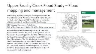
This presentation by the California Department of Water Resources outlines the status of flood management programs, focusing on SB 1278 mapping. The maps provide insights into estimated water surface elevations and include a composite map of identified breaches, although they do not account for local flooding sources. Future modeling of the Yolo Bypass and regional planning initiatives are discussed, as well as pertinent reports from the US Corps of Engineers. For further details, contact Paul A. Marshall, Assistant Division Chief at the Department of Water Resources.

E N D
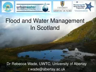
Flood Management ProgramsStatus and Interactions June 13, 2013 Presented by: California Department of Water Resources
State Plan of Flood Control Facilities • Maps show estimated water surface elevations • Composited Map of Several Breaches • Will not show flooding from local sources What the SB 1278 Mapping Will Show DRAFT
Future Modeling of the Yolo Bypass • Regional Planning Elements • Sacramento and West Sacramento US Corps of Engineer reports • Special Studies to Refine Planning
Questions? Paul A. Marshall, Assistant Division Chief Division Of Flood Management Department of Water Resources Paul.Marshall@water.ca.gov (916) 715-1848