Download
1 / 9
90 likes | 241 Views
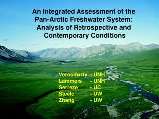
An Integrated Assessment of the Pan-Arctic Freshwater System: Analysis of Retrospective and Contemporary Conditions. Vorosmarty - UNH Lammers - UNH Serreze - UC Steele - UW Zhang - UW. Arctic-RIMS: A R egional, I ntegrated M onitoring S ystem for Pan-Arctic Water Cycle Studies.

E N D
An Integrated Assessment of the Pan-Arctic Freshwater System: Analysis of Retrospective and Contemporary Conditions Vorosmarty - UNH Lammers - UNH Serreze - UC Steele - UW Zhang - UW
Arctic-RIMS: A Regional, Integrated Monitoring System for Pan-Arctic Water Cycle Studies GOALS • Characterize Variability in Land-Atmosphere Water System (from 1960-) • Assess Response of Ocean • Identify Sources of Change • Develop Real-Time D Detection System for Pan-Arctic Water Cycle Collaboration of UNH, CU, UW, JPL, SHI, AARI, Ohio St., UDel
Framework for the Enhanced ArcticRIMS Data and Model Integration System “Tracking the Water” RIMS Schematic Tracking the water - Atmosphere, ocean and land - interdisciplinary - multiple data sets - real-time estimates - some redundancy
E-RIMS FRAMEWORK FOR COUPLED PAN-ARCTIC LAND-OCEAN-ATMOSPHIRE STUDIES E-RIMS - enhanced effort - Ability to link land and ocean processes - increase conversations between scientists - Temperature data Domain of the E-RIMS, with some key data sets and proposed products. Runoff contributed from the pan-Arctic land mass is mapped together with variability in the Arctic Ocean. Note plumes of low salinity water associated with inflow through Bering Strait and large river basins of Eurasia and N. America. These anomalies will be analyzed and tracked to "source areas" within the linked atmosphere, land, ice, and ocean system. Gridded fields, basin-specific and pan-Arctic aggregations are planned as operational products. River temperature (lower right) from Russia is one of several new data sets to be incorporated into E-RIMS, in this case supplying an important boundary condition to the ocean model that estimates outflow through the Fram Strait (lower left). A real-time component, expanding our existing hydrographic and NWP archive (top right), is proposed. Through analysis of historical time series, contemporary changes to the Arctic water cycle are placed into broader context. Location of RIMS historical and operational hydrographic stations are shown. R-ArcticNET ArcticRIMS River Discharge Source data: Mark Serreze (CU), Mike Steele (UW), UNH, and government agencies from around the pan-Arctic
E-RIMS DATA SYSTEM • Coordinated Geospatial Data Sets • On-screen Roving • Data Mining Tool • Multi-Dimensional Queries • Archival, Real-Time Station Data and Gridded Fields • Web-based w/ On-line Data Downloads
E-RIMS REAL-TIME • HYDROGRAPHS • Collaboration of several agencies • Mouth of river emphasized for • land-ocean flux studies • • Provisional data w/ reanalysis
RIMS Real-Time Gauges Real-Time River Discharge Monitoring - Real-Time data - monitoring (first look at hydro cycle) - source of comparison for near-real time models
Russian Data Flow to the Arctic and Antarctic Research Institute (AARI) Russian Data Flow - data collected and passed on to regional Roshydromet offices - FAX, email or teletype to AARI - AARI then does data harmonizing QC data, winter corrections and puts data on web - UNH scoops it and harmonizes with RIMS
• Critical but Uncertain Pathway: Atmospheric • Net Convergence on Land Dominates • Budget Closure Disparity Large -- Land 1700 km3 y-1 -- Ocean 2800 km3 y-1