Download
1 / 15
150 likes | 212 Views
Learn the basics of ArcGIS, including how to locate and run the program, navigate the three ArcGIS interfaces, and work with GIS data. Discover the data available on campus and online, and explore helpful resources like the Davis Library and online tutorials.

E N D
Goals • Become familiar with ArcGIS • Locating and running the program • Introduction to the 3 ArcGIS interfaces • Experience with some of the basic tools in each interface • Become familiar with GIS data • Data available on campus • Data available on the web • Introduce help resources • Davis Library • Other on campus resources • On-line resources
Agenda • ArcGIS: What is a GIS? • ArcCatalog • ArcCatalogExercise • ArcMap • ArcMap Exercise • ArcToolbox • ArcToolboxDemo
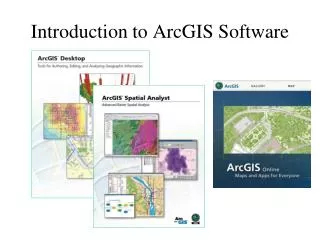
ArcGIS • GIS is the combination of tabular data with a geographic representation • ESRI’s Premiere GIS software • A scalable GIS system which includes ArcView, ArcEditor, and ArcInfo • Provides a wide range of GIS tools for needs which range from Desktop mapping to Geostatistical Analysis
ArcGIS has a 3 part interface • ArcCatalog • Navigating spatial data • ArcMap • Creating presentation graphics • ArcToolbox • Powerful geoprocessing tools
Data for ArcGIS • Vector Data • ArcView shapefiles • ArcInfo coverages • Geodatase • CAD drawing • Raster Data • Most common imagery formats can be read • ArcInfoGRIDs, MRSID
ArcCatalog • ArcCatalog is similar to the Windows “explorer”, or the “My Computer” icon on your windows desktop. It is a tool for navigating through your GIS datasets. The benefit of using ArcCatalog is that it has been specially designed for use with spatial data.
ArcCatalog: Previews • Using ArcCatalog you can easily preview both your spatial datasets, and the attribute data associated with them • ENVR 468 short course 1 for example.
ArcCatalog: Spatial Search • Within ArcCatalog you can easily search for data based on location and attributes stored in its metadata
ArcCatalog: Data Management • ArcCatalog is provides an environment to cut and paste spatial data into new directories and geodatabases. Additionally, several common conversion routines are available from ArcCatalog.
ArcCatalog: Metadata (exercise 1) • ArcCatalog includes tools for viewing and editing Metadata.
ArcMap • ArcMap is like a virtual drafting table. It contains a canvas where GIS data layers are drawn, and a Table of Contents (TOC) which helps keep track of the data in the canvas. For desktop mapping, this is the interface which you will spend most of your time. The canvas can be viewed in two states: data view and layout view. • There are several toolbars available in ArcMap. The standard toolbar contains basic file management tools. The tools toolbar contains simple navigation, identification, and selection tools. The draw toolbar is a basic windows style drawing toolbar. There are several other special need toolbars available from the View menu. Among other things, there is an edit toolbar and there are special toolbars for extensions available. • In addition to the toolbars, there are several menus available in ArcMap. The menus contain some of the commonly used items from the toolbars as well as a few common functions from ArcCatalog and ArcToolbox.
ArcMap: Map View Menu bar Standard Toolbar Tools Toolbar Table of Contents Canvas
Saving your work in ArcGIS (exercise 2) • Map Documents (.mxd) • Saves your progress in ArcMap. Does not save GIS data, just references its location on disk. • Layer Files (.lyr) • Saves symbology and other display properties for a data source. Again, the data source itself is not copied, but instead referenced by the layer file • Map Templaces (.mxt) • If you are going to create several maps with a similar layout, the template can be a time-saving tool.
ArcToolbox • For heavy duty processing, ArcToolbox contains analysis, conversion, and data management tools. One can construct custom tools. You may set up most tools using wizards to better understand otherwise complicated options.