AQUATIC BIOMES
270 likes | 499 Views
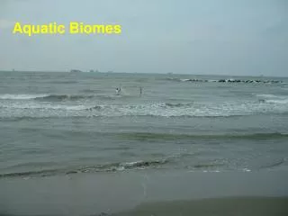
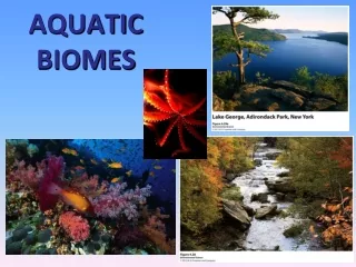
Aquatic biomes, covering nearly 75% of Earth’s surface, are diverse ecosystems shaped by abiotic factors such as salinity, flow, temperature, and depth. These biomes are classified into freshwater and marine ecosystems, including lakes, rivers, coral reefs, and open oceans. Each zone supports unique organisms adapted to its specific conditions. Freshwater biomes have low salinity and include flowing waters like rivers and standing waters like lakes. Marine biomes encompass the intertidal zone, neritic zone, and more, showcasing complex food webs and vital ecological processes, including photosynthesis and gas exchange.

AQUATIC BIOMES
E N D
Presentation Transcript
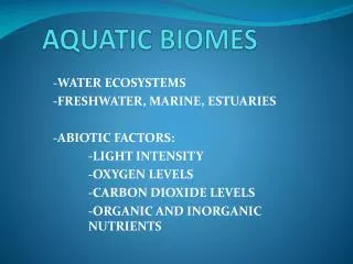
Biomes- Groups of ecosystems with organisms adapted to particular abiotic factors. So, abiotic factors determine the biome! Aquatic Biomes are characterized by: • Salinity- Freshwater, Saltwater, or Brackish • Flow- standing or moving • Depth of light penetration • Temperature • Pressure
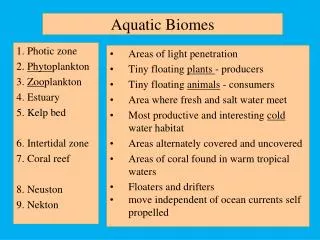
AQUATIC BIOMES • largest part of biosphere • nearly 75% of Earth’s surface • boundaries between biomes indistinct • more complex food webs than terrestrial biomes • different depths add 3rd dimension to food webs • photosynthesis confined to surface water • difficult to study vast and deep ocean (Moon, Mars better studied than ~95% of ocean)
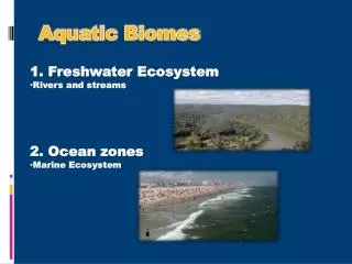
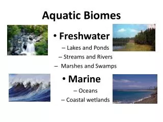
Freshwater Biomes • Flowing water (streams, rivers) • Standing water (ponds, lakes) • < 1% salinity • Organisms that cannot survive larger salt concentrations Marine Biomes • Open ocean, coastal zones • Algae supply much of world’s O2 • Take in large amounts of CO2 (photosynthesis, gas dissolution) • avg 3.5% salinity (mostly Na+ and Cl-) Wetlands • Boundary regions between terrestrial and aquatic biomes • Regions of wet topographic depressions
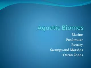
Types of Aquatic Biomes Wetlands: • Tidal wetlands • Nontidal wetlands Marine Aquatic Biomes: • Coral reefs • Kelp forests • Open oceans Freshwater Aquatic Biomes: • Lakes and Ponds • Rivers & Streams
Marine Biomes Intertidal Zone (alternating wet/dry) Neritic Zone (over continental shelf) Open Ocean (surface to depth) Benthic Zone (entire seafloor)
Intertidal Zone (alternating wet/dry) • Narrow band of coastline that exists between the levels of high tide an low tide. • Waves that crash onto the shore in this biome can make it a challenge for organisms to hold on and not get washed away. • Rocky – adaptations for clinging/hiding • ex. starfish, anemones, crabs • Sandy – adaptations for burrowing • ex. worms, sand crab and birds adapted to feeding
Neritic Zone (over continental shelf) • Found in warm, shallow waters beyond the shoreline. • Earth's most diverse marine biome even though coral reefs are found in water that is relatively poor in nutrients and food. Coral Reefs – tropical clear warm water - polyps secrete CaCO3 shells - algae live in soft tissue (mutualism) Kelp Forests – rocky w/ cold upwelling water - algae “trees”
The Open Ocean • The depth that light can penetrate in the open ocean is dependent on the amount of sediment and algae suspended in the water. • Photic zone- the zone that receives enough light to allow photosynthesis to occur. • Aphotic zone- the deeper water that lacks sufficient light for photosynthesis. • Chemosynthesis- The process that occurs in the aphotic zone when some species of bacteria use methane and hydrogen sulfide to generate energy.
Open Ocean Photic Zone – well lit - high DO (low CO2) - phytoplankton - some large nekton (whales, sharks) - many small nekton Disphotic downward into darkness - water T down to 4° C - zooplankton, small nekton rise to shallow water at night to feed Aphotic Zone – complete darkness - high pressure, low DO, low nutrients - water T near 4° C - nekton and benthos dependent on “marine snow” – organic debris raining down from surface region • unusual adaptation of bioluminescence • earthguide.ucsd.edu • biology.duke.edu • oceanexplorer.noaa.gov
Freshwater Biomes Standing Water Flowing Water Stream tributaries (like in • inset) form the watershed - steeper topography - faster, colder flow - higher DO River meanders in floodplain - flat topography - slower, warmer flow - lower DO Ponds and lakes have depth Estuary fresh and saltwater mixing (brackish water)- salinity gradient from river to ocean Land Ocean
Lakes & Ponds Standing water Might be too deep to support photosynthesis Lakes are larger than ponds but there is no clear point at which a pond is considered large enough to be called a lake.
Standing water • Littoral – region of emergent plants • Limnetic Zone – photic zone • Profundal Zone – aphotic zone • Fig. 4.29b • Diagram of lake
Lakes and Ponds • Littoral zone- the shallow area of soil and water near the shore where algae and emergent plants grow. • Limnetic zone- open water, where rooted plants can no longer survive. Phytoplankton are the only photosynthetic organisms. This zone extends to as deep as sunlight can penetrate. • Profundal zone- the zone where sunlight cannot penetrate and therefore producers cannot survive. • Benthic zone- the muddy bottom of a lake or bond beneath the limnetic and profundal zone.
Rivers & Streams Flowing Many originate from snow melt Change with the land and climate through which it flows Few plants can survive mosses with rhizoids to anchor Consumers must rely on leaves & seeds that fall into the water Animals have to be strong enough to fight the current Fish like trout or minnows
Wetlands • Regions of wet topographic depression • Land covered by water all or part of the year • Any region of saturated soil- tidal and freshwater • Boundary between terrestrial/aquatic biomes and poorly drained depression • Sustains vegetation adapted to saturated soil
Wetlands • Wetlands used to be considered wasteland for disease-carrying insects • Many were drained, filled, and cleared for farms or residential and commercial development. • The Florida Everglades used to cover 8 million acres; now cover less than 2 million acres
Benefits of Wetlands • They trap and filter sediments, nutrients, and pollutants, keeping them from entering lakes and oceans • They reduce flooding, protect agriculture, roads, buildings, and human health and safety • They buffer shorelines against erosion • They provide spawning grounds and habitat for commercially important fish and shellfish • They provide habitat for rare, threatened, and endangered species • They provide recreational areas for fishing, bird-watching, hiking, canoeing, photography, …
Importance • water filtration • slows runoff, sediments deposit, high productivity • abundant decomposers “nature’s sewage treatment” • protective cover for aquatic and terrestrial species (eggs, larvae, juveniles “nature’s nursery”) Wetlands poorly-drained depressions nontidal (inland) floodplains lake shores tidal (estuarine) tidal (coastal)
Tidal Wetlands Swamp - tropical/subtropical, salt- tolerant trees • “mangrove forest”, “mangrove swamp” Marsh • temperate salt-tolerant grass (cordgrass) • “salt marsh”, “salt meadow” • Fig. 4.32 • Fig. 4.31
Nontidal Wetlands marsh: • floodplains, lakeshores • “freshwater marsh”, “wet meadow” • wet depressions, some wet only 10% of year • “prairie potholes”, central U.S. • “bog” – high elevation or latitude (cold) • low decomposition, abundant peat moss swamp: • mainly floodplains, seasonal high water • “bottomland hardwood forest” • cypress, tupelo trees w/ buttresses