Download
1 / 15
150 likes | 239 Views
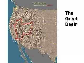
Western Great Basin Weather and Fuels. Winter 2011-2012. 100 Hour fuel moisture is lower this January than it has been in the past 20 years. This graph is the average for all of Nevada , but 100 hr FM is even lower north of Hwy 50.

E N D
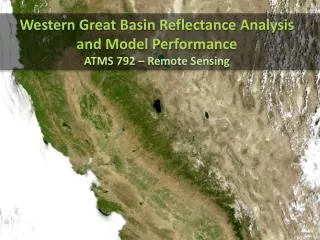
Western Great Basin Weather and Fuels Winter 2011-2012
100 Hour fuel moisture is lower this January than it has been in the past 20 years. This graph is the average for all of Nevada, but 100 hr FM is even lower north of Hwy 50.
As with 100 hr FM, 1000 hour fuel moisture is lower this January than it has been in the past 20 years. It is significant because it will take long duration precipitation to bring the 1000 hour fuel moisture back up. This graph the average for all of Nevada, but 1000 hr FM is at its lowest north of Hwy 50.
BI’s averaged across the entire state are approaching the all-time high for this time of year. There are record-setting BI’s north of Highway 50.
ERC’s are setting highs for this time of year across the state. North of Highway 50, some ERC’s are showing numbers that are normally only seen in the summer time.
Comparing Oct-Jan rainfall during the winters of 2010/2011 and 2011/2012 shows the difference between precipitation patterns during an El Nino (left) and a La Nina (right).
Eliminating October 2011 rainfall and just looking at the last couple of months shows that in recent months the WGB is getting progressively dryer (the rainfall bullseye in Esmeralda County is a processing artifact).
After two consecutive wet winters, January 2011 shows no trace of drought.
After a very dry fall/winter in 2011, drought signatures are seen across the Western Great Basin.
NOAA’s Climate Prediction Center forecasts that drought in northwestern NV will persist (brown area) through spring 2012, with additional drought spreading into central and southern NV (yellow area).
Targeting just years when La Nina continued for 2 years in a row, these composites show how precipitation varied from average during the 1st year of a La Nina event (top left) compared to the 2nd year (top right). 2011 was the first year of a La Nina event. The image on the left shows that precipitation was slightly dryer than average during Jan-Mar 2011, closely following the composite 1st year precipitation map (top left). If 2012 precipitation continues to follow this La Nina pattern, we can infer that Jan-Mar 2012 will be much dryer than average.
Conclusion Regardless of the fact that the WGB is well into winter, current weather and fuel conditions do not reflect the normally expected rises in RH and fuel moistures. In the last 2 months, the WGB has had 20 fires, 3 of them large. These fires typically happen when a dry cold front passes through our area, bringing single-digit RH and gusty winds. Combine this with record low 100- and 1000-hour fuels and record high BIs and ERCs and it creates an environment that supports large fire growth. Even though most of these fires last only one operational period, they have a large potential to impact lives, property and resources. This impact is increased due to the fact that they are typically human-caused and usually there is an element of urban interface involved. All weather forecast information points to a continuation of these conditions. Considering that we had 5 fires in the first 6 days of January 2012 (normal is 2 fires for the entire month), we should consider altering typical wintertime strategies to be prepared to meet the threat of continued large fires in the WGB.