Download
1 / 24
240 likes | 367 Views
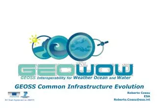
EC Grant Agreement no. 282915. GEOSS Interoperability for Weather Ocean and Water. Main objective: To evolve GEOSS for all stakeholders. GEOSS Common Infrastructure Evolution. Main Objectives.

E N D
EC Grant Agreement no. 282915 GEOSSInteroperability for Weather Ocean and Water Main objective: To evolve GEOSS for all stakeholders GEOSS Common Infrastructure Evolution GEO-IX Plenary
Main Objectives • GEOSS Infrastructure Evolution for all stakeholders (with a particular focus on the WOW SBAs), to: • Facilitate discovery, access & use of … • Data (with a particular focus on the GEOSS Data Core) • Other GEO-resources • Allow harmonised access to heterogeneous resources; & • Promote & simplify data sharing
GEOWOW Vision ooooo • What: A long-term vision for GEOSS - GCI evolution… • …considering feedback from all the stakeholders.____ • For whom: • For a growing number of user categories: ranging from data providers & data specialists to multidisciplinary scientists & decision makers. • How: • Via a flexible architecture: • with a modular approach, i.e. a set of interoperable component-based “GEOSS Infrastructure Evolutions” that respond to the community needs • enabling different usage patterns: different communities will benefit from the components in different manners, according to their needs and their usual working habits. • able to evolve with new components emerging from the technology landscape, however rapidly this is evolving… GEO-IX Plenary
Approach • GEOWOW adopts a structured system engineering approach: • User requirements from SBAs & across SBAs • Technology base: considering prior development efforts (current GCI, Thorpex, GOOS, previous efforts o improve the GCI such as EUROGEOSS, GENESI-DECetc.) & from SBA-systems • Constraints & recommendations: from relevant initiatives & standardization bodies (eg. GEO IIB, IEEE, OGC, INSPIRE, GMES, etc) AIP, StP SIF, IIB Current GCI Thorpex GOOS
GEOWOW Overview GEO Ministerial 2013: ‘Evolved' architecture properly tested and demonstrated within GEOWOW SBA's
Showcases • The GEOWOW proposed evolutions are being prototyped via Showcases. The following are examples: • #Coral Reefs – A new concept of operation for • elaborating environmental indicators. • #River Discharge - The Water & Weather SBAs are defining a scenario for an additional Showcase for prototyping additional components • #Droughts - Easy discovery & use of GEOSS resources for addressing multidisciplinary challenges related to drought scenarios
Showcase Developing environmental indicators: ocean ecosystems GEO IX Plenary Foz de Iguacu, November 2012 S. Grimes, A. Fischer IOC-UNESCOP. Gonçalves, H. Caumont Terradue J. van Bemmelen, R. Cossu, E. Li Santi ESA
Show-Case Introduction - WP6 objective: 'to support research & development of marine assessments, through availability of information from ocean data, combined with model data to feed decision-support systems.’ • Goal: to simplify complex natural system and human system interactions into indicators useful for scenarios, identification of decision points, & development of policy and management • Science Indicators Assessment for policy • Multidisciplinary (natural and social) science expert group helps in identification of available global data sets, model outputs, & to develops methodologies for combining them into indicators/maps GEO - IX
Value to Stakeholders? • More flexible development environment; • More up-to-date & more focused indicators for ocean ecosystems; • Better inform policy & management strategy, as well as to raise attention on importance of monitoring; • Provide services for implementing extension points towards GEOSS capability Various Stakeholders: decision-makers, developers of ocean assessments, ocean scientists & value adding companies. GEO - IX
Coral Reefs – Threats from Local Activity (2011) • Coral ecosystem services: food, income, habitat for commercially viable fish species, tourism, shoreline protection • Corals at risk from both local stressors (over-/destructive fishing, coastal development, watershed and marine-based pollution) & climate change & variability (temperature stress, ocean acidification, fast sea level rise) • Local stressors: blue-low, yellow-medium, red-high
Scenario GEO - IX
Scenario - TASKS Vulnerability of corals to local sea level change is greater than their potential growth rates Regional sea level rise projections vary tremendously Need to combine Ocean ecosystem data: coral reef location & vulnerabilities (WRI) Climate data: sea level rise projections from present out to 50 years (WCRP/CMIP5) – require ensemble calculations Calculations refining indicators • PRODUCT: • Maps & graphics • for policy mbly
A Vision For GEOSS • Present situation • expert scientific advice identifies the required datasets • discovery: we can look in the GEO portal, but most data required is already known • data usage rights are dealt with each individual provider if there are restrictions • downloads of individual datasets to local computing (repeatedly in case of evolving indicators) • calculations: on individual datasets, mostly for each needed spatial reference system transforms • heavy algorithm management & chaining for each host workflow & data input • web platforms designed to specific audiences, but live only as long as the project • Future GEOSS infrastructure?
HOW IT WORKS: 1. Cloud Sandbox Provisioning • Scientist browses data & services using its Community Portal extensions & selects experiment resources: datasets URLs, development tools • Once done, the Community Portal triggers the creation of a complete Virtual Machine (VM): a Cloud Sandbox development environment Foran experiment:keystore, user disk, application disk, datasets URL references… into a sandbox Virtual Machine Select from templates Ext. Ext. Select from templates
HOW IT WORKS: 2. Data & Processor Validation • Still from Community Portal, the Scientist instructs the ‘VM Store’ to boot a managed instance of the newly created developer’s Sandbox • Scientist develops & validates algorithms within its Cloud Sandbox, with access to dataset samples required for application testing GEO - IX
HOW IT WORKS: 3. Cloud Compute Provisioning • After validation, Scientist deploys algorithms to a selected Cloud Infrastructure • The deployed ‘Processor as a Service’ accesses complete pools of datasets, runs application intensive computing, & stores processor outputs back to the lab
HOW IT WORKS: 4. Sharing of Scientific Experiments & Results • Scientist readily shares its Sandbox VM work (can include GCI registration) with the scientific community for repeatable scientific experiments • Data Product results are registered in the GCI, & shared towards decision makers through Community Portals Ext. GCI registration
A European cloud computing partnership: big science teams up with big business • Strategic Plan • Establish multi-tenant, multi-provider cloud infrastructure • Identify and adopt policies for trust, security and privacy • Create governance structure • Define funding schemes To support the computing capacity needs for the ATLAS experiment Setting up a new service to simplify analysis of large genomes, for a deeper insight into evolution and biodiversity To create an Earth Observation platform, focusing on earthquake and volcano research
a vision for GEOSS • Present situation • expert scientific advice identifies the required datasets • discovery: we can look in the GEO portal, but most data required is already known • data usage rights are dealt with each individual provider if there are restrictions • downloads of individual datasets to local computing (repeatedly in case of evolving indicators) • calculations: on individual datasets, mostly for each needed spatial reference system transforms • heavy algorithm management & chaining for each host workflow & data input • web platforms designed to specific audiences, but live only as long as the project • Future GEOSS infrastructure? • expert scientific advice identifies the required datasets • assembly: needed datasets are assembled on demand into the GEOSS infrastructure (into a cloud?) • data usage rights are globally registered for scientific use of cloud computing infrastructures • data as a service can live & remain ‘in the cloud’, for the application of algorithmsand calculation of indicators • calculations: modular infrastructure components allow the exchange and reuse of scientist’s workspaces • repeatable environments allow for easy updates (in time or with new concepts) & scientific sharing • interactive ‘live’ web platform output maps & graphics readily part of the GCI: a legacy for other users
Benefits for generic scenarios • A specific example that can be generalized, eg: • adding projections of ocean acidification • combining sea level projections & detailed human population projections for indicators of vulnerability • mapping human impact (climate, fishing) on ocean biodiversity concentration to identify ‘hotspots’ • addressing indicators of ‘good environmental status’ under the EU Marine Strategy Framework Directive • creating indicators of water scarcity & human dependence from hydrological & social data • Temporary infrastructure needed; no need to maintain daily computing infrastructure & sharing results and tools with the wider GEOSS community GEO - IX
An exciting future! • The coral reef scenario presents a real demonstration of: • Easily producing relevant & accurate assessment indicators for use by policy makers; • Using completely scalable cloud computing to process extensive algorithms; • Setting up a domain for ‘repeatable’ calculations; & • Using the latest computing technology to assist ocean management decisions. The methods can be translated easily to other ocean & earth science contexts to improve environmental management decisions & ultimately, sustainable development. GEO - IX
Showcase Elaborating environmental indicators: ocean ecosystems GEO IX Plenary Foz de Iguazu, November 2012 Thank You!