Download

1 / 69
690 likes | 714 Views
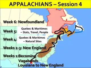
APPALACHIANS – Session 4. Week 6: Newfoundland. Quebec & Maritimes – Stats, Travel, People. Week 5: Maritime Provinces. Quebec & Maritimes – Natural Sites. Week 4: Quebec. Weeks 2-3: New England. Weeks 1:. Becoming Vagabonds. Louisiana to New England. APPALACHIANS – Session 4.

E N D
APPALACHIANS – Session 4 Week 6: Newfoundland Quebec & Maritimes – Stats, Travel, People Week 5: Maritime Provinces Quebec & Maritimes – Natural Sites Week 4: Quebec Weeks 2-3: New England Weeks 1: Becoming Vagabonds Louisiana to New England
APPALACHIANS – Session 4 Quebec & Maritimes – Natural Sites –
QUEBEC AREA Quebec & Maritimes – Natural Sites – New Brunswick Quebec Nova Scotia PEI • St. Lawrence River • Chute de la Montmorency • Truro Tidal Bore • Joggins Fossil Cliffs • Island stats • Island Formation • Bay of Fundy • Hopewell Rocks • Reversing Rapids
QUEBEC AREA Quebec • St. Lawrence River • Chute de la Montmorency
ST. LAWRENCE RIVER SYSTEM • St. Lawrence River is 750 miles long from outlet of Lake Ontario • St. Lawrence River is 1,900 miles (82% of MS) from it’s headwaters in Minnesota. • Watershed drainage is 519,000 sq miles (42% MS) • River is freshwater till Quebec where it turns tidal • St. Lawrence River is in an ACTIVE fault zone, part of an ancient rift system ! 750 mi Quebec 1,900 miles
ST. LAWRENCE RIVER SYSTEM WHAT’S A RIFT SYSTEM? RIFT SYSTEM?!! “A large area of the earth in which plates of the earth's crust are moving away from each other, forming an extensive system of fractures and faults.”
ST. LAWRENCE RIVER SYSTEM REMEMBER THIS SLIDE? The plates are moving apart This is a rift system or rift zone
ST. LAWRENCE RIVER SYSTEM Let’s look at a BIG picture…
CAMBRIAN & ORDOVICIAN PERIODS Specifically, lets look at the time periods of the PRECAMBRIAN 650 mybp thru 540 mybp 650 MYBP 540 MYBP
RIFT FORMATION - 570 MYBP Now, let’s see what that left behind… 600 Million Years Ago (Ma), continents were arranged on the planet like this… Let’s focus just on our “neck o’the woods” Proto-North American Continent Future Rift Zone Two Continents tore apart a RIFT zone 560 540 580
ST. LAWRENCE RIVER SYSTEM CANADA USA
ST. LAWRENCE RIVER SYSTEM CANADA St Lawrence Rift System Areas above and below this line are trying to split apart
ST. LAWRENCE RIVER SYSTEM Saquenay Graben Ottawa – Bonnechere Graben CANADA St Lawrence Rift System 630 mile long ACTIVE fault! Let’s, look at a cross section of a Graben
ST. LAWRENCE RIVER SYSTEM • As two sides of a fault zone pull apart (red arrows) • Fractures occur in the rock (faults) • Sections of rock drop • Dropped sections are called Grabens WHAT’S A GRABEN?
ST. LAWRENCE RIVER SYSTEM Saquenay Graben ½ Graben Ottawa – Bonnechere Graben St Lawrence Rift System
ST. LAWRENCE RIVER SYSTEM St. Lawrence Rift System “Aulacogen” – “scar or zone of weakness” Iapetan Rifted Margin New Madrid Seismic Zone (Reelfoot Rift) Ramapo Fault
QUEBEC AREA NATURAL SITES Quebec • St. Lawrence River • Chute de la Montmorency
QUEBEC AREA NATURAL SITES Canadian Shield Face of Horst Appalachian Sediments fill this ½ Graben
QUEBEC AREA NATURAL SITES • 275 ft high (98’ higher than Niagra Falls!) • 150 ft wide
PRINCE EDWARD ISLAND (PEI) PEI • Island stats • Island Formation
PRINCE EDWARD ISLAND (PEI) • Island is 140 miles long by 20 miles wide in Gulf of St. Lawrence • Located 9 miles off the mainland; across Northumberland Strait • 104th largest island in the world and 23rd largest in Canada • Formerly Sedimentary basin of red sandstone/mudstone & formed by glaciers • Island rose after weight of glaciers removed; high point is 450 ft 140 mi long 20 mi wide
PRINCE EDWARD ISLAND (PEI) Prince Edward Island was a big surprise… • Rolling hills of green pasture lands • Tranquil bays/inlets • Bed & Breakfasts everywhere (“No vacancies”) • Lots and lots of “crafts” • Very relaxing setting
NEW BRUNSWICK New Brunswick • Bay of Fundy • Hopewell Rocks • Reversing Rapids
BAY OF FUNDY OVERVIEW CANADA USA
BAY OF FUNDY OVERVIEW CANADA USA
BAY OF FUNDY OVERVIEW CANADA USA
BAY OF FUNDY OVERVIEW CANADA USA
BAY OF FUNDY OVERVIEW NEW BRUNSWICK Chignecto Bay Minas Basin Bay of Fundy NOVA SCOTIA
BAY OF FUNDY OVERVIEW Chignecto Bay
BAY OF FUNDY OVERVIEW • Bay of Fundy is 130 miles long by 30 miles wide • Tides here are Semi-diurnal (2 times a day) • Hence, 4 times a day, 14 BILLION tonnes of seawater rushes in or out • Translates to 78 billion cu ft per hour • Equivalent to the flow of 31 Mississippi Rivers EACH TIME! 1 2 130 mi long Turn down that faucet! 30 mi wide
BAY OF FUNDY OVERVIEW • Bay of Fundy is funneled shaped causing extra high tides at end of bay • Highest tide is in the Minas Basin at 52 feet! • Giant whirpools form in the bay during tidal flow • Energy of the tidal inflow is said to be equal to 8,000 locomotives • Only 1 tidal pilot power plant captures any of this energy at Annapolis, NS
ANNAPOLIS TIDAL PWR PLANT • 20 MW plant (3rd largest); startup 1984 • one of 7 tidal power plants in the world. (Korea w/254 MW, France w/240 MW, plus small ones in China, Russia, UK) • located on a small island at mouth of the Annapolis River • feeds the grid every 12 hours and 25 minutes. • on 5 hours, off 7 hours, generating enough power to run about 4,000 homes
WHAT ARE TIDES? • Tides are the rise and fall of sea levels caused by the combined effects of the gravitational forces exerted by the Moon and the Sun and the rotation of the Earth. • Spring Tides occur when the pull of the sun and moon on earth are in alignment • Neap Tides occur when the sun pull is at right angles to that of the moon s
BAY OF FUNDY FORMATION 2. Flooding of valley by warm shallow sea. 1. Formation of rift valley about 350 million years ago. 6. Tilting of land and changing of drainage, 15 million years ago. 5. Warping of land by pressure, eruption of volcanoes, 210 million years ago 4. Sandstone bearing fossils deposited in Coal Age swamps, 315 million years ago. 8. The Bay of Fundy today 3. Erosion of mountains and formation of Hopewell conglomerate 330 million years ago. 7. Glacial covering of land, one million years ago.
NEW BRUNSWICK New Brunswick • Bay of Fundy • Hopewell Rocks • Reversing Rapids
HOPEWELL ROCKS, NB Water (rain or snow) finds its way into cracks and crevices of cliff Cycles of freezing temps expands water, widening the crack; rainfall erodes crack Tides and wave action erode base of cliffside Section of cliff is gradually separated from mainland “Flowerpot” is formed “FLOWERPOT” FORMATION
NEW BRUNSWICK New Brunswick • Bay of Fundy • Hopewell Rocks • Reversing Rapids
REVERSING FALLS, ST. JOHN, NB NEW BRUNSWICK NOVA SCOTIA
Advancing Glacier REVERSING FALLS, ST. JOHN, NB St. John’s River Retreating Glacier ? 3. Advancing glaciers left sustantial amounts of till material, blocking this route 5. Once glaciers retreated, ocean levels rose and river cut a new path to the ocean 4. Once glaciers retreated, the old path to the ocean was filled in 2. BUT…20,000 yrs ago, the river drainage might have taken this path 6. Twice a day, tidal waters flow up the St. John River creating “Reversing Rapids” 1. This is how St. John, NB looks today… To Ocean
REVERSING FALLS, ST. JOHN, NB St. John, NB Falling tide, river flows to the right (east) to the ocean St. John River cut this small gorge as a new path to the ocean On rising tide, St. John River reverses, flowing to west