Download
1 / 21
210 likes | 292 Views
Explore the research conducted by Assistant Professor John R. Mecikalski at the University of Alabama in Huntsville, supported by NASA, using geostationary satellite data for nowcasting convective initiation and lightning initiation to improve aviation safety.

E N D
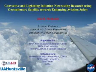
Convective and Lightning Initiation Nowcasting Research using Geostationary Satellite towards Enhancing Aviation Safety John R. Mecikalski Assistant Professor Atmospheric Science Department University of Alabama in Huntsville Supported by: NASA New Investigator Program (2002) NASA ASAP Initiative The NASA SPoRT & SERVIR Initiatives Collaborators: University of Wisconsin-Madison, CIMSS MIT-Lincoln Laboratory NASA MSFC USRA
Methods: Convective Nowcasts/Diagnoses Why might geostationary satellite be superior to radar? A: Satellites “see” cumulus before they become thunderstorms! A: There are many available methods for diagnosing/monitoring cumulus motion/development in real-time (every 15-min). See the published research. t=–30 min t=–15 min t=Present Monitor… 8 IR fields: CI Time 1st ≥35 dBZ echo at ground
SATCAST Algorithm: GOES IR Interest Fields Note: There are several more IR fields with MSG & MTG
SATCAST Capabilities • 0-1 hour CI nowcasting • 0-90 min Lightning Initiation nowcasting • Satellite climatologies for daily forecasts • 1-6 hour CI/LI forecasting support • Data assimilation possibilities
Good CI detection in Cloudy Environment MIT-Lincoln Lab: CoSPA testing • Using convective initiation to predict storms: • Location – CI score • Timing – how long until VIL reaches CI threshold • Mode – line or cell • Growth – predict growth of cells 1815Z 1945Z 90-min VIL Forecast with satellite CI 90-min VIL Forecast without satellite CI
SATCAST Strengths/Weaknesses Strengths: • Lead time on the radar for CI ~10-45 min (up to 75 min at night) • Provide an alert for first-time LI of up to 1 hour • There is promise for heavy rainfall (QPE) nowcasting • It exploits GEO satellite in the ways it was designed for, namely frequent updates (5-15 min) visible and infrared data • Readily expandable to new instruments/methods • Monitors cloud growth and associated microphysical changes Areas for Improvement: • PODs are very high (>95%) for CI, but so are FARs (~65%) • SATCAST monitors only cloud-top properties • Other non-satellite fields are needed to “constrain” SATCAST nowcasts of CI, LI and rainfall • Little convective environment delineators, presently
Outstanding Questions: New Research • How many interest fields are “important” when performing 0-1 hour nowcasting? • What fields are more important, and which fields are most important in: (a) particular environments, and (b) across environments? • How to constrain satellite CI nowcasts? • Understanding how satellite IR data relate to the physics of cumulus convection, and then, appropriately use the satellite data. • Minimizing errors: Better tracking & detection of cumuli.
Northern Alabama LMA Lightning Source Counts Lightning Initiation Potential 2040-2050 UTC 2140-2150 UTC kkkkkkkkkkkkkkk
LI Theory • Storm Electrification • Through graupel/ice interactions in the presence of supercooled water (non-inductive charge transfer, Reynolds 1957) • Particle collisions transfer charge • Temperature difference between particles and liquid water content determines charge transferred • Particles fall through or are carried upward in updraft and separate charge • Conditions to be observed from satellite: • Strong updraft • Ice particles • NWP model information: • CAPE • Ice/grauple flux through -10 to -15 C layer Saunders (1993) Chris Siewert/UAH - 2007/2008
Daytime Cloud Microphysics: 3.9 m • Separate 3.9 reflection and emission • Uses methods developed by Setvak and Doswell (1991) and Lindsey et al. (2006) • Low 3.9 reflectance values indicate ice aloft • Most accurate for solar zenith angles up to 68o (morning to evening): Undefined > 90o • Expect 3.9 reflectance values ~ 0.05 (5%) for ice clouds R = fk1 / [ exp (fk2 / (bc1 + (bc2 * temp))) - 1 ] • R3.9 calculated using 3.9 brightness temperature and constants • Re3.9(T) calculated using 3.9 constants and 10.7 • brightness temperature • S calculated using 3.9 constants, sun temperature (5800 K), average radius of sun (A) and Earth’s orbit (B), and solar zenith angle
3.9 m Reflectance Calculation • Need to convert brightness temperatures back to radiances: • Now separate components… Provided by ASPB & CIMSS Calibration Homepage
Development of LI Interest Fields • Co-location of satellite and LMA data • Satellite data re-sampled to 1 km2 grid • LMA has slightly smaller grid (~ 0.9 km2) • Match the satellite data to an LMA pixel using nearest neighbor technique with latitude and longitude values • Time-series plot analysis • Examine multiple cells from various case days • Allows for visual representation of interest fields with time in comparison to first flash within the cell • Isolate cell by drawing box around its movement area prior to and after the first flash. • Follow coldest pixel(s) in this box (assumed updraft region) • Average the brightness temperature values of these coldest pixels for all channels and perform channel differences • Plot values 2 hours prior and 1 hour after the first flash within the cell • Compare to expected results and define appropriate initial threshold values for LI interest fields
Mecikalski and Bedka (2006) framework: • Forecast location of first 35 dBZ echo using eight CI “interest fields” • Each interest field represents physical process within growing cloud • Individual pixel must meet at least 7 of 8 field thresholds to be labeled a a “threat” of CI Mecikalski and Bedka (2006)
LI interest period Mecikalski and Bedka, 2006 Chris Siewert/UAH - 2007/2008
Lightning Initiation Interest Fields Chris Siewert/UAH & EUMETSAT - 2007/2008
1-6 hour CI Nowcasting CI “Trends of Trends” - for LI eventually
Ongoing Work with SATCAST • Evaluating use of MSG (as a proxy for ABI) for enhancing SATCAST with additional interest fields, especially related to microphysics • Perform new work with • CloudSAT & MODIS to • enhance SATCAST for • various convective regimes • Transition to FAA • nowcasting system • Bound SATCAST with various other NWP model fields to better bound the CI & LI nowcasts • Determine the feasibility of making 1-4 km QPE nowcasts using this system
Onward to MTG… post MSG (GOES-R) COPS data analysis ongoing
Ongoing Satellite-Lightning Research • NSF: Relating lightning initiation (LI) to polarimetric radar and (geostationary) satellite fields. Several topics…~2-3 graduate students/post-Doc. Into 2011. • NASA ROSES 2007: Optimizing the SATCAST algorithm for convective regimes, and extending to LI across various convective environments. Into 2010. • NASA ASAP: Developments of LI nowcasts and products towards aviation sector. • Overall: How to constrain satellite CI and LI nowcasts with NWP information. Enhance the lightning threat product. • Minimizing errors: Better tracking & detection of cumuli.