Download
1 / 27
270 likes | 319 Views
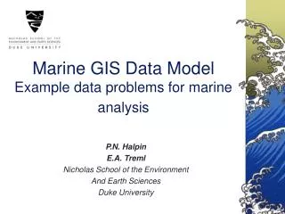
ArcGIS Marine Data Model Technical Session. Joe Breman, Michael Blongewicz, Pat Halpin, Dawn Wright. Agenda. Data Model Purpose Thematic content Demonstration Detailed design discussion Implications Q & A. For Sample Database and Design Documents

E N D
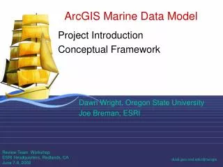
ArcGIS Marine Data Model Technical Session Joe Breman, Michael Blongewicz, Pat Halpin, Dawn Wright
Agenda • Data Model Purpose • Thematic content • Demonstration • Detailed design discussion • Implications • Q & A For Sample Database and Design Documents See Data Models at support.esri.com/datamodels
ArcGIS Data Modeling • The Marine Data Model • Designing a geodatabase to best fit marine data • Coastal and Marine Managers, Educators Researchers, and Professionals • Use and implementation
Marine Data Model Purpose • To support marine data management • Template Includes • Marine Points, lines and polygons • Multiple dimensional and dynamic data • Relationships between the features and tables • Implementing multiple z, and time attributed data • Leverage other existing practices/standards • Approaches to managing marine data
Demonstration • Important feature classes, relationships, and attributes of the marine data model • In the process of design planning consider tools and final result as part of the process
Web Site 1 • Content • Case study, template • Geodatabase diagrammer tools on arcscripts
Web Site 2dusk.geo.orst.edu/djl/arcgis • Background • Additional content • Mirror of UML, gdb, etc. • Related links • MDM-only user forum
Marine Template • Provide a structure for relationships between complex multidimensional dynamic data • Consideration to method of data collection • Provide a basis for describing marine data types
Metadata Documentation • Important to document the details about the data collection and attributes
Extending the model with 3-4D A Method: • Creating a fishnet • Converting to polygon • Joining to points • Extrusion Some design questions: When to implement z aware data (PointZM)? When to relationship classes and how? How to best include time series and duration measurements?
MeasuringDevice Measurement Measurement MeasuringDevice TSType TimeSeriesTurnTable TimeSeries3 TimeSeries2 TimeSeries1 TimeSeriesPoint TimeSeriesPoints Z X Y
Marine GIS Data Model • Implications of a marine data model? • An data model provides a basic template for: • Inputting / formatting data • Geoprocessing / analyzing data • Sharing data • For developers, it provides a basic framework for writing program code and maintaining applications
Marine GIS Data Model Building a template… • Strategy: • As generic as possible… • As exhaustive as possible… • As temporally dynamic as possible…
Time Series Location Series Marine GIS Data Model Building a template… An extension of GIS features to better fit marine applications…
Marine GIS Data Model • Strategy: • As generic as possible… • As exhaustive as possible… • As temporally dynamic as possible… • Resulting Issues: • Too generic for unmodified use… • Usefulness will vary with applications… • Some common marine data types (rasters) do not directly benefit from relational UML model…
Project Data Model Project Data Model Project Data Model Marine GIS Data Model A data model hierarchy… “Generic” Marine Data Model Inheritance User Group Data Model User Group Data Model User Group Data Model
Marine GIS Data Model • Implications: • Inputting & Formatting Data • Provides common data structures • Allows control of required data fields from collection through analysis phases
Marine GIS Data Model • Implications: • Geoprocessing & Analysis • Allows explicit spatial & temporal relationships to be used in geoprocessing and analysis
Statistical Applications GIS Applications GIS Applications Build Better Models / Analysis Data Space Geographic Space Geographic Space 2. Statistical methods Redefine Model Model Habitat 4. Model validation Sample Data 1. Sampling 3. GIS models
vector data raster data metadata map Data Type: Z39.50 FGDC Tools/Protocols: XML DODS WMS Marine GIS Data Model • Implications: • Data Sharing • Within / Between Projects • Internet Map Services(Geography Network, NSDI, OBIS…) • Internet Map Services: data conflation tools
AnalysisPhysical Ocean & Species Physical data Species data Web Map Service (WMS)
Implications • Use the data model as a part of the workflow • Project implementation • Industry and Academic cooperation Oregon State, Duke, NOAA, Fisheries Use multi-dimensional dynamic data in the geodatabase to facilitate display, analysis, queries, and map making for marine applications.
Implications continued… • Extremely generic • Coastal vs. deepsea • Use tutorial, case studies to help w/ data input • dusk.geo.orst.edu/djl/arcgis/MDM_tutorial • Feature classes document (glossary) with • Marine data types graphic • SIM diagram • Bear DM in mind when collecting data • More case studies welcome!!!
Crosswalks • ArcHydro (surface and groundwater) • IHO S-57 data model • Possible atmospheric data model • Focus on temporal, attend ATM SIG • SciViz (Viz5D, Fledermaus, CTech, etc.)
Summary • More information • Case Studies / White paper • Data Model Poster • To represent the model design • Metadata Template, Tools • Stay tuned for news on MDM book • Join MDM list at dusk.geo.orst.edu/djl/arcgis • Websites: support.esri.com/datamodels dusk.geo.orst.edu/djl/arcgis • Questions?