ArcGIS Hydro Data Model
870 likes | 1.66k Views
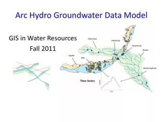
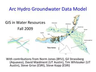
ArcGIS Hydro Data Model. Design principles for the data model Data model components Time series Arc Hydro tools. Bringing together these two communities by using a common geospatial data model http://www.crwr.utexas.edu/giswr. GIS. Water Resources. CRWR.

ArcGIS Hydro Data Model
E N D
Presentation Transcript
ArcGIS Hydro Data Model • Design principles for the data model • Data model components • Time series • Arc Hydro tools
Bringing together these two communities by using a common geospatial data model http://www.crwr.utexas.edu/giswr GIS Water Resources CRWR GIS in Water Resources Consortium
Trends During 1990’s • Standardized GIS data sets were produced for hydrology • Internet became a major conduit for data distribution • Most US hydrologic models had GIS interfaces constructed for them • Microsoft COM protocol became a standard (Word, Powerpoint, Excel, Visual Basic for Applications) • ESRI adopted COM for ArcGIS
Trends during 2000’s • Relational databases (Access, Oracle,…) will be the standard for data storage • Geospatial and temporal data for hydrology will be more formally synthesized • Use of component technologies will blur the line between applications (hydrology-hydraulics-water quality) • Increasing use of real-time applications • More use of terrain surfaces e.g. LIDAR
ArcGIS Data Models • Facilitate a process with the user community • Capture the essential, common data model for each discipline • Build a database design template that works well with ArcGIS • Build on experience, not a standards exercise • Share the model on ArcOnline http://arconline.esri.com/arconline/datamodels.cfm
Organization B Organization A Organization D Somethingin common Organization C The data model for a business organization tends not to change greatly over time unless the business organization changes the fundamental way that it does business Essential Data Model
Model Definition • Develop a data model to support Hydrology and Hydrography • Link the vector and raster worlds • Understand producer and consumer needs • Exercise with real data to validate the model • Use a geometric network for faster tracing and data quality validation
Evolution of the Model • Hands-on experience was key to evolution • We have somehow struggled through the process and found new ways of managing Hydro Data • Consistent structure • Varying detail • Multi-purpose • Common tools and techniques (Patterns) • You will hear interest and excitement about this in the presentations today
Acknowledgements Many people and organizations have contributed to the development of Arc Hydro. We thank you!! • CRWR – ESRI team • BYU, CDM, DHI, Dodson, EPA, HEC, LCRA, NHD, TNRCC, TWDB, USGS • Many individuals in academia, government and industry
ArcGIS HydroData Model Hydrology Hydrography
Flow Time Time Series ArcGIS Hydro Data Model Network Drainage HydroFeatures Hydrography Channel
Data Model Based on Inventory NHD Points Make an inventory of all features of a given type in the region NHD Lines NHD Areas Gages What is it? Where is it? Dams Bridges
Data Model Based on Behavior Follow a drop of water from where it falls on the land, to the stream, and all the way to the ocean.
Integrating Data Inventory using a Behavioral Model Relationships between objects linked by tracing path of water movement
Workspace Geodatabase Feature Dataset Feature Class Geometric Network Relationship Object Class Arc Hydro Implementation
Arc Hydro Design Principles • Classification • Partitioning, typing, and naming of classes • Attribution • Feature description, including time series • Association • Relating features using key attributes • Navigation • Following water movement from feature to feature
Classification • Partitioning • Like features are grouped into components (Network, Drainage, …) • Typing • Object, Feature, Network feature • Naming • Common names if possible, defined by a glossary
Text descriptore.g. FType Coded Value Domain e.g. FDir Subtypes – separate classes with same attributes e.g. HydroEdge Subclasses - separate classes with different attributes e.g. HydroPoint FType = “Stream/River” 1 = “WithDigitized”, 2 =“AgainstDigitized”,.. EdgeType = 1 for Flowline, = 2 for Shoreline Dam, Bridge, Monitoring Point, … Classification Hierarchy Light Heavy
EdgeType = 1 FlowLine FType = “Stream/River” “Canal/Ditch” “Pipeline” “Connector” “Waterbody FlowLine” EdgeType = 2 Shoreline FType = “Bankline” “Shoreline” “Coastline” Two-Way Classification:FTypes of Subtypes
Attribution • Minimal attribution in the model • Assume user will add more • Attribute Names are all 10 characters or less so they are not truncated when exported to Shapefiles • Standard conventions • ID is a long integer • Code is a string
Hydro Features • Every Arc Hydro feature is a Hydro Feature with a HydroID and HydroCode • HydroID = Class Number + ObjectID e.g. 12000013 is object 13 in class 12 (unique within a geodatabase) • HydroCode = HydroID + Geodatabase name e.g. Mybasin12000013 (unique within a set of geodatabases)
Association • An association is established using key fields in two separate tables • Can build relationship if necessary • Hydro Assocation – HydroID of one class is an attribute of another class • JunctionID (Drainage Outlets) • FeatureID (Time Series) • NextDownID (Downstream feature)
Navigation • Navigation means tracing the movement of water downstream or upstream • Dendritic Navigation – using NextDownID within a single feature class • Network Navigation – using Network Analyst tracing tools on Hydro Network • Schematic Navigation – using SchematicLink and SchematicNodes to connect features in several classes
National Hydro Data Programshttp://www.crwr.utexas.edu/giswr/nhdconf/nationalhydro.html National Elevation Dataset (NED) National Hydrography Dataset (NHD) Elevation Derivatives for National Applications (EDNA) Watershed Boundary Dataset
How do we combine these data? Digital Elevation Models Streams Watersheds Waterbodies
Where Does the Raindrop Go? Dale Honeycutt’s concept, May 2000
Water Flows from an Area to a Line • Problems with this: • Areas and lines are not always consistent with one another. • Sometimes many lines within one area.
How to Connect Areas to the Hydro Network? Regardless of where the drop falls in the area, its runoff is on the network at the outlet point Areas connect to lines at points Outlet Points
ArcFM Water Water Infrastructure Water distribution Wastewater collection Storm sewers Arc Hydro Natural water system Catchments drain to storm sewer inlets Storm sewers discharge to streams ArcHydro and ArcFM Water
Schema • A schema is the structure or design of a database. • A schema specifies the feature and object classes -- including their attributes and relationships -- of the geodatabase.
Repository • A repository is database that contains the schema information needed to create a geodatabase from a UML model created using a CASE tool.
ArcGIS Hydro Data Model • Design principles for the data model • Data model components • Time series • Arc Hydro tools
Workspace Geodatabase Feature Dataset Feature Class Geometric Network Relationship Object Class Arc Hydro Implementation
GIS in Water Resources Consortium ArcGIS Hydro Data Model Network
GIS in Water Resources Consortium ArcGIS Hydro Data Model Hydrography
River networks for 8-digit HUC watersheds
GIS in Water Resources Consortium ArcGIS Hydro Data Model Hydrography
GIS in Water Resources Consortium ArcGIS Hydro Data Model Drainage
Watersheds of the US 2-digit water resource regions 8-digit HUC watersheds
Watershed Hierarchy Digit # 2 4 6 8 HUC 10 12 EDNA Available In Progress
National Program by USGS and USDA (NRCS) Boundaries for 10- and 12- digit watersheds First cut is by automated delineation from NED Hand checked and edited Watershed Boundary Dataset 10-digit watersheds
National program by USGS and NWS 5000 cellthreshold on a 30m DEM (~ 8 km2 average drainage area) ~ 1 million catchments for US when completed Includes grid derived products e.g. topmodel index Elevation Derivatives for National Applications (EDNA
Area to Area Connectivity: SchematicLinks built using NextDownID